CouchtoCDT

Hiking the Continental Divide Trail (CDT) Northbound in 2013- sharing my preparation for the hike and my day to day experience while I'm on the trail. Inspiring people to follow their dreams.


Leave a comment

Butte to Helena

P1010769

I arrived in Butte with a good spirit, having just joined my new group of hikers who allowed me to join them on the trail for however long I wanted to.  I was excited to be with a new group, to have some new experiences and learn from these 3 other hikers that were on their way to achieving their triple crown (Appalachian Trail, Pacific Crest Trail & Continental Divide Trail).

We spent a couple of days resting in the cramped confines of a two queen bed hotel room for the 5 of us, 1 of them being a old friend of my new group from Oregon who was in the neighborhood.  We ate Chinese food, enjoyed the local brewery and I saw my first and only movie on the trail on Labor Day.  I was grossly disappointed with the movie but at least the movie theatre experience made me feel a apart of society again, that I was once again capable of doing normal things.  We spotted a Labor Day picnic at a community park hosted by the local electrical and pipe fitters union where there was free hotdogs and soda to be had and being cheap hikers we were obligated to stop by and consume our 3 hotdogs and 4 bags of chips like any true American.

P1010711

After a couple of days of leisure we started back on the trail right where we had stopped.  I was only about a mile outside of Whitehall but my other companions were about 4 miles behind me.  A farmers market that offered up fresh local produce and cookies that I was happy to buy and enjoy immediately distracted me.  My companions passed me after finding a too comfortable tree to enjoy my new food.  Walking the roads several people stopped to ask what we were doing and I gave them my regular response.  Most said that’s great but a few said that’s crazy.

P1010764

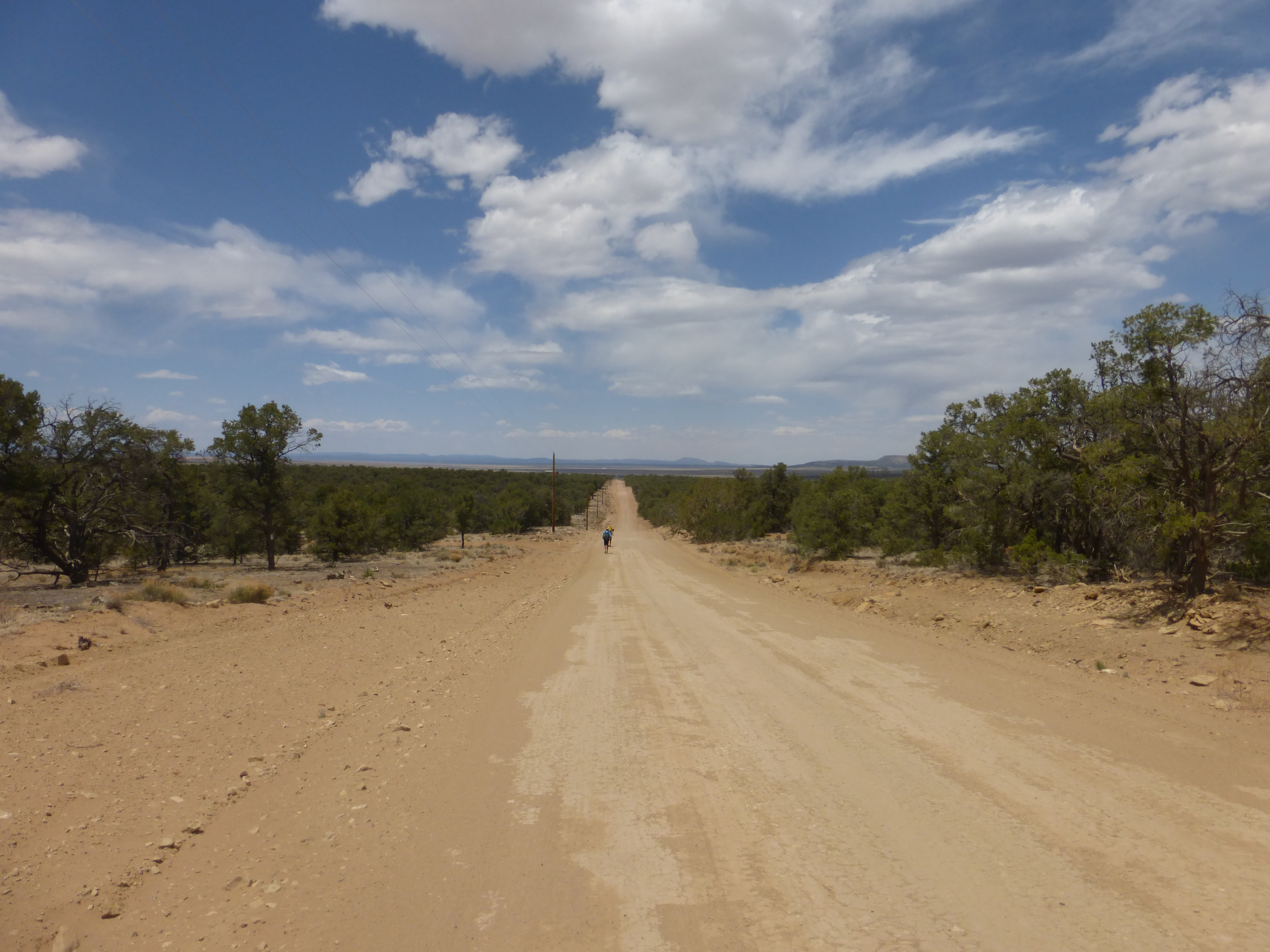
That day was all about road walking, going under the bridge of highway 90 as the cars and trucks zipped by at high speeds and then entering the local forest area on the east side of Butte.  Walking the gravel roads of forest areas is a big part of a CDT hike and they can be methodical and boring.  I was lucky enough to be recommended a new podcast ‘Things you should know’ and was enjoying learning about how ejector seats work, universal health care and diving bells.  Podcasts are a great way to make the miles just slip away.  That night we slept in a typical car camping spot while our friend from Oregon met up with us and brought pizza and beer.  The next morning we rose with a purpose but not the usual one.  It was Sunday and that meant that the newest episode of Breaking Bad was on AMC and we did not want to miss it. It would be a 17-mile day and we had to be done by 5 to get back to a hotel room that had AMC and watch our show that night.  We all walked with a purpose that day even if it was for a T.V show.

You hike for different reasons every day

You hike for different reasons every day

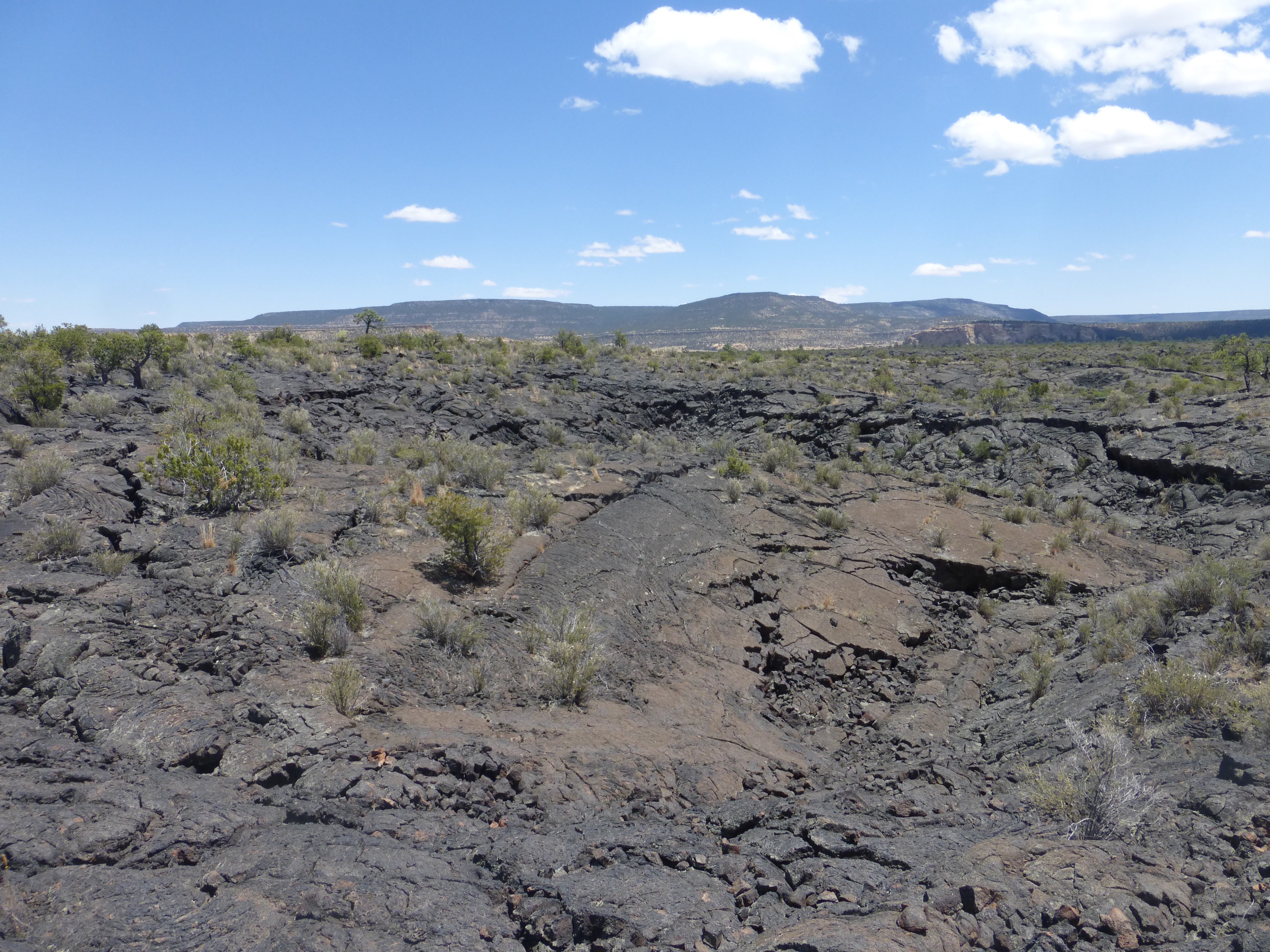
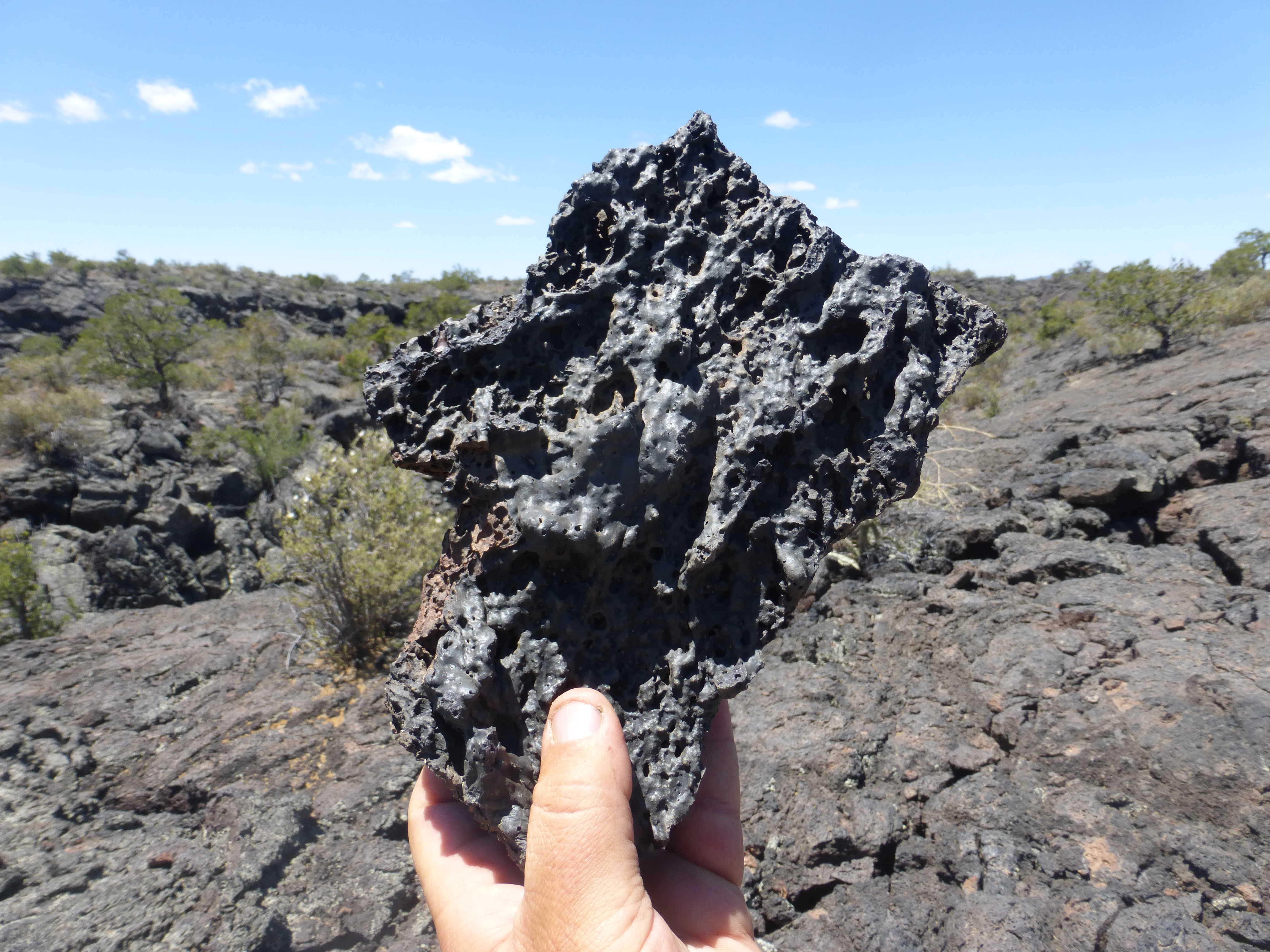
After we all injected or should I say snorted our Breaking Bad fix we were off again, entering the Beaverhead-Deerlodge National forest.  We had 71 miles to go to get to Helena and we were back on the official CDT after taking the Big Sky Variant due to time restraints and fires.   We made it up Champions Pass and through some pretty normal hiking that had good water sources, easy to follow trail signs, big open views and old mining towns long ago abandoned.  Excitingly as we sat next to the trail one day for lunch 2 old friends happened to turn the corner and walk right into us.  We hadn’t seen them in several weeks and it was great to be back with them.  Immediately we started talking about which sections had sucked, what town was cool and what goodies we had decided to carry.  We had ourselves a little party at camp that night and it was great to be amongst friends.  I knew that night was one to be cherished and remembered as only a night like that can be.

P1010747

We all hiked at different speeds so it was a constant game of leapfrog as you went.  One person would stop for a break as the other person kept going until you started up again and caught back up to them.  Each person was in their own worlds, listening to their music, books, podcasts or the sound of their own feet.  The trail would take you up high to gorgeous views and then surround you in woods that looked like no one had hiked them in a long time.  You’re brought back to reality when you pass huge power lines as they buzz with electricity and make eerie sounds as the wind passes around them.

P1010743

P1010799

P1010752

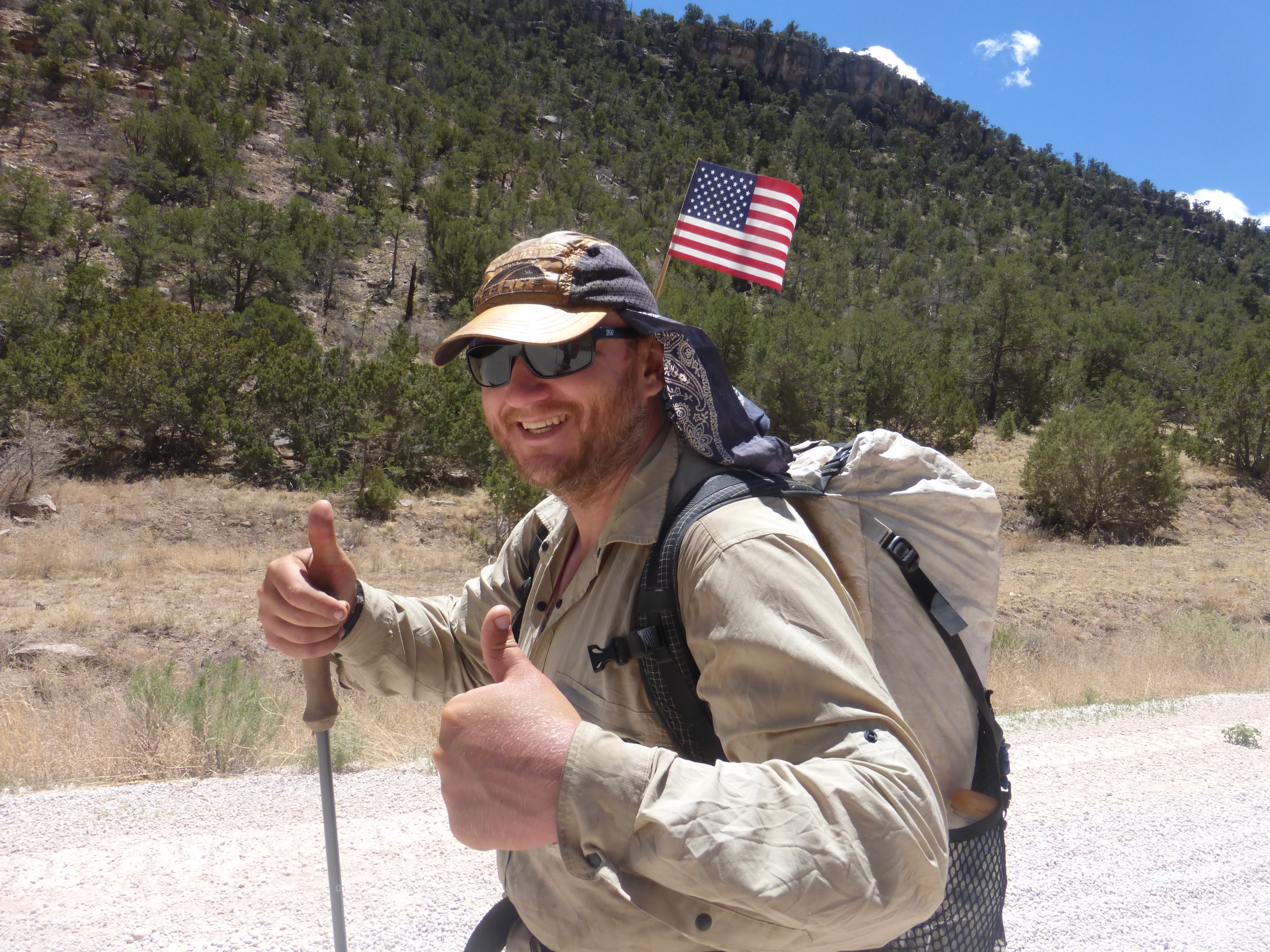
After only 3 days we covered the 71 miles to McDonald Pass, which was our highway to hitch into Helena.  The view before you hit the highway was a vast expanse of forest and a large open valley to the east where Helena waited for us.  It was a gorgeous view and one that I will remember.  I arrived at the pass, second only to Bonelady, who was drying out her sleeping bag from last nights rain waiting for us to arrive.  I had chatted up some nice tourist at the ‘lookout’ but that did not lead to a ride into town.  It’s all about chatting up the people you can actually talk to to get a ride because that is much easier then putting out your thumb and hoping for the best.  Eventually 5 out of 6 of us were at the pass and a nice guy pulled over and immediately asked if we were CDT hikers.  We said yes and he mentioned how we were going to be the 15th hikers he was taking into town.  We had great trail magic with someone who knew what we were all about.   We piled into his truck leaving one person behind to catch his own ride.  Now this isn’t considered rude mind you.  We had waited for as long as we could and you can’t jeopardize a ride that can take 5 hikers to town.  If we had let this ride slip away we wouldn’t have been considered nice but idiots.  So we drove off heading into Helena for a day of rest and the fried chicken I had been dreaming about for the past several days.

HIKER TO TOWN

HIKER TO TOWN


2 Comments

Apps for Thru Hiking

apps

I brought a phone with me on my thru hike, yes a phone, and in the end I was very happy I did.  Some say that a phone takes away from your experience, which it can, but if used correctly as a tool, it can enhance your hiking experience, not hinder.  I used it to stay in touch with family and friends, check the weather ahead, listen to audio books, read books, get intel on the trail ahead, listen to music, take pictures and video, transfer photos, listen to podcasts and keep a audio journal.  Apps helped to enrich my experience on the trail.

OverDrive Media Consule:  Do you have a library card?  If yes, then you can use this great app to connect to your local libraries digital collection of ebooks & audio books.  After you’ve downloaded the app, you enter in your library card number and start searching your libraries collection.  You can scroll through hundreds if not thousands of titles to download to your phone in several formats that are available whenever you want. I listened to a total of 19 audio books on my thru hike.  It was a great way to use the time I had to learn about things I normally wouldn’t read about or catch up on all the things I wanted to learn about.  Starting and stopping your progress was easy and you can borrow the title for 14 days to listen/read your selection.   You can also put holds on titles that aren’t currently available and get an email notification when it’s ready for you to download.

Smart Voice Recorder:  After hiking 25 miles the last thing I wanted to do was type a diary entry on my phone.  I started out using a word program but after losing several entries due to crashes I gave up and downloaded this app.  Being able to simply push a button and record my thought and feelings without having to stumble through typing was great.  You have so much emotion on the trail that listening to your tone, mood and feelings afterwards brings you back.  I also recorded random thoughts and great reminders to do that day, next town stop or just stupid random thoughts.  The recordings are crisp, void of any dead noise and easy to transfer from my phone to computer.  No more worrying about spelling or my fat fingers messing something up.

Spotify:  Music, music, and music!!!  I listened to a ton of music on my hike.  Everything from Rage Against the Machine, Rolling Stones, Wutang Clan, B.B King, Elvis and everything in between.  For only $10 a month for the Premium subscription, you can download as many titles to your phone as it can handle.  I enjoyed listening to music before but wasn’t able to listen to a lot of it that was unknown to me.  I had the opportunity to listen to bands and artist I never heard of by following the ‘recommendations’ tab and other music by similar artists.  I’m now a fan of blue grass, classical and techno.  The sound of the birds and trees are great but when you need to get moving nothings better then putting on my headphones and listening to Gogol Bordello’s – Trans-Continental Hustle to get you moving!

iPP Podcast:  Podcasts are a great way to keep up with all the things that you love.  This app was easy to download and subscribing to podcasts was even easier.  All of your subscriptions are easy to track and new episodes are downloaded when you get back into cell reception.  You can store them for however long you like or can delete them once you’ve listened to it.  The podcasts I listened to most were:  Tara Brach (Dharma Talks & Guided Meditations) NPR Fresh Air, This American Life, The Truth, The Moth, TedTalks, Brewing TV and Stuff you should know.

Facebook:  I’m not a huge fan of Facebook but was an invaluable tool while on the trail.  The CDT thru hikers had a Facebook page, CDT 2013, that helped us keep everyone informed on trail conditions, best/cheap places to eat and sleep and to find out where your friends were.  Is the trail rerouted in the Winds?  Is the fire still raging out of control in southern Colorado?  What’s the best burger joint in Grants?  Facebook had it all.  Also, eventually you will get lonely on the trail so keeping up with friends and family back home and sharing your experience with them helps make your trip even more special.

P.S ( I had a Android phone but many of the above apps are available on the iPhone as well)

Do you bring electronic devices with you when you hike?  Which ones and why?


1 Comment

Section 5: Pie town to Grants

I love Pie!

I love Pie!

After stuffing myself with pie and loving the Toaster House, while in Pie Town, it was unfortunately time to start the hike to Grants. We left late in the afternoon after meeting two other CDT hikers, Trip and Michigan Wolverine, in cafe where  we were having a late lunch. I couldn’t resist having one more piece of pie before I left.  We chatted for a while and shared stories of the past section, which is customary to do with other hikers. They are both great guys and I was glad to bump into Michigan Wolverine later on the trail in the El Malpais ” The Badlands” . We left the Toaster House with new hiker friends, Virgo and Nicotine, and did a 10 mile road walk until we called it a night near the road out of town. It was a cool night with a half moon that lit up my tent.

P1000941

The next morning we started on a full day of road walking before we hit Amejo Canyon which would be our camp for that night. We got water halfway through the day by stopping at the Thomas ranch which is run by some of the sweetest people I had ever met.

John and his wife have lived on the ranch for many years, having purchased the property from a flyer they happened to receive in the mail many years before .   They ranched the property and lived in a what you would call a “large open shed” that they converted into their living space. Everything was beautifully compartmentalized and decorated with antique, family pictures and an old west-looking ‘outhouse’ indoors. Its was a wonderful place. We sat and talked with them for 2 hrs about all the hikers that had come through the property since they started hosting hikers in the late 90’s, I believe. They had nothing but good things to say about hikers and the visitors they’ve had over the years. John told us stories about his time being a medic in Korea and how proud he was of his service and his continued mission work around the world. He was a pastor and his wife had joined him in his journey while raising their children.

John told us a story about how he had saved a man’s life in Korea.  He was called to a mortar explosion that a private had been unfortunate enough to be standing near.  When John arrived he used what he calls his “basic” military medical training to help the private whose insides were now outside of his body. The skin tends to shrink after the tension has been released from it so he picked up a large safety pin that was used to close laundry baskets and pinned the skin to his pelvis, pushing all of his insides back into his body.  They had been laying on his chest before that time and it was doubtful that the private would survive.  John did all he could for him and took him to the helicopter that would take him to the MASH unit that was waiting for him but not before he took a picture of the chopper as it flew away.  Fast forward 42 years, and after some investigative w0rk by John over the years, he obtained a phone number from the private’s cousin he’d  found through the internet.  With shaking hands, dialed the number and waited for someone to pick up… ring… ring… ring…  Finally someone picked up and it was the man whom he had saved 42 years earlier.  John told him his name and explained “I was one of the medics that pinned you up that day.”  The shocked private acknowledged, saying only “Oh, Oh…”  Unsure of what to do next, John asked him if he had plans for breakfast, being as the phone number was in the same area.  The private told him that he ate breakfast at the same place everyday, and he suggested they meet there.  John replied “Ok, I’ll meet you there but you better not die tonight because I’ve waited 42 years to meet you again.”

The next morning, two men who had not seen each other for 42 years are face to face in a coffee shop.  They embrace other and quietly start to cry.  This is the story that John tells us and as he tears up, I can feel myself doing the same.  This is bravery and love from service that I will never know.  It warms my heart thinking about it even now.

The Thomas's

The Thomases

John then embraced his wife, for whom he has so much love, it practically glows from their faces and  bodies. It was truly a wonderful place to rest our weary bones. Two hours later, we continued on our road walk until dark when we reached the canyon and setup camp for the night. The next day we headed up and over the ridge to Sand Canyon, which as you expect, was lots of walking on road and sand that just sapped the energy out of me. Virgo is a faster hiker than me, so he took off and we didn’t see him again until we arrived at Grants. Everyone has their own hiking style, and that’s fine with me. We continued down the canyon and eventually started our road walk to the Rim Trail which provides a great overlook of the Ventana Arch and the expansive volcanic area called El Malpais National Monument.

P1010011

P1010024

P1010017

The black basalt terrain was created over the past million years by volcanic forces that created this vast landscape of cones, trenches and caves. The black volcanic rock was tough to walk on and brought the end of my shoes by cutting up the soles so badly that my feet were completely exposed to sand. The going was slow but, the beauty of the landscape and it’s rugged terrain was a great change of pace. After the 4 hours of walking across the El Malpais we entered the final canyon which would take us to Grants the next day. We camped that night on the side of the forest road with Michigan Wolverine, who we’d caught up to toward the end of our hike in the Malpais. The next day we continued on the forest road but not before spotting my second snake of the trip. It was sunning itself on the road and cared less that we were near it until we got a closer at it. It was still a young snake so it’s rattle wasn’t loud and it didn’t seem as afraid of us, as I was of it.

USA

USA!!

Walking into Grants I was happy to back in a town that provided me with the opportunity to rest and relax before the next section. We stayed at the Travel Inn, which has cheap rates, and did our laundry, which needed lots of presoaking. I’ve learned that washing machines are designed for normal humans, not thru hikers.


8 Comments

Thru hiking with Crohn’s

crohn's

Living with Crohn’s disease isn’t easy but, trying to hike 3,000 miles from Mexico to Canada doesn’t make it any easier.  I’ve lived with stomach pain since a very young age and it stopped me from doing all the normal things that kids and young people do.  Now as an adult, it’s even more difficult with work, social life and private life that’s affected by this disease and really, there is nothing we can do about it.  Regardless, I have decided to live my dream and hike the Continental Divide Trail (CDT) and bring Crohn’s with me.   Right now I’m in Ghost Ranch, NM, 580 miles from the Mexican border I started at 40 days ago.  These 580 miles have been a challenge for me because there is no place to hide from the pains that have been affecting me everyday with cramping, diarrhea and constant nausea.  Its hard enough trying to walk 20-25 miles a day with a 20 lb pack on, following “trail” that isn’t really there makes it even harder to keep your cool and keep going.  Luckily, you can ‘go’ where every you want but stopping several times a day doesn’t help you keep your pace and get the miles you need to make it to the next town.

I can go where ever I want

I can go where ever I want

Hiking 20-25 miles a day and thru-hiking in general requires that you eat 3,000-5,000 calories a day which makes you eat a lot of processed, disgusting manufactured food that has these high calories per ounce which is very important.  At home I can control my pains with a strict diet but out here I’m happy to eat a banana or apple every 5 days. This has been the biggest problem for me; getting the calories I need without causing me so much pain that I can’t get out of my sleeping bag in the morning.  Food is always on your mind as you stare at the “trail” ahead but, you know the pain that comes with it.  I try to buy whole grains or gluten free foods when I can but, Walmart, which seems to be the only grocery store in New Mexico, has a section that is smaller then the respect Crohn’s & Colitis patients get.
The trail has been wonderful as well.  The beautiful orange, red, purple and pink sunsets have brought me to tears that I can even be out here to enjoy this gorgeous landscape.  The smell of the plants, the wind in my face and the ever changing landscapes have given me a reason for my pain.  As I hike I am always looking around at the views, the little lizards that run across the trail and the birds with their great calls.  I’m always worried about 6 types of rattle snakes
that live in these areas and can say that unfortunately I have seen two already.  I’m not against snakes, they have their purpose but, for a Chron’s sufferer its pretty easy to scare the crap out of me.  One was a long, scary looking black tipped rattle snake I almost stepped on in the Gila River valley and another young one on the way into Grants, that was sunning itself on the warm road.  Both got into their coiled positions with their rattles rattling loudly, heads poised to
strike and muscles tight ready to leap the 3/4 of their body length to inject me with their venom.  I stayed far away from them letting them know I had NO intentions of causing them harm and that I would wait all day for them to get off the trail.  Even then I wait and proceed with caution just in case this is some new technique to bite me just for fun.

snake
I can’t imagine not being out here and I know that making it this far is a privilege that many other suffers can’t do.  When I get down on myself and the pain is to much, I think of all the other people who couldn’t be out here, who can’t make this type of journey.  I walk for you.  I walk to help find a cure for this disease and think that this pilgrimage is a blessing that I hope will inspire and change peoples minds about the what is possible for us.

If you wish to make a donation to fund research and awareness for Crohn’s and Colitis you can donate on my page:  http://www.stayclassy.org/fundraise?fcid=241603


8 Comments

Section 4: Doc Campbells to Pie Town

About to Rock the Gila's

About to Rock the Gila’s

Being at Doc Campbell’s was a great milestone of my trip as I knew that if I made it there that I was making good progress to make it across New Mexico and my eventual goal of Canada.  At Docs I got my resupply box that my sister had prepared for me with little surprises of good chocolates and notes from home that were welcomed motivation to keep going.  Knowing that people back home are supportive of my hike really keeps me going and the positive encouragement helps you stay connected to home.  After staying the night in the campgrounds to soak in the local hot springs which loosened my aching muscles we did the road walk up to the Gila Cliff Dwellings Visitor center and took the time to check out the site.  You can’t walk this far and just pass up a piece of local history that is only an extra 2 mile road walk away.  The dwellings were amazing, snuggled up on the rock facing south with the light hitting the interior of the caves.  The Mogollon’s are ancestors of the ancient Puebloen people of the southwest were in this area over 700 years ago. The caves at Gila are considered to be everything from ceremonial sites, permanent dwellings to only seasonal residence.  The caves are amazing and you can feel the history when your inside with the petroglyphs, the dark ceiling from the fires and the intricate construction of the homes that once stood there.  This is our American heritage and being there and walking in the same area that they once considered sacred was an honor.  After visiting the dwellings I took a alternate route towards the Middle Fork of the Gila River, coming out of a slot canyon to its wonderful high walls and its beautiful flowing river.  The river is amazing and I couldn’t wait to start getting my feet wet with its endless river crossings.

Cliff dwelling

hand print

After repacking my backpack just in case I fell in while making a crossing I put my sleeping bag, clothes and electronics in protective cases and just a plain old garbage bag.  I started the winding trail through the Gila, crossing from dry trail to dry trail, crossing the river with different depths where only my feet got wet to water up to my waist.  Having your feet and legs constantly wet was a nice change from the hot and sandy desert.  Dealing with wet feet all day brought new challenges of loose skin on my feet, more rocks in my shoes and trying to dry my socks and feet at night to prevent even more blisters.  I only got 1 new blister because of the Gila which was good for me.
Gila pic 1
gila pic 2
I slowed down my pace through the Gila’s as it was one of the places I was really looking forward to during my CDT trip. During one of these day dreaming episodes I was abruptly stopped in my tracks by a loud rattling sound.  Oh crap, I had almost just stepped on a black tipped rattle snake!  As soon as I heard the rattle I stopped, looked down and ran back really quick.  I hate snakes.  I don’t like them and honestly would have been happy as hell if I didn’t see one the entire time I was in New Mexico.  After running away, I made my way back a little closer to see the coiled up body of a huge rattle snake with its head sprung back, tongue out tasting the air and ready to strike.  I moved in closer to get some pictures and every time I did it rattled louder and louder.  If you’ve never heard a rattle snake before, trust me, you will know one is around because it is loud.  Cowboys and others in the southwest call them the “gentleman of the desert’ because of these rattles.  After about 15 minutes of picture taking, me checking my shorts and stepping back the snake slithered into the rocks below but not before giving me one last rattle to let me know who was in charge out here.  I gave it another 10 minutes before I ran across the trail where it had been, hoping it wouldn’t jump out and bite me.  I was glad that experience happened without me being bit and me not needing to change my shorts.
Holy Sh*t!!

Holy Sh*t!!

The rest of the Gila went great with its high cliff walls, winding river and beautiful cool temperatures and all the water I could drink.  In all I did 147 river crossings before hitting the end of the trail and getting back into the open valley’s ahead.
After the Gila’s we entered into the open plains again and towards higher mountains that rises above the valley floor, following new CDT trail and forest roads towards the highway that takes you to Reserve.  The water situation was tougher in this section because we had to take water from springs that were surrounded with cow pies and other nasty stuff making me miss the Gila even more then I already was.  Passing through burn area that had used blazes like you see on the AT for trail markers made it very difficult to navigate through.  The blazes were chopped into the tree but, of course this was burned as well and blended with the rest of the tree.  Losing the trail here was easy to do and took me extra time to make it through the section down to the highway.  Once down at the highway I made a failed attempt to hitch to Reserve to surrender to my craving for town food.  After 3 hrs of attempting to get a ride, I gave up and slept in the tree’s eating my sad rice and tuna dinner versus the big steak I had been envisioning for days.
burned trees
The next morning I got up and headed into the Apache Forest on my way to Pie town and the famed Toaster house I had heard so much about.  I had been following the Ley route the entire way but, heard the official route was new and nice so I decided to go that way.  After about 3 hours of constant winding around the hills I got frustrated  and bushwacked back to Ley’s route and continued from there.  The official route is nice, don’t get me wrong but thru hikers don’t want to take the scenic route, we just want to get there already.  So after summiting Mangas Mountain and coming back down the other side I made a push to make it into Pie town before the Cafe would close.  That morning I decided to hike the 30.5 miles to the Toaster House, which would be my longest day of hiking ever.  The trail was good and the roads were easy to follow but the road just kept going on and on and on with no end in site.  After making my last left turn and knowing I only 5 more miles to go I made the final push in the dark to make it to the Toaster house at 9:30 pm.  I was greeted by 2 CDT bikers and a fridge full of Tostinos pizzas which I ate 2 of, drank about a gallon of water and crashed in one of the beds.  The Toaster house is an amazing place and Nita is a wonderful women who leaves it open for all weary travelers to enjoy.  The pie is amazing, the people are colorful and welcoming.  The Toaster house is truly like a CDT hall of fame and I only wished the walls could talk….
toaster house


19 Comments

Section 2: Deming to Emory Pass

P1000354

A bum knee isn’t something to stop you from hiking, so I took off from the American Inn hotel after taking a day off to rest the knee.  I started out with a new knee brace from Walmart and enough food to make it through the next section.  The first 6 miles was a road walk through town towards an old non-working windmill outside of town, following the highway that had brought me into town.  I was still in high spirits, despite my aching knee, which I figure is just part of the experience.

Windmillin'

Windmillin’

The weather was hot walking out of Deming. I’ve learned that road-walking on the highway is not only fun from the steaming heat rising from the asphalt as it hits you in the face, but that most people don’t drive, they stare at their phones as they text, which is scary.  I was happy to leave the highway and start weaving through the residential streets north of Deming.  After about 7 miles I was outside of town and heading toward the broken windmill that was my first landmark on the map.  Once I found that, I was on my way to Spider Windmill. It had good water, but was also surrounded by the typical mounds of horse manure and whatnot.  The water was greenish with floaties, which I’ve become used to.  Its amazing how quickly you become used to something that normally you would look at and say, “I would never touch that.”

Leaving Spider Windmill I headed northwest to a non-functioning windmill and gate.  The map did not have rose on it so it was difficult to orienteer, but I took my best guess and started walking.  I thought it was odd to be going cross-country when the maps said there was a road, but I’m learning that in New Mexico, a “road” often isn’t really anything more than an obscure line in the dirt.  Admittedly, I got completely misplaced after about 2 miles, seeing no tracks or foot prints from the group of hikers who had left 2 days before me.  I was being hard on myself because at home I’d stare and stare at the maps. I thought I’d have a better idea of what to expect, but staring at them in the comfort of my home is completely different than actually being here.  I decided to sit down, drink some water, calm myself down and figure out where I was and where I needed to be going.  After about 15 minutes, I stood up high on a fence and spotted a shiny object about 3 miles to the west of me. I was convinced it had to be the non-functioning windmill and decided to go for it.  After an hour I reached it and the “heavy gate” that was supposed to be there.  Although I was relieved, I can say it was the lowest point of the trip so far.  I consider myself a good navigator, so getting lost 10 miles outside of town was disheartening.  It’s a real blow to your ego to get lost in a place you thought you had researched thoroughly.  I started feeling as though, if I had gotten lost here, how am I going to handle being in the middle of nowhere?  During my little pity party I saw 3 people walking toward the tank and figured they were other CDT hikers.  Immediately my mood changed and I was relieved when they finally got to the tank and I met Alarick, Abbey and Daniel, who were CDT hikers as well.  They sat down with me in the shade behind the tank and we started sharing stories of the trail. They were needing new shoes already and they shared some of their high and low points.  I have to admit it was great to be around other hikers and to hear they had been having trouble as well.  Swallowing my pride, I asked if I could hike with them and I was grateful when they said yes.  So now I was part of pack of CDT hikers and was very happy about it. We hiked together for a few more hours to the nicest windmill so far. There was good water and actual shade from a real tree, not just a big bush.

P1000360

Over the next couple of days we hiked together, leaning on each other for navigation, sharing food and having good laughs. We got misplaced the next morning, requiring us to go cross-country to get back on the actual trail.  Alarick and Abby had been suffering from severe blisters that looked horribly painful to walk on.  They were determined to keep going, though. They’re both strong hikers who definitely have a no-quit attitude.  Being from Seattle, they had done plenty of hiking and had decided to do the trail as a challenge, just as I had.  Daniel was from Austria and was on the CDT because he was debating between this trail and the Pacific Crest Trail (PCT) and flipped a coin, which landed him here with me.  I was grateful to have the company.

Over the next couple of days we hiked from windmill to windmill, fighting the brutal New Mexico wind, full of sand that whips you in the face each and every moment of the day.  There is no escaping this wind… It is relentless. I don’t know how the people or the cows who live here handle it.  We met a local rancher with a weathered face. He was nice enough to inform (and scare the crap out of ) me by saying this area is home to 6 different types of rattlesnakes, of which the rancher explained, “If you get bit by one of thems Mojave rattlesnakes you might as well bend over and kiss your ass good bye, because there ain’ts no anti-venom for them.” Having already been hyper-aware of rattlesnakes, I was now even more worried about them.  According to the rancher, during this time of year they hang out in the afternoon, hiding behind rocks and biting people as they walk by.  Great.

P1000366

Hulk Hogan the Messiah?

Hulk Hogan the Messiah?

Over the next couple of days we traveled from the desert to the hills which had trees and shade for us to hide under.  We passed an abandoned house that looked like one day the owners just picked up and left. There were shoes, clothes, dishes and piles of National Enquirers laying around.  Its was a creepy place for us to take our afternoon siesta, but it was shaded and provided us with some good laughs thanks to the tabloids, which told of aliens, bat boy and how JFK is still alive.  The next day we got deeper into the hills and met with another hiker named Sunday who joined our group, as well.  It was fun hiking in a pack and hearing his stories from the thru hike of the PCT he completed last year.  We got misplaced again, which left us with a fun bushwack over two mountains and down several sketchy sections to get back to the trail.  Once back on the trail we headed toward our last water source, which was a spring that was 200 meters from a trail junction.  Well, that water was barely there, leaving the 5 of us only 1 liter of water each to make it the 7 miles to Emory Pass.  That night, tired and dehydrated, I dreamt of showers, pools and ice cold classes of water.  I’ve never dreamt of water before and got a taste of what it feels like to be severely dehydrated, wanting nothing more then to chug a bottle of water.

Emory Pass!

Emory Pass!

The next morning we reached Emory pass at 10 am. We held a sign reading NEED WATER, which fortunately worked because a kind person gave us half a gallon, which we split between the 5 of us.  Now it was time to get a hitch.  Alarick, Abby & Daniel held a sign that read HIKER TO TOWN, which got them a ride after about an hour of trying, leaving me and Sunday to get the next one.  We got a ride an hour later with a nice couple on their way back to Arizona.  They were a wonderful couple who drove us all the way to the Motel 6 where I stayed for the next two days resting my swollen right ankle.  I’ll be going back to Emory Pass tomorrow to start the next leg of this journey though Mimbres and on to Doc Campbell’s at the foot of the Gila River, which I’m very excited for.  So far I have been humbled by this experience and can’t wait to keep going because I’m loving the experience and want more!

HIKER TO TOWN

HIKER TO TOWN


1 Comment

New Mexico Sections 6-10

This is my plan for sections 6-10 which ends in Chama, NM which is my last stop before I start heading into the San Juan section of my hike.  Here’s how I’m planning to hike these sections:

Section 6:  Reserve to Pie Town:  39 Miles

Ley Maps 28-26-Mail Drop

This section of trail is a pretty short section to go before hitting Pie town, and is not known to be that difficult.  There is decent water throughout this section with many solar wells and a couple of spots where local ranchers will let you take water directly from their spiggots.  Pie town is famous mostly for one thing… you guessed it, Pie!  There is very little here other than the two restaurants that serve some of the best pie in the world, according to some hikers.  If the Appalachian Trail (AT) has a “½ gallon challenge,” then I think that Pie Town should have a whole pie challenge.We’ll see if I actually do that when I get there.  A mail drop is pretty much mandatory here because there is no real grocery store in town other than the Top of the World store, which is 3 miles west of town and has a limited resupply selection.  I will be sending to, and staying at, the Toaster House which is a very friendly hostel that accepts packages (UPS only) and has cheap accomodations.  You can also call head to the Grants Visitor Center to see which windmills are operational. However, this is an old note I read from 2008, so I’m not sure whether or not it’s still valid.

Section 7:  Pie town – Grants:  86 miles

Ley Maps:  26-20-Local Resupply

This seems like it will be a very cool section because it takes you through a lot of canyons and Anazasi ruins.  The water supply is spotty in places with some stretches of 20+ miles if the sources you do find are not suitable to drink.  The area is also known for illegal drug activity  – with planes dropping bales of something for pickups waiting to haul it away.  I’m sure they move their smuggling spots around so I’m not too worried, but I might think about camping ‘out of sight’ in this stretch, just in case.  When I hit Grants I will be happy to stop by some wonderful Trail Angels – Hugo and Carole – who run a small B&B.  They are extremely welcoming and will help you with anything you need, especially water caches for the next section.  They used to allow people to stay in their home but as of this year, they are no longer doing it. Apparently an extremely rude hiker trashed the couple online about the accommodations and their help.  They will still help you with everything above, but you can’t sleep at their house anymore.  This just shows that you need to be nice to every person that you meet along the trail.You are just a person with a pack on your back , not some rock star, so don’t expect to get special treatment.  Be thankful for every bit of help you get.

Section 8:  Grants – Cuba:  111 miles

Ley Maps:  20-11- Local Resupply

This section is where you start hitting more mountainous  terrain, with more ups and downs, and an option to summit Mt. Taylor.  Mt. Taylor is just northeast of the town of Grants and is directly on the Ley route vs. the Bear Creek maps which goes around it.  The Navajo People call it Tsoodzil, the turquoise mountain. It is one of four sacred mountains that are part of the cardinal boundaries of the Dinetah, which is the traditional Navajo homeland.  As a big fan of native culture(s) I am definitely planning on hiking to the summit.  These places always have a unique power and feeling to them and knowing the history you can’t help but think of days gone by and the people who had been there before you.  The town of Cuba is said to be a little run down but, has all the things you need.  Thru hikers report having a good experience at Del Prado Motel, as the owner is very hiker friendly.  It has a laundry, comfortable beds and the owner will even loan you her laptop for the night if you want to use the free wifi.  The grocery store is said to be good if you’re not too picky.  You also have the option of staying at Circle A Ranch which is only a little bit past Cuba.  The ranch is hiker friendly and some hikers report this being their favorite hostel along the whole trail.  There is not a resupply there, but they do accept packages and you can use their full kitchen to prepare meals.  If you don’t want to stay in town, this might be a good option at only $60 for one night and $30 a night for two nights.

Section 9:  Cuba – Ghost Ranch:  55 miles

Ley maps 11-7- Mail drop

This section of trail goes through some good canyons with reliable water sources nearby or along the trail.  The real highlight of this section is getting to Ghost Ranch which is a great spot, and not to be missed.  It’s a Presbyterian retreat, but is very hiker friendly with basic amenties like showers, laundry and a cafeteria that serves breakfast, lunch and dinner at a reasonable fee.  They also have a library that is open 24 hours with good wifi and outgoing mail.  They will also hold packages for you at no fee as long as you clearly indicate what your arrival time is and how long they should hold the package for.

Section 10:  Ghost Ranch – Chama:  80 Miles

Ley maps 7-1-Local Resupply w/ equipment mail drop.

If you want to see an  intimidating-looking section of maps, this is the section.  There are more notes on the Ley maps here than anywhere else. Notes such as‘trust your compass’ and ‘pay attention’ are littered throughout.  There are a lot of alternatives you can use here, including some old routes, the new Bear Creek route, or even road walking the entire distance between Ghost Ranch and Chama.  You can take a train from Chama to Cumbres Pass.  There are a lot of forest roads, side roads, bad tread and everything in between for this section. However, I’m positive my navigation skills will be good at this point, so I hope it doesn’t  matter.  In Chama I plan on sending the gear that I will need for the San Juans, since they start shortly north of Chama.  I plan on buying my food locally, but I will have my sister mail me a box I’ll have packed up ahead of time, including warmer clothes, ice axe (if needed), microspikes for my feet and my maps for the next few sections.  I might also do a zero day here to prepare me for one of the parts of the CDT I am really looking forward to (not to mention one of the most physically demanding sections as well).  I don’t think that this year will be as high of a snow year as 2011 was, but low snow still means there is snow on the ground, so I’m sure postholing will be in my future.


Leave a comment

New Mexico Sections 1-5

Welcome to New Mexico


Wind, sand, heat, scorpions and snakes will greet me as I start the first leg of my CDT adventure in New Mexico.  It’s a beautiful, yet harsh landscape, where water supplies are limited. Here’s how I’m planning my trip for the first 5 sections in New Mexico.

Starting dates/routes:

My start date is Saturday, April 20th.  I will solely be using the Ley Maps and taking the Columbus vs. the Crazy Cook route. My research shows there is better water along the route and it is more scenic as well.  It is also the easiest to reach and since my family is driving me down to Deming, I wanted it to be easily accessible for them as well.  They will not be taking me to the actual border because honestly, I don’t think it’s safe for my sister, mom and nephew to be in that area.  It’s fine for me but, not something that I’m completely comfortable with.

The ride to the border will be with Keith from Deming, NM.  Keith is a long time trail angle from Deming and offers rides to the border for only $25.  He will tell you exactly how to get back to Deming, alert border patrol of your presence and knows the local landscape.

Here is my plan for the first 5 sections out of 10.  I’ve split them up with the help of Yogi’s CDT Handbook and various other resources:

(Mileage is my own estimates; please do your own research as well-this is also in North bound order)

Section 1- Mexican Border to Deming:  68 miles

Ley Maps Columbus 11-7  – Local Resupply

After taking some pictures and walking a couple of feet into Mexico I’ll start heading north.  Now it’s time to stop dreaming, and time to start doing.  My plan is to take it easy in this first section.  I plan on putting in some easy miles and not get too excited. I don’t want to push it too hard, too fast, and risk an injury.  I do not plan on doing anything as I walk through Columbus except maybe pop into a convenience store.

Section 2-  Deming to Emory Pass ( Hwy 152)  69 miles

Ley Maps Columbus 6-3 –  Hitch 40 miles to Silver city- Local Resupply

I plan on leaving a resupply box and Heet at Keith’s to keep things easy and to keep up my early momentum.  This will make for a quick and easy exit out of Deming after staying the night, probably in Keith’s back yard.  Hopefully take a shower and wash some clothes.  Once I’m in Deming I’ll tell my sister to mail my package to Doc Campbell’s because this is a must for resupply.  This gives it plenty of time to arrive and ensure it is waiting for me.

The ‘trail’ out of Deming is a mostly gravel road that hugs private property lines.  I hope to avoid any problems with local ranchers.  I think my biggest problem will be finding reliable water during this section, with most of it coming from cow tanks.  Maybe some nice old lady will let me take water from her faucet, who knows?

Section 3- Emory Pass (Hwy 152) – Hwy 35 (Mimbres): 26 miles

Ley maps Columbus 3-1- Hitch/walk 6 miles to town- Local Resupply

From what I can tell this is an uneventful section, but fun I’m sure.  The town of Mimbres is only a 6 mile walk (or hitchhike) and has a decent resupply from what I have read.  I expect to get creative here with food selection.  But it’s not too far to get to Doc’s where a resupply will be waiting for me.

Section 4-  Hwy 35 (Mimbres) – Doc Campbell’s: 47 miles

Ley Maps NM30j, 36-34 – Mail box to Doc’s- Zero Day

This stretch will start to be a change as we start heading into the Gila’s and getting close to more exciting terrain.  I’m excited for this section because I am a fan of Ancestral Pueblo or Anasazi culture.  I believe that I will start to see some cliff dwellings, rock art and possibly some ancient remains.

Section 5- Doc Campbell’s to Reserve – Gila River Route: 86 miles

Ley Maps 34-28 w/ river route – Hitch 30 miles to Reserve – Local Resupply

Once at Doc Campbell’s, I plan on taking a zero day.  I’m excited to look at the Gila Cliff Dwellings and all the sites in the area.  I will also have a chance to lounge in the hot springs and sleep in a bed if I choose to spend the cash.  Other hikers have stayed at the campground in the area for much cheaper and still have access to the hot springs.  Notes for the area say to bring cash and not to skip the homemade ice cream at Doc’s.  I know I won’t miss that!

When you leave Doc’s you can either take the mountain route or the river route. I am definitely taking the river route.  They say you do about 85 river crossings total, but the scenery and history along the river is unbelievable.  I can’t wait for this section as most say it’s finally like you’re in wilderness after walking on the roads for what seems like forever.