CouchtoCDT

Hiking the Continental Divide Trail (CDT) Northbound in 2013- sharing my preparation for the hike and my day to day experience while I'm on the trail. Inspiring people to follow their dreams.


1 Comment

Rogers Pass to Benchmark

P1010923

Captain Meriwether Lewis and Second Lieutenant William Clark of the famed Lewis & Clark expedition were one of, if not the greatest explorer, in the new America’s.  They crossed the unknown land with shear brute and resolve.  75,607 days later I stand at Lewis and Clark Pass in much more pampered and humbling circumstances.

P1010932

Screen Shot 2014-02-23 at 12.13.39 PM

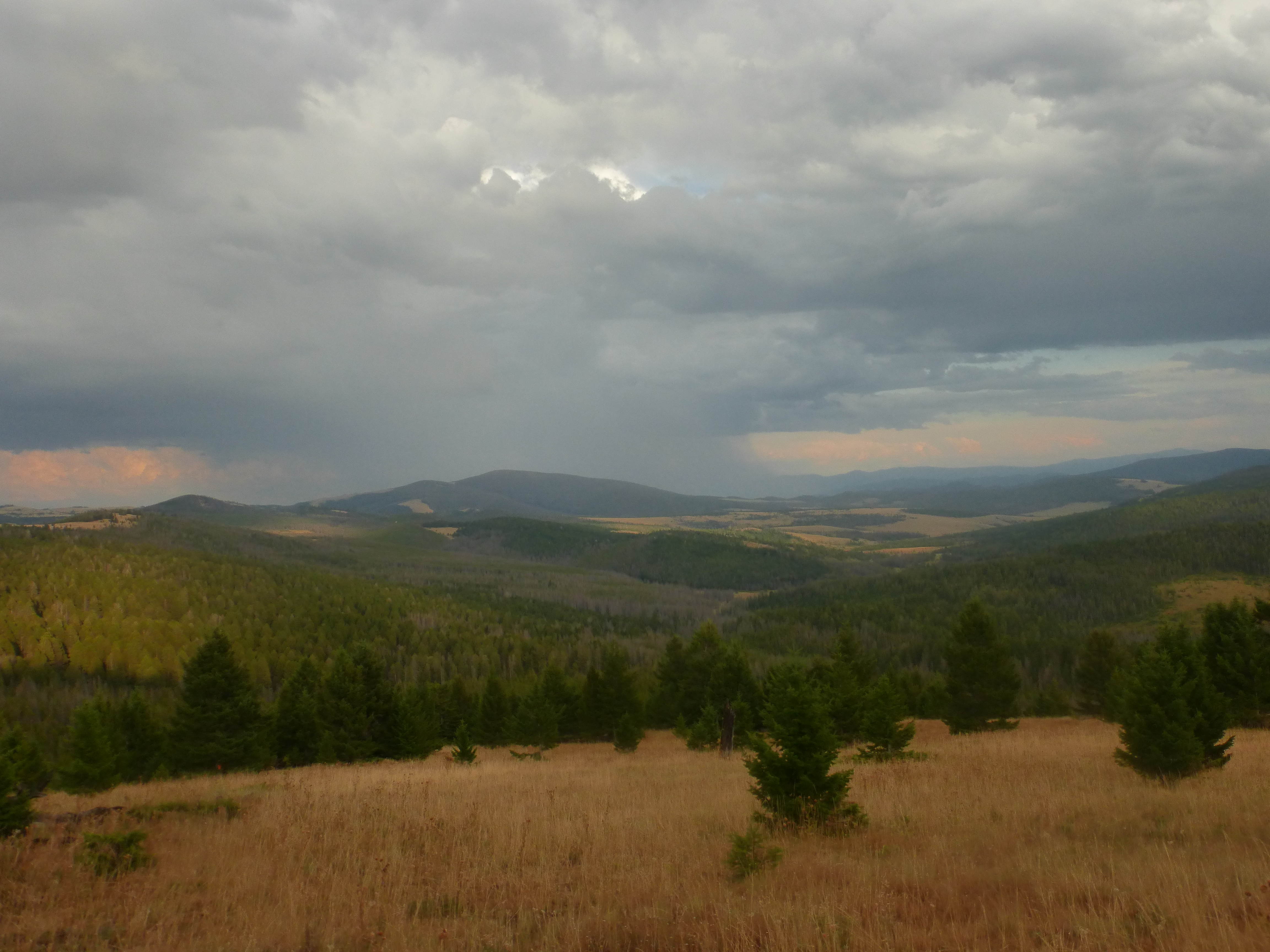
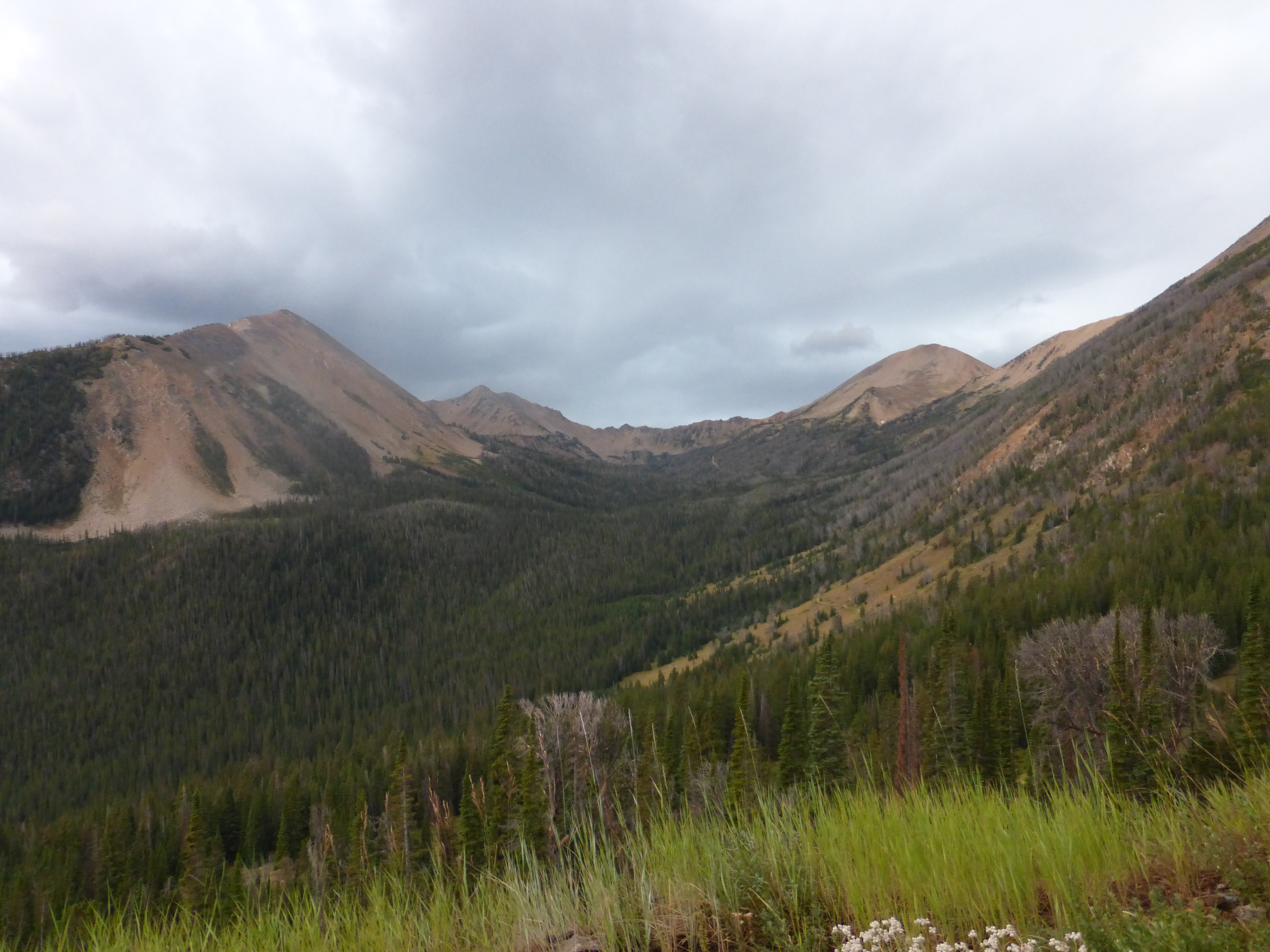
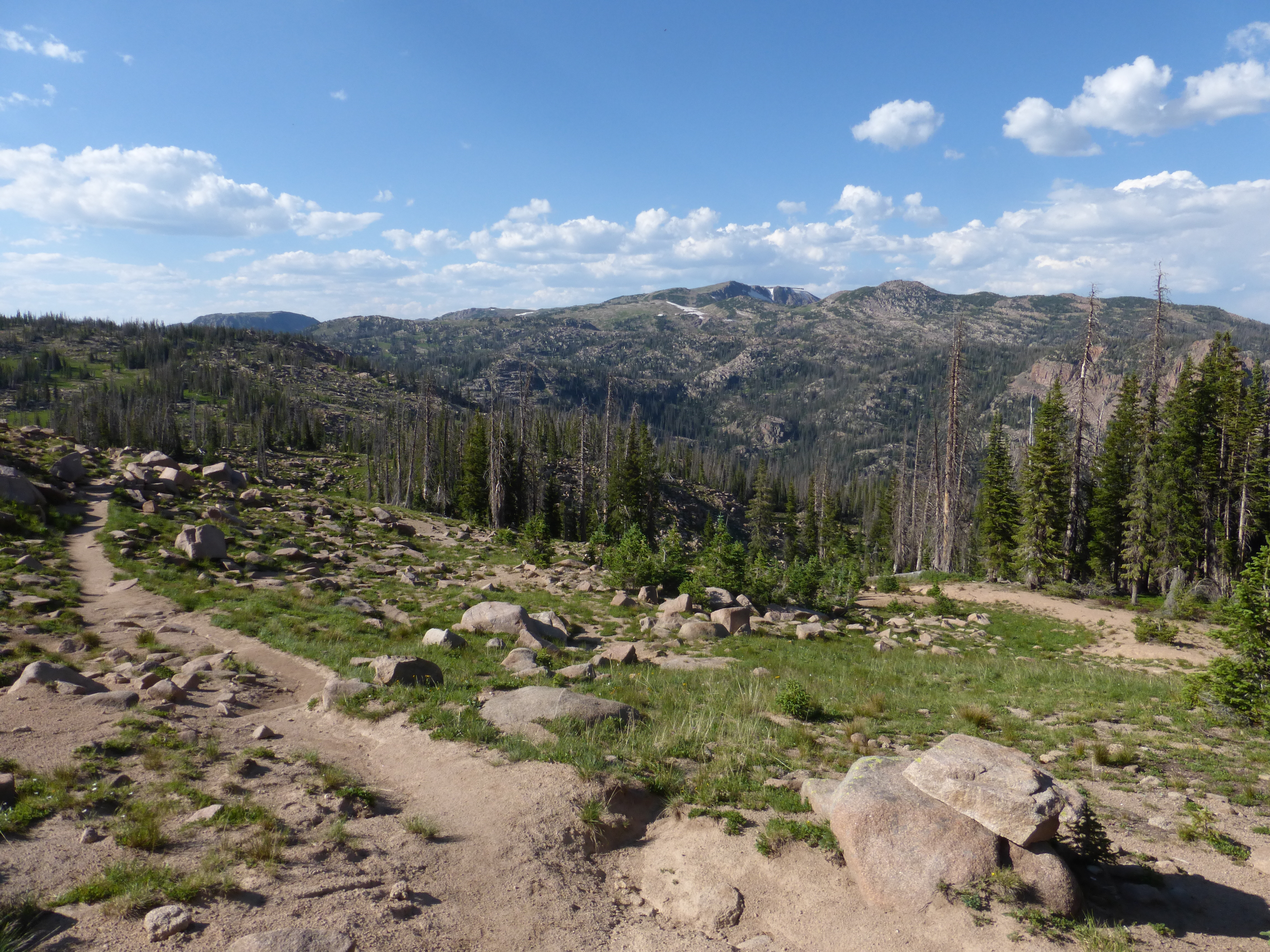
This section of the CDT is know as “The Rollercoaster” because of the extreme up and down over the next 56 miles to Benchmark, my next resupply.  The elevation gain gives no mercy, up and down the mountains that stare at you with a snicker.  I was tired, sweat pouring down my face and my thighs feeling every step.  My shoes were starting to give me problems with holes in the mesh around my toes that let in little pebbles causing me to stop frequently to shake them out.  Water is an issue when your walking ridges because there is no water on ridges, those pools and streams are down the mountain and I sure don’t feel like going lower and then coming back up just for a couple liters of water.   Yet, with all these obstacles I felt immense happiness and pride.

P1010922

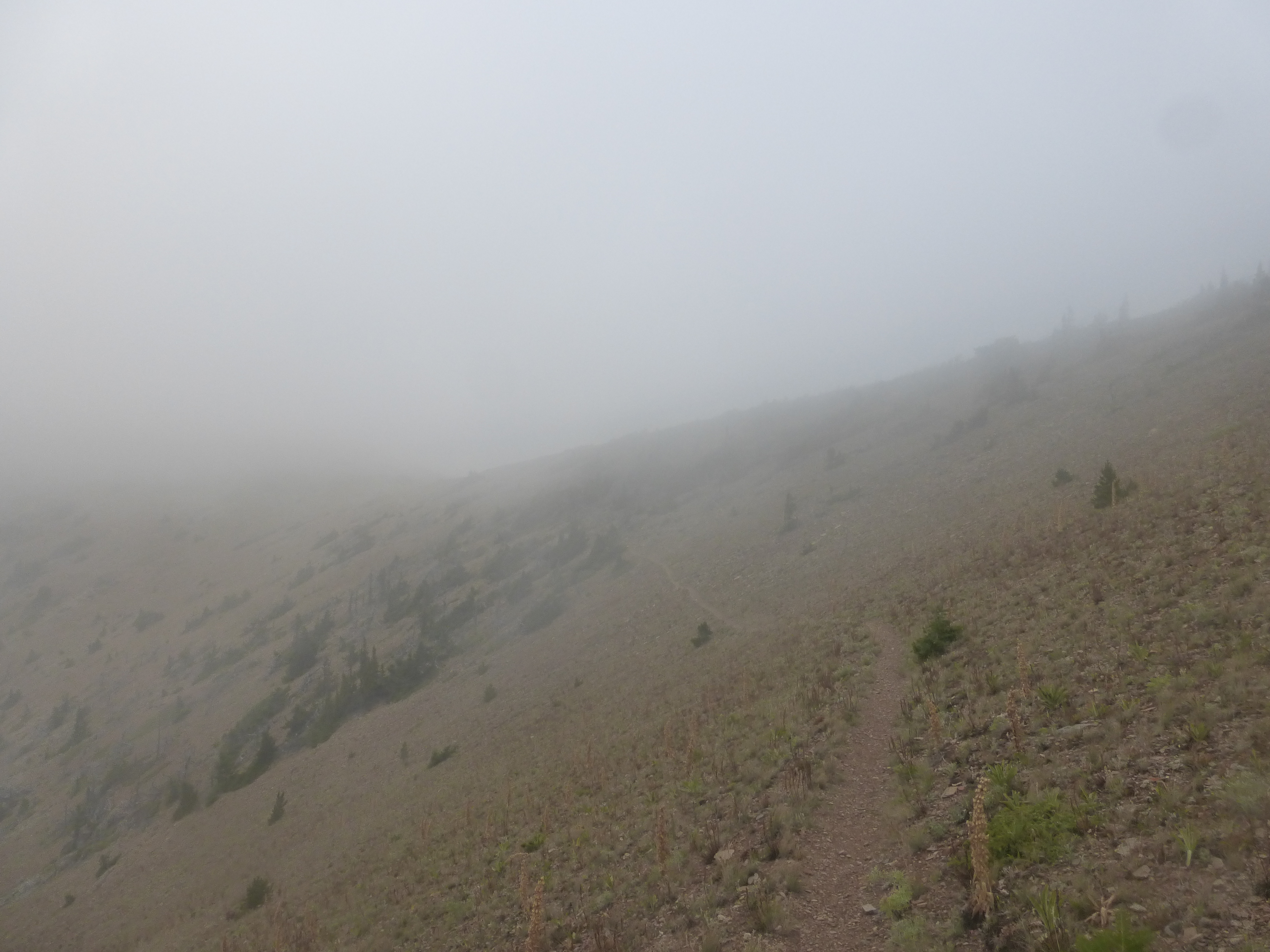
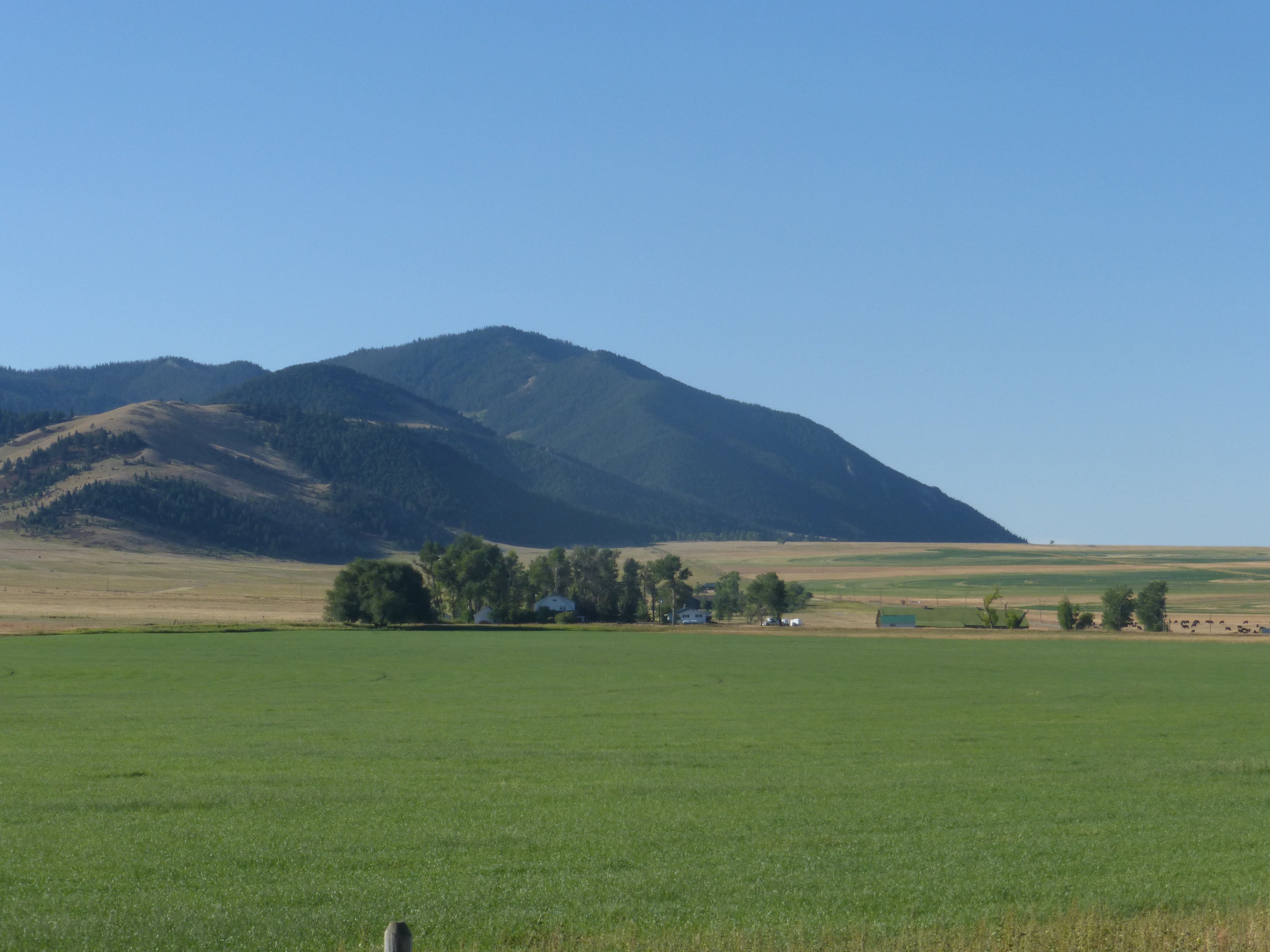
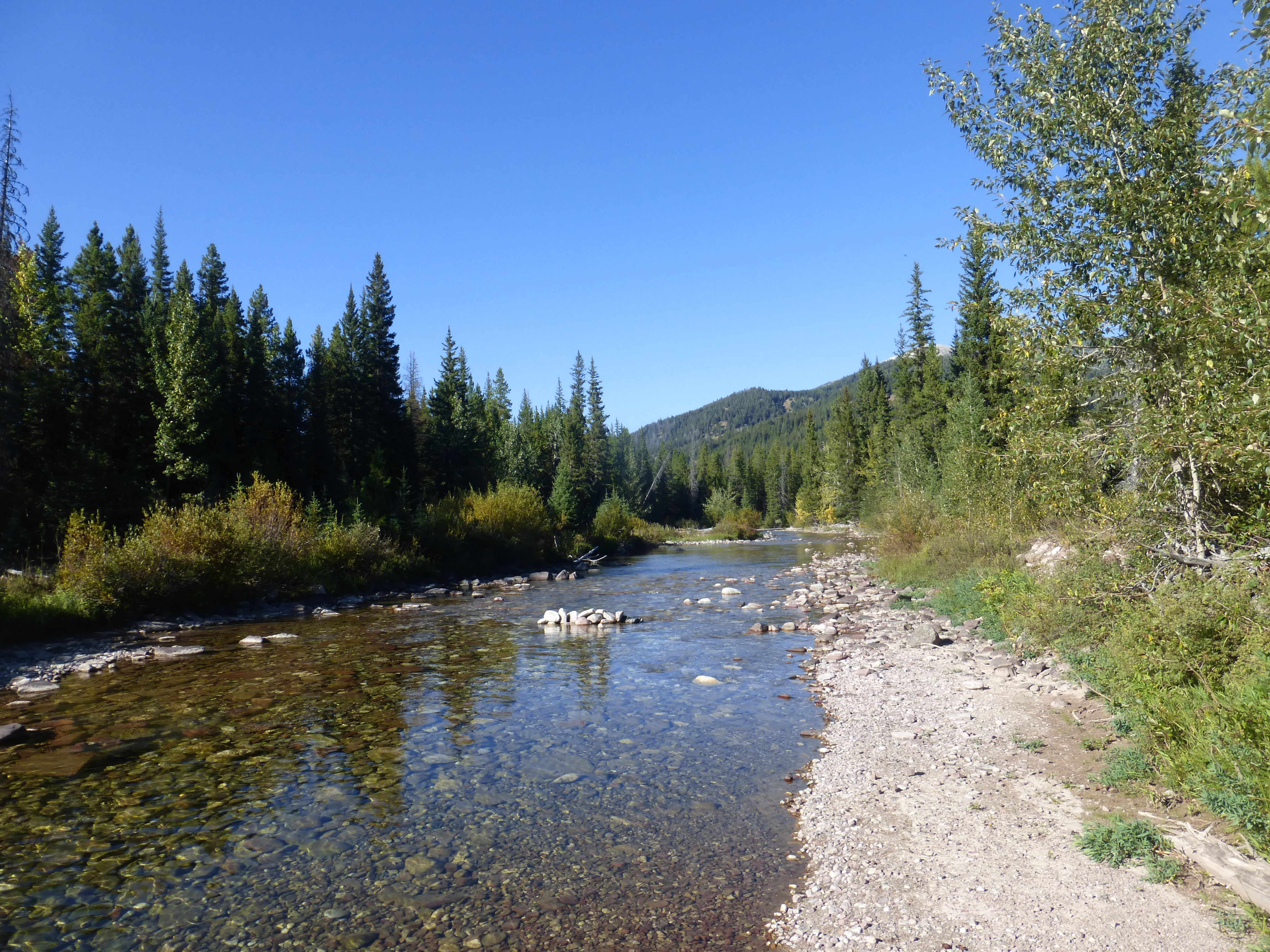
I wake up still tired from the tough climbs from yesterday and start eating what I’ve nicknamed “vitamins’ but its Tylenol.  Since I’m prone to developing blood clots I take Coumadin, a blood thinner, so I’m not able to take the traditional thru hiking vitamin, Ibuprofen, which is better for inflammation but Tylenol is better then nothing.  I’m sure my liver or kidney hates me but my legs and back appreciate it.  I begin hiking in the gorgeous, challenging ridges. The view down to one of the valleys is gorgeous and while hiking down I try my best at being Ansel Adams, playing with every setting on my camera; Black and white, Vibrant, Sunset and a bunch of other stuff I have no idea what it does.

P1010952

I spend miles walking the ridges then dropping down and back up the defined trail while soaking in the view and clouds that are moving past at high speeds.  The lodge pole pines are barely covered with anything as they struggle to even survive at these altitudes and tough conditions.  I skirt past dried up ponds that South Bounders probably used to quench their thirsts months earlier and I wonder what the landscaped looked like to them vs. what I see now.  Moving slowly again up a mountain I’m almost happy that my pack is light.  Its only light because I’m low on food, only about 2 days left of food and more importantly only 2 snickers and a half bag of chips.  This is a problem because candy has become my main stable at this point.  I’m consuming about 6,000 calories a day to keep my body going and I know that I’m not reaching that at all.  I start eating half rations, swallowing my pride and not ask my other hikers for any of their food because that would be like asking for a first-born or for them to carry my tent.  No way, to much pride.

P1010877

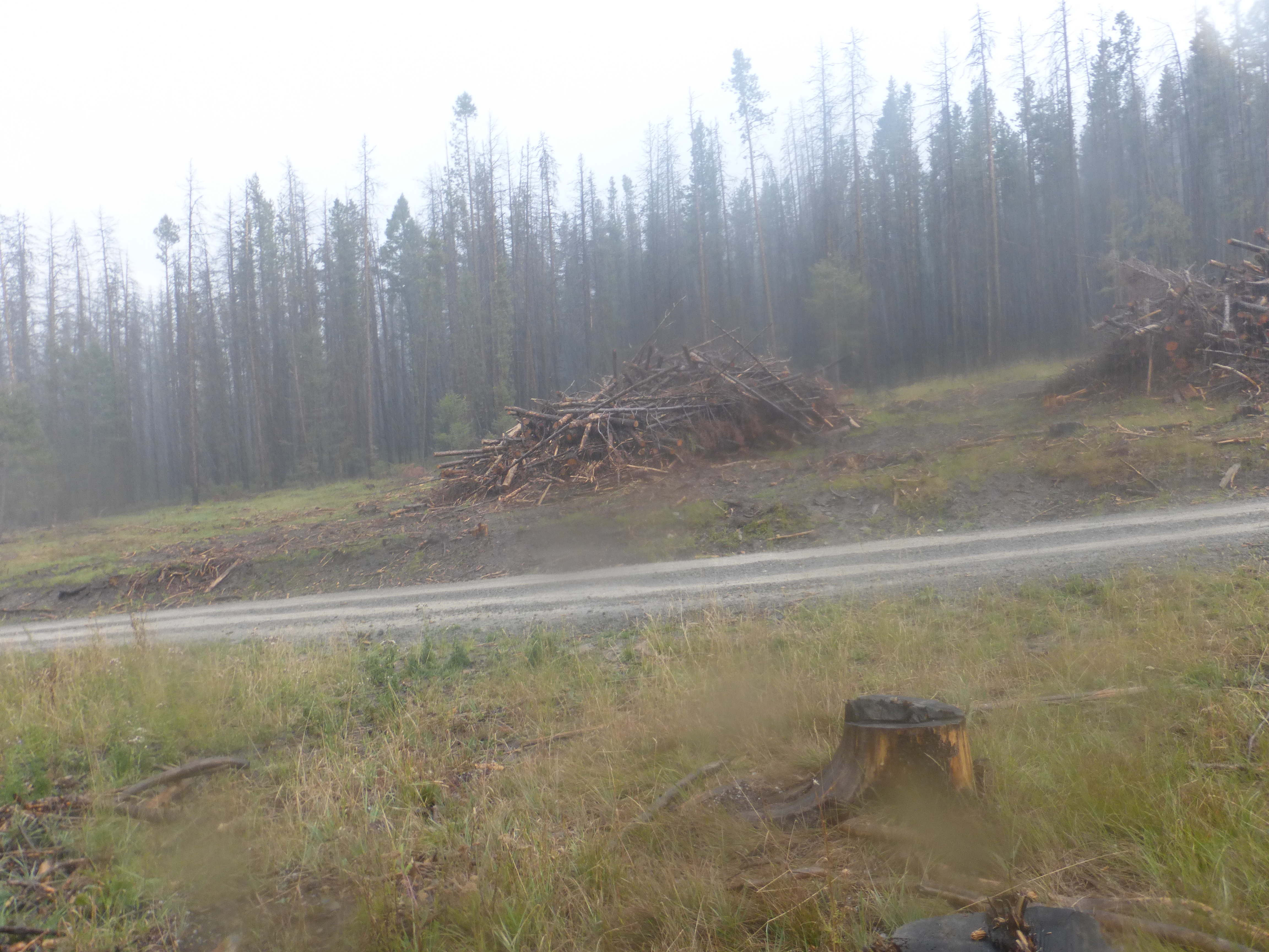
Instead I just crank the music coming through my Yurbuds and start singing along to the Fugee’s.  Hip hop is great while hiking because its got a good beat that keeps you going and like any runner knows the right beat can keep you motivated.  I’m singing loudly as I start descending the mountain coming into the trees.  I turn a corner and smack.  I fall to the ground in pain, rolling around on the forest floor grabbing my right foot as it’s throbbing in pain.  I look back and see the small stump I had just slammed my right foot into.  My toe is throbbing and bleeding.  I’m worried I broke the toe.  I think about just amputating it and moving on but my little blade would probably cause more harm then good.  I instead just sit there for about 5 minutes, pop some ‘vitamins’ and keep going with the pain subsiding the next day.

P1010996

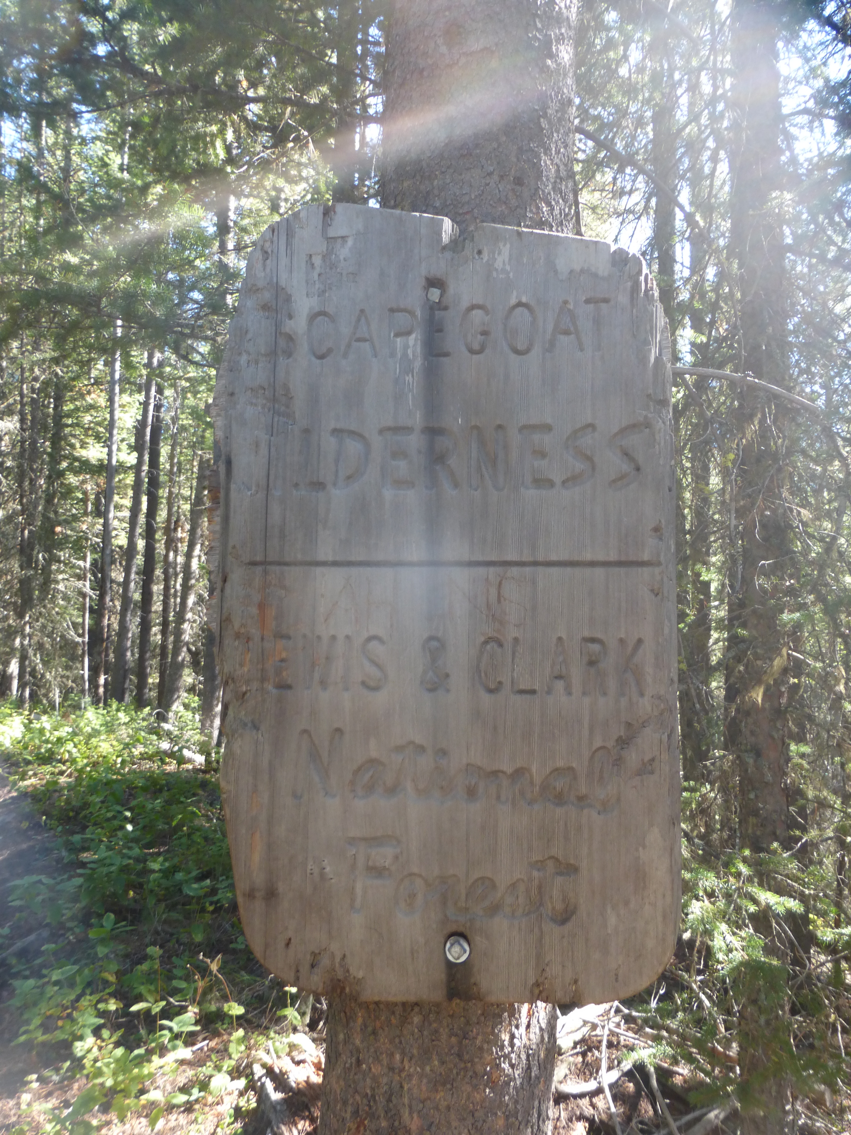
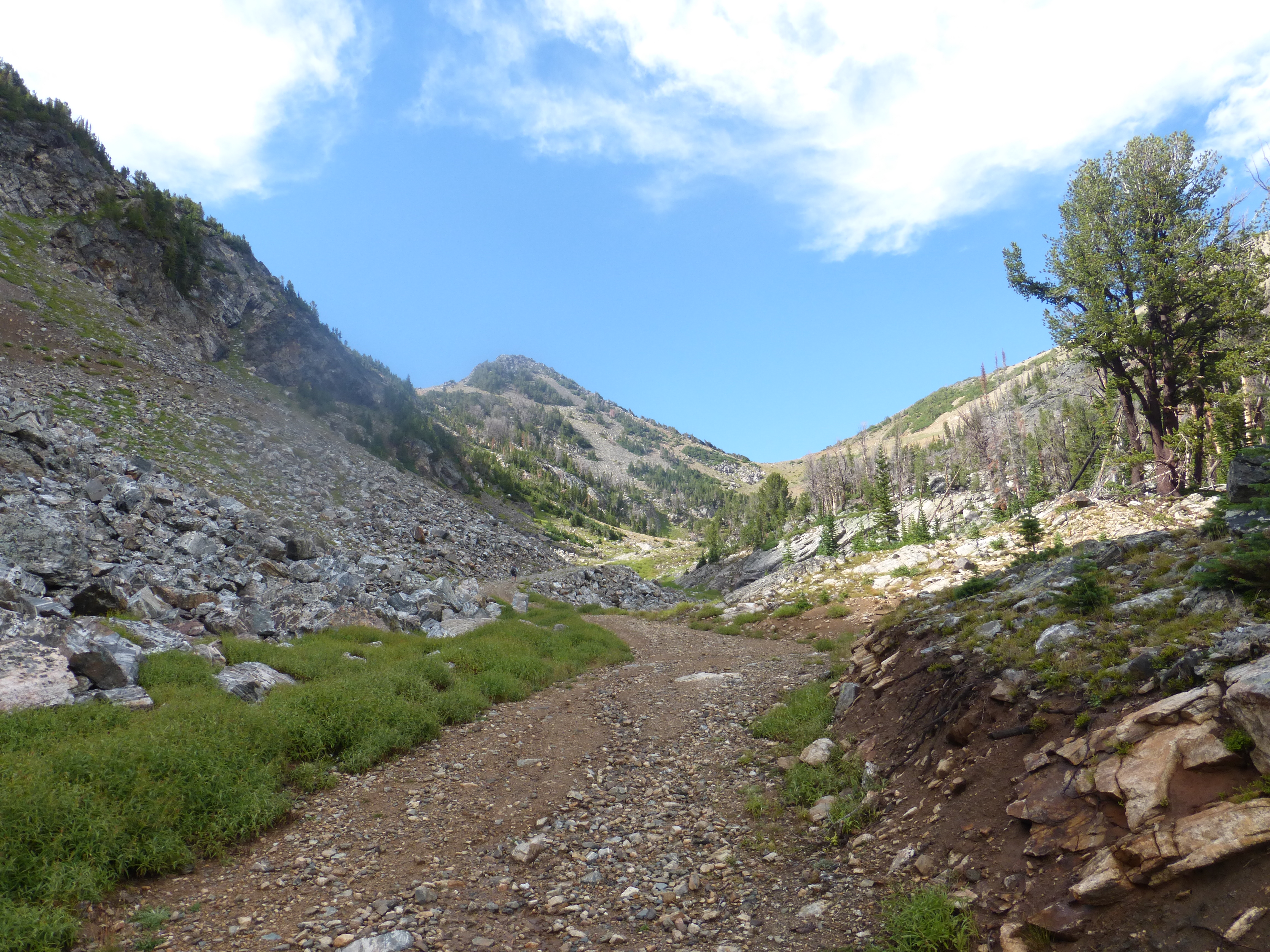
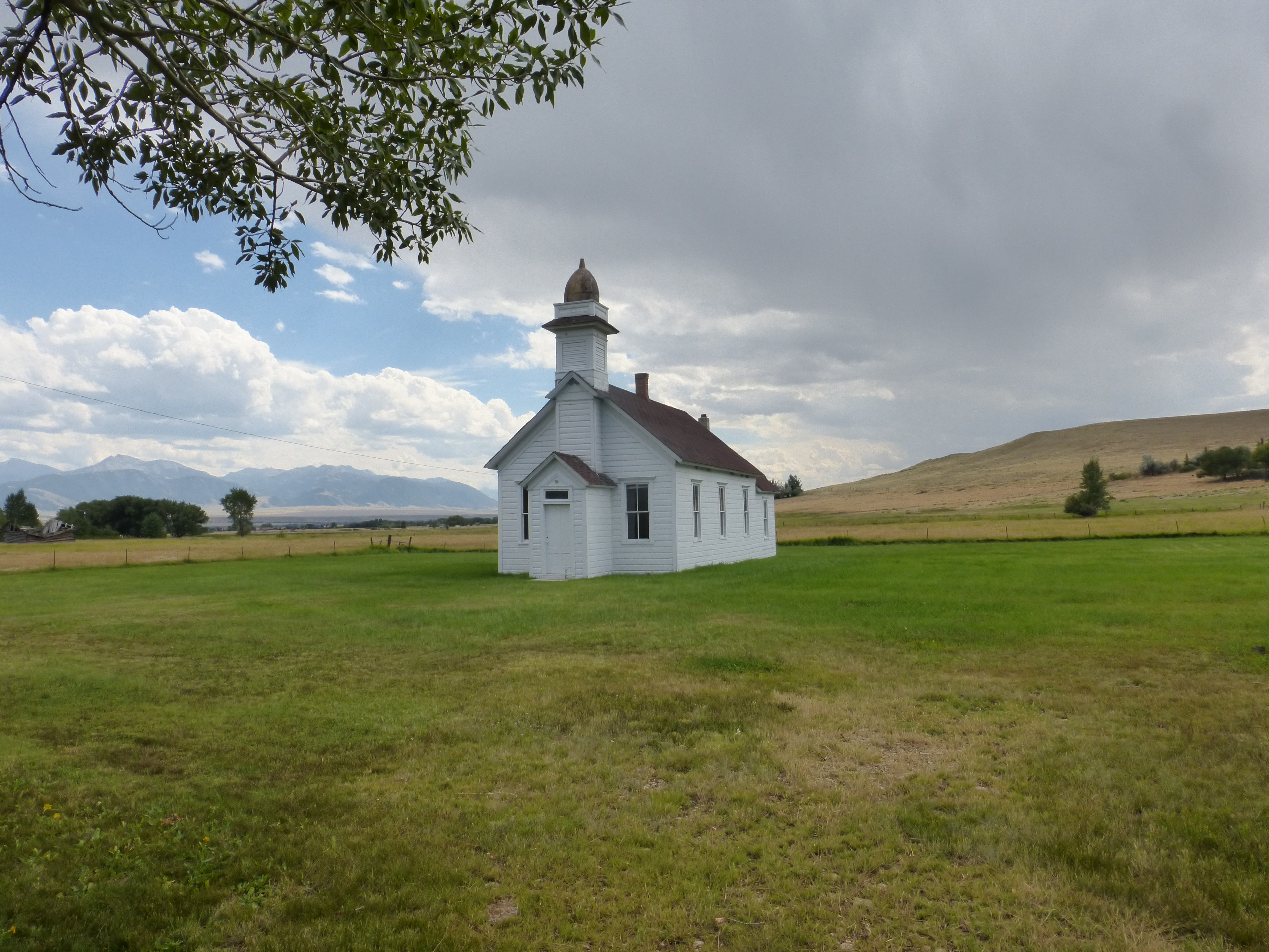
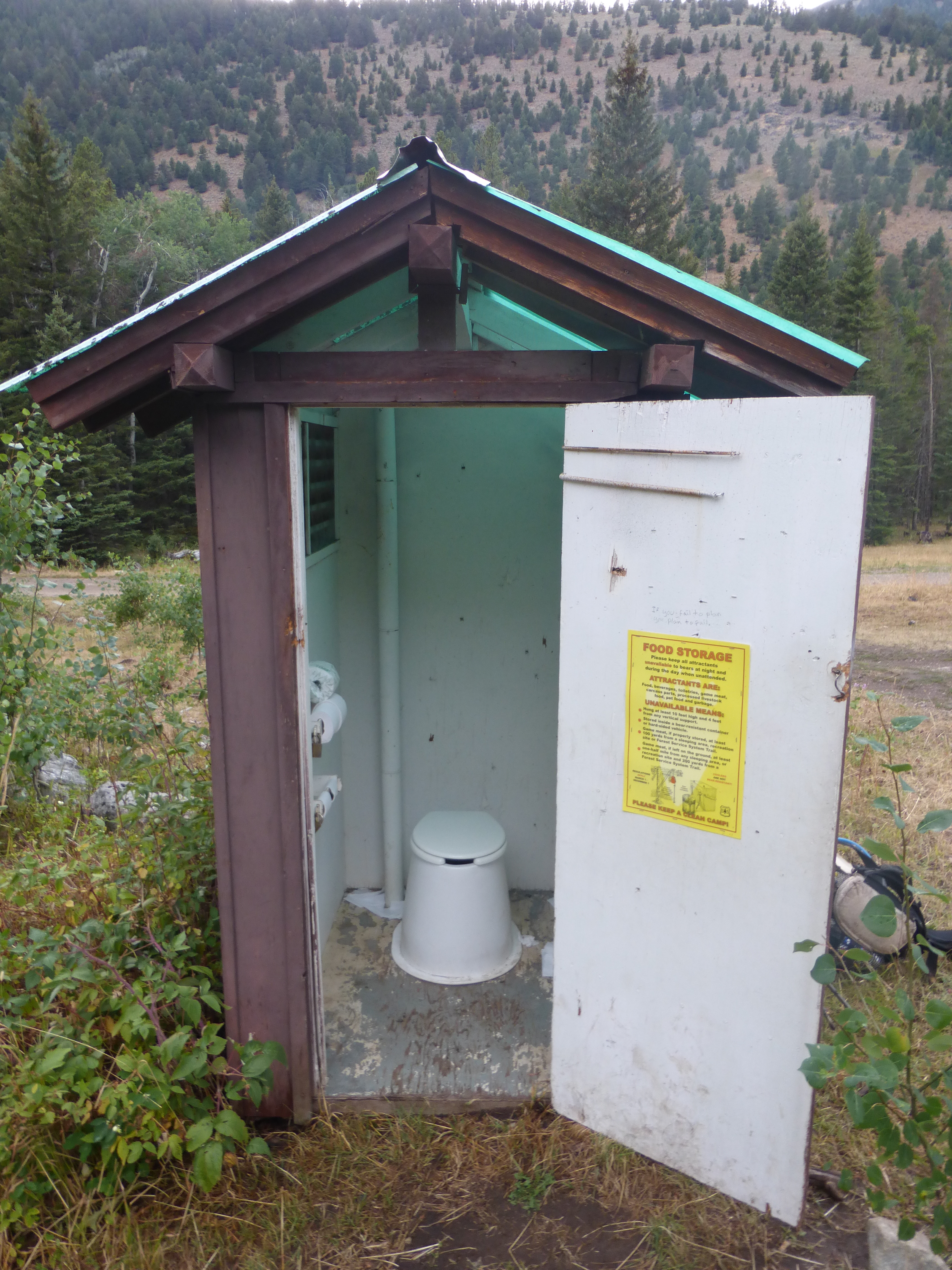
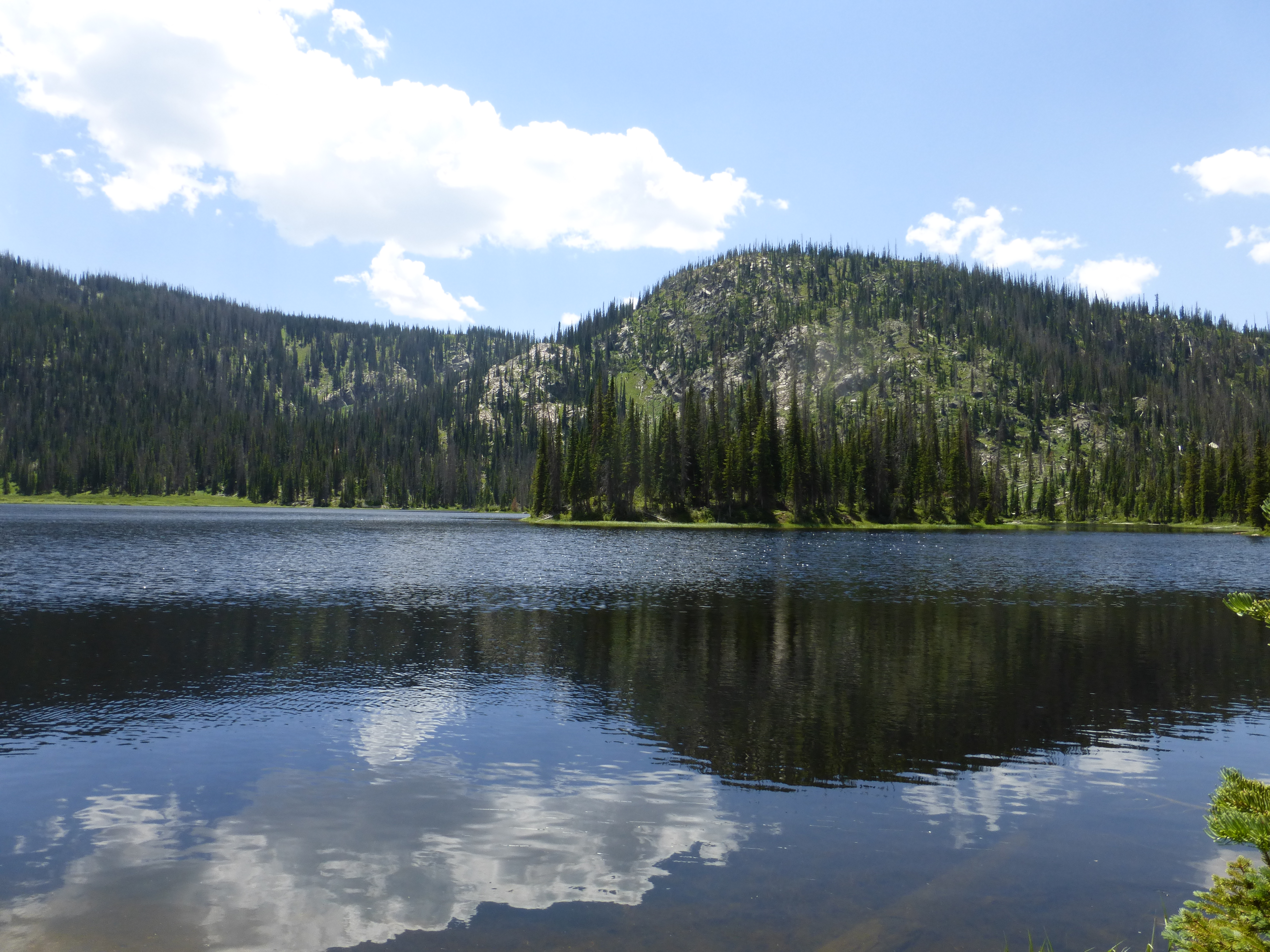
Being in the Scapegoat Wilderness which is part of the 1.5 million acre Bob Marshall Wilderness Complex is surreal, such a vast wilderness that swallows you.  Its full of bears, bighorn sheep, bald eagles, falcons and moose but I had not seen any of them yet.  Rainbow trout the length of my arm and northern pike gracefully glide in streams waiting for dinner to come by.  I wish I had my fly rod with me now more then ever as I know that this deep in the wilderness, they are rarely tempted by my mere mortal flies.  My biggest joy is the sweet tasting water. It is hands down the best tasting water I have ever and probably will ever drink.  The water is so clear, so pure that it’s hard to believe that it’s real.  It touches my lips and I can already feel its immediate absorption into my body.   To treat this water would be like watering down a 100-year-old bottle of Don Perion, it just isn’t done.

P1010998

I make a few more winding turns on the trail and start noticing more foot prints, more evidence of civilization and realize I must be getting close to Benchmark.  I pass a couple of day hikers, a older couple out for the sights gripping their bear spray tightly next to their hip.  One last turn and I hit the trailhead and the dirt road.  I throw my pack off and sit down leaning up against the old trailhead board and pull out my food bag.  I find one lonely cherry starburst sitting at the bottom of the bag and nothing else.  I unwrap it, pop it into my mouth and wait for my ride down to Augusta.


1 Comment

Helena to Rogers Pass

P1010839 Taking a shower after 10 days is a great feeling.  The mud, dirt and grime of your body washes away, sloshing down the drain and quickly forgotten.  How much dirt and grime I put down the drain is a badge of honor and this time it didn’t disappoint. We were dropped off at the Lamplighter Motel, a collection of small individual ‘bunkhouses’ that accommodated various sized groups.  The owner was a kind man who offered us a little discount because we were hikers but crammed 5 of us into a 2-room bunkhouse.  It’s a crazy atmosphere with 5 people in one little room.  It’s a yard sale of clothes, groceries, beer cans, cell phones, drying sleeping bags and cameras being charged and prepared for the next section.  My first stop was the grocery store to pick up all the cravings I had during the last section including chicken, grape gatorade and popcorn.  With my food needs satisfied, the group settled in to watch the beginning of the NFL season with my beloved Broncos playing their season opener.  We slept that night two to a bed with the smell of nasty shoes and Taco Bell clinging in the air. The next morning came on like a tidal wave.  The guy who had dropped us off called and said he could take us back to the pass at 9 am.  It was 8:30 am.  I had hoped to hang out more in town and relax but a guaranteed ride is hard to pass up.  I couldn’t decide but soon opted for the guaranteed ride.  I now had 15 minutes to shop for the 64-mile section to Rogers Pass, which would get me to Lincoln for resupply.  You would have thought I was on the old 90’s  TV show Super Market sweep for how fast I got all my grocery shopping done. Before I knew it, I was riding in the back of the pickup, waving good-bye, ending my “lengthy” 12-hour stay in Helena. The trail snaked up and around the mountain.  I opted to take the Ley purple route, staying low in the valley versus going up high on the divide because of the thick clouds in the distant.  Walking the dirt roads for a few hours I found a nice patch of shade and had a quick lunch.  Surprisingly I got a call from my mom who lives in Europe and I Skyped with her awhile, sitting in the shade of the trees.  All was well until a large crack broke the conversation.  I quickly, and probably to my mothers horror, hung up while yelling something like ‘Here it comes!’.   I quickly threw on my rain gear and battened down my pack and walked right into the storm.  The marble sized hail came with a fury, slamming into my head and body from all angles.  Trickles of water quickly collaborated with the others to create large streams where there once was a dirt road.  I cowered under a tree that offered little protection and after a while I just said “to hell with it” and walked out into the bombing of hail.   The hail bombardment continued for a solid 30 minutes before letting up and the sun finally smiled on me again.

Hail bombardment

Hail bombardment

Twice this size before melting in my hand

Twice this size before melting in my hand

I was walking alone and climbed even higher into the Helena National Forest feeling great.  That day I learned that I actually enjoy being wet, cold and a little miserable while hiking.   Cresting a ridge I found my next water source, which I definitely felt in need of.  I opened up the lid of the spring and found it to be nearly empty.  I was able to get enough water out of it for that night and a little for the next day to make it.   I would later learn that the group behind me would find it in even worse condition, filled with dead squirrels that had fallen in. My nose awoke me the next morning.  It was a clean smell; a freshness that absorbed into my nostrils.  I rolled to my side, still in my sleeping bag and peeked out under my vestibule and saw that I was surrounded in mud thick fog.  I could barely see 15 feet from the tent.  It was a slow moving ghost of white that flowed over me like a stone in a creek. P1010842 I crawled out of my bag and stood outside my tent with my bare feet sending a cold mossy chill up my body as the fog engulfed me.  It was the freshest air I had ever smelled in my life.  I raised my arms out, puffed out my chest, tilted my head back, opened up my nose and took a long deep breath.  The air quickly ran down my throat, into my lungs and was absorbed throughout my entire body.  I was cleansed.  I was free and I knew it. The whole day was full of amazing hiking.  The fog rolled in and over me all day leaving the forest mysterious and medieval.  Pine trees with green moss hanging from its limbs and fog hiding everything else in the background.  The fog was my mistress, teasing me with quick flashes of distant peaks and trail.  I snaked up and down the crest of the mountain excited to feel its next move and tantalizing surprise. P1010845 This day had been an experience that I would soon not forget.  The day ended with a continued rain but I didn’t care.  I was happy and content.  I made it to Stemple Pass where a hunter invited me into his RV for hamburger steak and 2 tasty beers.  I slept that night with a smile stretched across my face. In the morning I woke to a revived spirit, one that was ready to tackle the trail with no worries, only focus on the end goal.  I hiked along the mix of trail and dusty dirt road having to choose between the confusing official CDT route and or the alternates.  Thinking I was on the alternate I headed around a mountain and came to a clearing.   An established trail was to my left; a more defined one was on the right.  I choose right.  Wrong choice.  I went for about 2 miles, always looking back, questioning my decision.  Finally I realized I had taken a wrong turn.  Instead of turning around and going back the way I came, I figured why not just go cross country and connect back up with the trail I should have gone with.  I was in the middle of the woods, following game trails that lead nowhere but somewhere.  I knew I was in the middle of nothing but kept going thinking that eventually I would hit a road I saw on my map but wasn’t particularly sure if I would.  The place was uninviting but not scary.  I decided to just keeping going, assuming it was the best course of action at this point.  Stop thinking and just go. P1010809 I hit a road about 2 hours later and followed it to what I figured was an intersection with the trail I should have been on from the get go.  I needed to clear my head so I sat there, drying out my gear from the night before, digging into my food bag finding whatever chocolate I had left.  I eventually went cross -country to meet up with the original trail and followed it until nightfall, giving up on the ridge walk that awaited me in the morning. P1010904 In the morning I woke up to beautiful conditions of more fog and clouds that covered my path.  It was glorious.  I was high up on a ridge that was obscured with clouds rolling through, up and over the ridge.  I felt like I was part of the clouds and not just passing through.  This lasted for about 15 miles before coming down the mountain to Rogers Pass and my highway to Lincoln.  I was semi-happy to have hit the road, not really needing to get to town other than to satisfy my stomach’s desire for the indulgences of town food.  I put out my thumb in the cold and waited for a ride.  No ride came.  I didn’t care deep down if someone stopped or not, I was in the zone, fully charged and ready to tackle the trail.  My trail friends popped out of trees and I noticed them out of the corner of my eye.  I felt happy to see them, and ready to abandon my hitchhiking quest. After standing by the side of the road for the better part of 2 hours I felt ready to hike, instead of hitchhiking. It was 53 miles to my next resupply in Benchmark.  My food bag was getting a little light but I had bought more food then I needed in Helena.  Maybe I would make it on what I had to eat or maybe I would go hungry for a day or so. What I lacked in food I made up in desire to keep going and not stop.  I was ready for the next section dubbed “The Roller Coaster”.


1 Comment

Big Sky to Butte

P1010670

I sat shivering on the bus stop bench after being dumped off at the base of Big Sky Ski resort.  Having spent the night in a park in Bozeman and getting drenched by the parks sprinkler system at 5 am started my day off on the wrong path.  Now I just wanted to get warm and get my mood into a better place.

Walking up to the base I found a visitor center and met ‘Chad’ a mountain concierge who asked me how my overnight hike went; assuming I was a tourist who ventured out for the evening.  I gave him a slight smile and explained my already scripted CDT story.  I think he saw my desperation for a warm place to relax and charge my phone.  He took me to the hotel across the way and got me an access card to the fitness center.  Another act of kindness from a complete stranger. This place was heaven!  Stocked with showers, sauna, shampoo, conditioner, TV and places to hang my gear out to dry.  I spent the next 3 hours taking full advantage of everything; getting my core warm with a long hot shower, drying gear and going through my food resupply.

Leaving Big Sky with dry gear and a warm core lifted my spirits.  I left town staring at the beauty of the mountain and promising myself to come back and ski here one day.  I turned on my newest audio book, Ted Turners autobiography “Call Me Ted”, began following Jay Road, a private dirt road with many millionaire’s homes, winding over and through the mountains.

P1010609

The next day I stood in an open valley surrounded by hay fields and beautiful farms that seemed to go on forever.  There is something beautiful about being in the middle of a large valley surrounded by fields, watching high thin clouds, and a truly big sky.

P1010613

Crossing the Madison River I entered the town of Ennis, MT population 900, on the town’s main street that served as its main corridor.    After eating at the  local pharmacy/diner I found the local library and hopped on the computer to catch up on some blog posts and overdue emails to friends.  Many of these small town libraries have time limits of 50 minutes on the Internet, so you have to type fast or beg the librarian for more time, which is usually accomplished with a small donation.  I still had plenty of food from my Big Sky resupply but I bought some small treats and snacks that I couldn’t pass up.  I had been planning on leaving that same day but after long phone calls home, eating at the diner again and some general wondering around the sun was setting and I didn’t want to get stuck on the side of the highway for the night.  Instead I ended up hanging out in the back of the library where their Wifi reached and I caught up on the first 3 episodes of the new second half of Breaking Bad on my phone.  It was fun to squat behind the back of a library snacking and watching shows.  I finished my last episode at 11:30 pm and simply laid out my sleeping bag between the library and the house next to it in the dark shadows hoping I wouldn’t get caught.  Thankfully I didn’t, instead I caught a great nights sleep!

P1010622

Nice place to camp

Nice place to camp

Heading up the highway towards McAllister the sky opened up with a flash of rain that sent me running towards an old bar with an overhanging roof.  There I stayed until some other thru hikers came by and sat under the overhang with me.  One of them, Bone Lady, had found some money as she was walking the road and then more, and then eventually finding a pile of credit cards, hunting/fishing license and a total of $375 in cash!  Thankfully we found a phone number on the fishing license and called the relieved owner who had left it on top of his car.  We agreed to leave the contents at the post office across the street for him to pick up later.  Thru hiking karma points!

P1010641

We turned off the road at McAlister and began walking on a dirt road that lead us into the Tobacco Root Mountains in the Beaverhead National Forest, a 26 mile long and 18 mile wide wilderness full of 10,000 ft peaks, lakes and old mining claims.  Walking up the road, reaching a high point, I looked back into the valley of where I had just been and with the shine of Ennis Lake and the Spanish Peaks with the Big Sky mountains in the background.  I closed my eyes to lock in that view in my memory forever.  It was truly amazing.

P1010650

The next morning we continued on the hike up the forest road, watching the clouds creeping in over the range to the west of us.  We knew we were going to get hit by them but when and how bad was another question.  Shortly after pondering this question, the clouds came in and unleashed a world of hell on us.  The rain came down hard, like buckets of water being poured on us with the wind and cold right behind it.  I hid under a scraggly group of trees that offered little protection but at least made me feel like I was somewhat protected.  My MLD pack cover was keeping the contents of my pack dry but I was another story for the most part.

P1010667

After about 30 minutes of non-stop rain it suddenly came to an end.  Content with my future of walking through mud and cold I continued on.  Shortly after passing a barrier to keep out the jeeps and off road vehicles I reconnected with my fellow thru hiker, Cheese, who had hid only about a 100 yards ahead of me.  As we walked ahead on the trail we chatted but noticed the second wave of clouds approaching.  Cheese, being a veteran thru hiker and on the CDT to complete his Triple Crown, saw the signs and started setting up his tent.  Not one to be left out, I helped him setup quickly and as soon as we got inside, the second wave had reached us.  This time the rain came down harder then before with bigger rain drops, stinging wind and cold and it was relentless.  We hid inside that tent listening to Bob Dylan, Rage Against the Machine and Black Joe Lewis & The Honey Bears pouring out of my phones speakers.

One hour passed before the rain let up and we packed up Cheese’s drenched tent into his pack.  We hiked up and over the pass that was covered in old mining equipment long along left behind; it must have been cheaper to leave it behind then to bring it back out.  Coming down the trail was reminisce of old cabins, cables and every kind of mining equipment you could think of.  I always try to imagine the life of those miners who had lived here before, how they had lived, where they were from and about the day that they left.

P1010680

P1010672Emerging off the trail we were back on a dirt road that lead us to the town of Mammoth, a very small cluster of houses that looked abandoned but still lived in.  It was a very cool looking town; the kind you know you could survive any looming zombie apocalypse in.   I wish I could have met some of the people who lived there but no one was in sight and knocking on a door was not an option.

P1010690

P1010688

The next morning was cool, with a slight frost on my tent, which is just how I like it.  It was a good morning because I knew that within 23 miles I would be taking respite in Whitehall that night, sipping a beer with my feet kicked up.  Unfortunately it would be dirt roads and pavement for 20 miles to get me there but nonetheless I was excited for the day.  Dirt roads never bother me but the main paved roads were different because of the traffic and percentages were against me.  The best part of my walk into Whitehall was the apple a group of older women gave me as I walked past their property.  They asked if I was a hitchhiker, which I explained I wasn’t and told them about my hike.  They were amazed and offered me a fresh picked apple from the tree.  They said they were collecting them to make some pies that night, so I jokingly said I would be walking past again tomorrow to get a slice!

P1010681

As I approached Whitehall, Cheese told me that a friend of theirs was going to pick them up at Whitehall and take them into Butte where they would be taking a zero day.  I was ready to take a zero but felt bad leaving the guy I had been hiking with for the past month, who unfortunately was not getting along with the other 3 hikers.  We had been having some tension building between us for a while and I was ready to hike with a new group.  I made the tough decision to tell him I was leaving and essentially had to break up with him on the side of the highway.  He was ready to hike alone anyways so I feel it was mutual but it was still a little awkward. I began getting excited about moving on from Whitehall into Butte.   As I hopped into the back of Dirty Feet’s pickup, I waved good-bye to Flippi and looked into the setting sun looking forward to the cold beer waiting for me in Butte.


21 Comments

Finished!! Hello Canada!

P1020594

Oh man, I can’t believe I’m saying this but I REACHED THE CANADIAN BORDER!!!   I can’t believe that I made it and am thrilled that I’ve accomplished my goal.  Thanks Grannyhiker and OregonTrail for checking in on me, things have been crazy trying to get things in order.  I apologize for being behind on my blog posts but trying to find a computer in small Montana towns had been very difficult.  I’ll be doing some catch up work in the next week.  I’ve got some great stories of what happened in Montana including the hike through the Tobacco Range, sleeping in a public park in Bozeman, finding a wallet with $350 inside, avoiding fires & hunters in the Bob Marshall Wilderness and my cold and snowy finish in Glacier National Park!  Stay tuned.


1 Comment

The Exceptional, the Good and the Ugly: Part 2

P1000844

The Exceptional:

Golite BL2 Crewneck Baselayer: This baselayer has been with me since the start and has never let me down. It’s a great baselayer that weights only 5 oz and fits snug next to my body, keeping me warm at night.  Wicking moisture away quickly is key to keeping dry and it also stays relatively odor-free, even after 7 days of constant use. Its also my town shirt that I can wear to restaurants and bars without being that smelly looking homeless guy.

New Balance Leadville 100’s 1210’s: People always talk about the big 3 (pack, shelter and sleeping bag) but I think it needs to be the big 4, including your shoes. Lets face it, if your feet are all blistered up or in pain you aren’t going anywhere. These shoes feature a Vibram sole which grips the dirt and mud with ease and only weigh 10.4 oz, which is light. The synthetic/mesh upper keeps my feet dry. When I do have to ford a river they drain quickly and don’t wear out, retaining their form. My last pair were on my feet for 800 miles, so these shoes are built to last. Foot wear is SO important, and I’m lucky I found a pair that work so well. * I wear a size 13 4E for reference

Suunto M3 IN Compass: Having a compass is essential to being outdoors and this compass has not disappointed me. The features that make this compass so great are: Specifically balanced for the northern hemisphere, adjustable declination, magnifiying lens, ruler and luminous markings to help me us it at night. It’s lightweight and fits easily into my pocket. Even with all the dust and sand its encountered the bezel ring has yet to let in debris that would stop it from rotating and giving me the right direction. I will have this compass for life and highly recommend it. Now, just buying it won’t guarantee you don’t get lost but, thats a whole different blog post.

Otter Box Defender Phone Cover:  This protective case for my phone (Motorola Droid Razr Maxx HD) has kept it working after 2,500 brutal miles on trail.  I have dropped it on concrete and rocks, seen it roll down a mountain and submerged it in water with no problems to my phone.  The 3 layer protection of screen protector, polycarbon and silicone outer layer protect the screen and body from damage.  I can’t recommened Otter box more enough, its saved my phone from utter destruction

The Good:

Suunto Core Watch: I was so excited and researched this watch like crazy before I purchased it. At $299, it’s not a cheap watch but it’s feature rich with alti/barometer, compass, storm warning indication, elevation profiles, alarm and a host of other features. What makes this watch only good is that its not an easy watch to learn how to use and after 2,000 miles I still don’t know how to work 50% of the watch features. The storm indicator goes off at random times even when the skies are clear and a count down timer turns on for some reason. As with all Altimeter watches, you need to update your elevation frequently to keep it accurate. With storms coming and going, it can give you false readings as well. This is a good watch, but in order to learn all of its features, I feel like you need a degree to use it and then spend more time fiddling with it then actual hiking.

REI Sahara pants: These have been my pants of choice for many years and I love these pants, but there has been a recent redesign that has changed the fit and feel of the pants. The material does not last as long, and my right leg pocket is starting to rip right in the center, making it useless for most anything other then my large folded map. The zip-off pants do come off easily and the side zip feature helps me get my rain pants on quickly. The belt that comes with the pants does ‘unbuckle’ easily so if your adding a pocket to the hip belt make sure you don’t lose it when the belt becomes loose. Overall, I do like these pants but feel the new cut and material used have made it of lesser quality than previous generations.

Starter boxer briefs: Can’t believe I’m actually talking about my underwear but, these pair have lasted me the entire trail. I bought them at the Walmart in Deming, NM and surprisingly they have worked the entire way, beating out more expensive pairs I tried out. They are tight to my skin, help prevent chaffing and comfortable for all day wear. They also don’t collect much odor after miles and days of use and are an easy wash in a gas station rest room and dry very quickly. I don’t know what exceptional underwear feels like so they got put into the good category. I’m sure they would also be good for regular wear or other sporting activities.

The Ugly:

Sliding Zip lock bags: These bags are completely useless in my experience and should not be used for protection from the elements. The sliding mechanism works only for a short amount of time and rarely keeps a tight enough seal to keep out water, dust and dirt. Stick to your regular freezer bag quart size zip lock bags as they feature the double seal and are much more durable then any other type.

Pop-Tarts: Some people might not agree with me but Pop-Tarts have never worked for me on the trail. Other hikers love them for their very high calorie content but for me they would just crumble into tiny saw dust pieces that made them very difficult to eat. Hikers have explained that you need to get the kind with a cream or sticky filling so they bind more but, I guess I gave up too soon.


Leave a comment

Grand Lake to the Wyoming Border

P1000651

After being in the ultra-tourist town of Grand Lake, I was ready to get back on the trail. Steamboat was 73 miles away and the hike would include plenty of high ridges.  I headed out of town following the highway, officially entering Rocky Mountain National Park. Soon I would start winding up the never-ending connections of ATV roads that lead to the ridge of Cascade Mountain.  After a couple of hours I reached the ridge that would take me to the top of Rudy Mountain. However, after spying some thick, dark clouds to the west, I decided to get my tent set up and hunker down for the inevitable storm that was going to pass over me soon.  I was correct in my prediction as heavy rain, hail and lighting rushed over my tent.  The gale-force winds and rain were so strong I could feel myself almost being lifted off of the ground.  I laid there knowing I had no control over what was happening, and that was amplified when lighting struck not 50 yards from my tent.  It was an immediate BOOM-CRACK followed by a sensation of electricity flowing right through my body.  My hair stood up like Mr. T and I could feel a complete sensation fill my body.  I had just been a medium for the current to flow through me.  This was the scariest weather-related incident on the trail, for me, so far and I hope it doesn’t happen again.

P1000592

The next day, I packed up and made my way around Cascade Mountain and down the dirt bike track, leading to connecting trails to Willow Creek Pass.  The trail was good but the constant up and down was draining my energy.  I only made it a couple of miles past the pass and made camp in a car camping spot that provided some protection from the rain.  In the morning I climbed up Parkview Mountain, which has an old weather cabin at the top that is now littered with mice and spiders.  The cabin was also full of tags from CDT hikers that came before me and other hikers I’d have heard of like D-Low, Andrew Skurka, Lint and the ghosts of many other hikers that came before me.  It was like the CDT wall of fame and I was proud to leave my mark behind for all others to look at, in the future.  Leaving the cabin lead up the ridge at 11,200’ until dropping down and around Haystack Mountain.

P1000463

Being up high was great for the views but it makes water sources scarce, so its important to camel up or take enough with you.  The trail remained high on the ridge for most of this section, which I really enjoyed, but made timing really important.  You have to get up early enough to avoid the afternoon thunderstorms because you don’t want to get caught up high when the clouds come bearing down on you.  I also didn’t want to do too many “bonus” miles escaping the ridges.  Luckily this didn’t happen to me, but I got close a couple of times.

P1000541

I started my descent from the mountains on Indian Creek Road, which leads to Highway 14 and eventually, Muddy Pass.  It was a dirt road that went on for a long time.  My sunglasses fell victim to my brain dead walk. I left them at the last decent water spot I could find before a herd of cows fouled the water.  I like to think there’s a cow out there wearing my shades right now.  After spending the night in a camping spot off the road, surrounded by cow pies, I started my walk down highway 14, which connects to highway 40 at Muddy Pass and the end of the section at Rabbit Ears Pass.  Walking a total of 15 miles on the highway is hell. Not only are cars passing only 2 feet from you as you’re walking the barely-there shoulder, but it turns your feet into ground beef.  It was a miserably hot day.

After making it to Rabbit Ears Pass and hitching into town with another hiker named Pacer, I was happy to have the comfort of a hotel and a hot shower.

P1000488

Leaving Steamboat and rejoining the trail at the pass, I was excited to be entering the Mt. Zirkel Wilderness Area.  This area is famous for its high passes, alpine lakes and gorgeous scenery.  It had been a place I’d wanted to visit for some time and I was happy it was on my route.  It was also the first place I had seen the name ‘Wyoming’ so far, following the Wyoming trail 1101 until I hit the border.  The Zirkel did not disappointment, with its many lakes such as Round Lake, Luna Lake and dozens of others.  Going over or near Mt. Ethel, Lost Ranger Peak and The Dome which was spectacular.  I took an alternate path down the Three Island Lakes trail as it was a little shorter and described as scenic on the Ley maps.  I was not disappointed with a great lake to dip my feet into after some rough down hill and hot weather.

P1000592

Dropping down to the forest road and following it on my way to Diamond Park I was flagged down my some campers next to the road.  They asked me what I was doing and I gave them the now-scripted story of hiking to Canada on the CDT.  One of the guys in the group quickly advised me that “well hell, you must need a beer!”  Yes, yes I did need a beer!  I quickly became friends with this group of campers that consisted of two families and their kids, out car camping.  They were great people; feeding me a burger, potato salad, beans and BBQ chips.  Before dinner it was customary to drink a couple of beers and then shoot off some guns, which I was happy to do, since I don’t own guns nor shoot them off very often.  Turns out I’m a pretty good shot!

P1000630

In the morning I said my goodbyes and headed up trail knowing I was getting close to the Wyoming border.  I hurriedly made my way on forest roads and deadfall trail.  I tried to make it to the border that day, but fell short by only 7 miles.  In the morning I got up early and bolted up the trail knowing Wyoming was close.  Finally around noon I saw a sign nailed to a tree saying ‘Wyoming State Line’.  I was elated!  I was so happy to had known I walked into Wyoming.  I took about 40 pictures of myself with the sign, near the sign, funny face, serious face, thumbs up and the victorious arms raised pose.  There’s a white line of rocks that marks the borderline of the two states and I couldn’t help jumping back and forth between the two and lay there so that my upper body was in my Wyoming while my lower body was in Colorado.  I’m a dork but it was fun to play around.

P1000658

Not long after that I was at Battle Pass hitching my way down to Encampment where my resupply was hopefully sitting at the post office.  I was excited be in Wyoming and knew that I now only had one more state to go!


1 Comment

Section 5: Pie town to Grants

I love Pie!

I love Pie!

After stuffing myself with pie and loving the Toaster House, while in Pie Town, it was unfortunately time to start the hike to Grants. We left late in the afternoon after meeting two other CDT hikers, Trip and Michigan Wolverine, in cafe where  we were having a late lunch. I couldn’t resist having one more piece of pie before I left.  We chatted for a while and shared stories of the past section, which is customary to do with other hikers. They are both great guys and I was glad to bump into Michigan Wolverine later on the trail in the El Malpais ” The Badlands” . We left the Toaster House with new hiker friends, Virgo and Nicotine, and did a 10 mile road walk until we called it a night near the road out of town. It was a cool night with a half moon that lit up my tent.

P1000941

The next morning we started on a full day of road walking before we hit Amejo Canyon which would be our camp for that night. We got water halfway through the day by stopping at the Thomas ranch which is run by some of the sweetest people I had ever met.

John and his wife have lived on the ranch for many years, having purchased the property from a flyer they happened to receive in the mail many years before .   They ranched the property and lived in a what you would call a “large open shed” that they converted into their living space. Everything was beautifully compartmentalized and decorated with antique, family pictures and an old west-looking ‘outhouse’ indoors. Its was a wonderful place. We sat and talked with them for 2 hrs about all the hikers that had come through the property since they started hosting hikers in the late 90’s, I believe. They had nothing but good things to say about hikers and the visitors they’ve had over the years. John told us stories about his time being a medic in Korea and how proud he was of his service and his continued mission work around the world. He was a pastor and his wife had joined him in his journey while raising their children.

John told us a story about how he had saved a man’s life in Korea.  He was called to a mortar explosion that a private had been unfortunate enough to be standing near.  When John arrived he used what he calls his “basic” military medical training to help the private whose insides were now outside of his body. The skin tends to shrink after the tension has been released from it so he picked up a large safety pin that was used to close laundry baskets and pinned the skin to his pelvis, pushing all of his insides back into his body.  They had been laying on his chest before that time and it was doubtful that the private would survive.  John did all he could for him and took him to the helicopter that would take him to the MASH unit that was waiting for him but not before he took a picture of the chopper as it flew away.  Fast forward 42 years, and after some investigative w0rk by John over the years, he obtained a phone number from the private’s cousin he’d  found through the internet.  With shaking hands, dialed the number and waited for someone to pick up… ring… ring… ring…  Finally someone picked up and it was the man whom he had saved 42 years earlier.  John told him his name and explained “I was one of the medics that pinned you up that day.”  The shocked private acknowledged, saying only “Oh, Oh…”  Unsure of what to do next, John asked him if he had plans for breakfast, being as the phone number was in the same area.  The private told him that he ate breakfast at the same place everyday, and he suggested they meet there.  John replied “Ok, I’ll meet you there but you better not die tonight because I’ve waited 42 years to meet you again.”

The next morning, two men who had not seen each other for 42 years are face to face in a coffee shop.  They embrace other and quietly start to cry.  This is the story that John tells us and as he tears up, I can feel myself doing the same.  This is bravery and love from service that I will never know.  It warms my heart thinking about it even now.

The Thomas's

The Thomases

John then embraced his wife, for whom he has so much love, it practically glows from their faces and  bodies. It was truly a wonderful place to rest our weary bones. Two hours later, we continued on our road walk until dark when we reached the canyon and setup camp for the night. The next day we headed up and over the ridge to Sand Canyon, which as you expect, was lots of walking on road and sand that just sapped the energy out of me. Virgo is a faster hiker than me, so he took off and we didn’t see him again until we arrived at Grants. Everyone has their own hiking style, and that’s fine with me. We continued down the canyon and eventually started our road walk to the Rim Trail which provides a great overlook of the Ventana Arch and the expansive volcanic area called El Malpais National Monument.

P1010011

P1010024

P1010017

The black basalt terrain was created over the past million years by volcanic forces that created this vast landscape of cones, trenches and caves. The black volcanic rock was tough to walk on and brought the end of my shoes by cutting up the soles so badly that my feet were completely exposed to sand. The going was slow but, the beauty of the landscape and it’s rugged terrain was a great change of pace. After the 4 hours of walking across the El Malpais we entered the final canyon which would take us to Grants the next day. We camped that night on the side of the forest road with Michigan Wolverine, who we’d caught up to toward the end of our hike in the Malpais. The next day we continued on the forest road but not before spotting my second snake of the trip. It was sunning itself on the road and cared less that we were near it until we got a closer at it. It was still a young snake so it’s rattle wasn’t loud and it didn’t seem as afraid of us, as I was of it.

USA

USA!!

Walking into Grants I was happy to back in a town that provided me with the opportunity to rest and relax before the next section. We stayed at the Travel Inn, which has cheap rates, and did our laundry, which needed lots of presoaking. I’ve learned that washing machines are designed for normal humans, not thru hikers.


6 Comments

34

Tomorrow is my Birthday.  I’m going to be 34 years old.

Birthdays are always the time that you start reflecting on life and what you’ve accomplished so far and what you still want to accomplish before your next one.  I can say that this will be one of my best birthdays ever because I told my self last year that I would be a more evolved person next year.  I can say that I’ve accomplished it.  I’m 60 lbs. lighter, stronger and more determined then ever.  I have also done something which you might not think is good, but I have scared the shit out of myself.  I have changed my life drastically and I am flipping out.  I have no real residence, no job, no income, no car and all of my belongings fit into 8 large Tupperware bins.  Funny thing is, that this will probably be one of the best years of my life.

It hasn’t been an easy year by any means and the last month has tested my resolve like none other.  It’s challenged me to see if I’m really committed to the big trip and the change of lifestyle I have for the next 5 months and beyond.  Where will I be this time next year??  Who knows but I know for certain that I will keep living, keep dreaming and then keep doing.  A dream is just that, a dream, unless you put it into action.

For this birthday, I wish happiness for me, my family and for all of you.  I want all of you to go out there and hug someone you love, call a friend instead of sending him or her a Facebook message and do something good for another person.  Do good.  Because this time next year I will be a different person… who will you be?


1 Comment

New Mexico Sections 6-10

This is my plan for sections 6-10 which ends in Chama, NM which is my last stop before I start heading into the San Juan section of my hike.  Here’s how I’m planning to hike these sections:

Section 6:  Reserve to Pie Town:  39 Miles

Ley Maps 28-26-Mail Drop

This section of trail is a pretty short section to go before hitting Pie town, and is not known to be that difficult.  There is decent water throughout this section with many solar wells and a couple of spots where local ranchers will let you take water directly from their spiggots.  Pie town is famous mostly for one thing… you guessed it, Pie!  There is very little here other than the two restaurants that serve some of the best pie in the world, according to some hikers.  If the Appalachian Trail (AT) has a “½ gallon challenge,” then I think that Pie Town should have a whole pie challenge.We’ll see if I actually do that when I get there.  A mail drop is pretty much mandatory here because there is no real grocery store in town other than the Top of the World store, which is 3 miles west of town and has a limited resupply selection.  I will be sending to, and staying at, the Toaster House which is a very friendly hostel that accepts packages (UPS only) and has cheap accomodations.  You can also call head to the Grants Visitor Center to see which windmills are operational. However, this is an old note I read from 2008, so I’m not sure whether or not it’s still valid.

Section 7:  Pie town – Grants:  86 miles

Ley Maps:  26-20-Local Resupply

This seems like it will be a very cool section because it takes you through a lot of canyons and Anazasi ruins.  The water supply is spotty in places with some stretches of 20+ miles if the sources you do find are not suitable to drink.  The area is also known for illegal drug activity  – with planes dropping bales of something for pickups waiting to haul it away.  I’m sure they move their smuggling spots around so I’m not too worried, but I might think about camping ‘out of sight’ in this stretch, just in case.  When I hit Grants I will be happy to stop by some wonderful Trail Angels – Hugo and Carole – who run a small B&B.  They are extremely welcoming and will help you with anything you need, especially water caches for the next section.  They used to allow people to stay in their home but as of this year, they are no longer doing it. Apparently an extremely rude hiker trashed the couple online about the accommodations and their help.  They will still help you with everything above, but you can’t sleep at their house anymore.  This just shows that you need to be nice to every person that you meet along the trail.You are just a person with a pack on your back , not some rock star, so don’t expect to get special treatment.  Be thankful for every bit of help you get.

Section 8:  Grants – Cuba:  111 miles

Ley Maps:  20-11- Local Resupply

This section is where you start hitting more mountainous  terrain, with more ups and downs, and an option to summit Mt. Taylor.  Mt. Taylor is just northeast of the town of Grants and is directly on the Ley route vs. the Bear Creek maps which goes around it.  The Navajo People call it Tsoodzil, the turquoise mountain. It is one of four sacred mountains that are part of the cardinal boundaries of the Dinetah, which is the traditional Navajo homeland.  As a big fan of native culture(s) I am definitely planning on hiking to the summit.  These places always have a unique power and feeling to them and knowing the history you can’t help but think of days gone by and the people who had been there before you.  The town of Cuba is said to be a little run down but, has all the things you need.  Thru hikers report having a good experience at Del Prado Motel, as the owner is very hiker friendly.  It has a laundry, comfortable beds and the owner will even loan you her laptop for the night if you want to use the free wifi.  The grocery store is said to be good if you’re not too picky.  You also have the option of staying at Circle A Ranch which is only a little bit past Cuba.  The ranch is hiker friendly and some hikers report this being their favorite hostel along the whole trail.  There is not a resupply there, but they do accept packages and you can use their full kitchen to prepare meals.  If you don’t want to stay in town, this might be a good option at only $60 for one night and $30 a night for two nights.

Section 9:  Cuba – Ghost Ranch:  55 miles

Ley maps 11-7- Mail drop

This section of trail goes through some good canyons with reliable water sources nearby or along the trail.  The real highlight of this section is getting to Ghost Ranch which is a great spot, and not to be missed.  It’s a Presbyterian retreat, but is very hiker friendly with basic amenties like showers, laundry and a cafeteria that serves breakfast, lunch and dinner at a reasonable fee.  They also have a library that is open 24 hours with good wifi and outgoing mail.  They will also hold packages for you at no fee as long as you clearly indicate what your arrival time is and how long they should hold the package for.

Section 10:  Ghost Ranch – Chama:  80 Miles

Ley maps 7-1-Local Resupply w/ equipment mail drop.

If you want to see an  intimidating-looking section of maps, this is the section.  There are more notes on the Ley maps here than anywhere else. Notes such as‘trust your compass’ and ‘pay attention’ are littered throughout.  There are a lot of alternatives you can use here, including some old routes, the new Bear Creek route, or even road walking the entire distance between Ghost Ranch and Chama.  You can take a train from Chama to Cumbres Pass.  There are a lot of forest roads, side roads, bad tread and everything in between for this section. However, I’m positive my navigation skills will be good at this point, so I hope it doesn’t  matter.  In Chama I plan on sending the gear that I will need for the San Juans, since they start shortly north of Chama.  I plan on buying my food locally, but I will have my sister mail me a box I’ll have packed up ahead of time, including warmer clothes, ice axe (if needed), microspikes for my feet and my maps for the next few sections.  I might also do a zero day here to prepare me for one of the parts of the CDT I am really looking forward to (not to mention one of the most physically demanding sections as well).  I don’t think that this year will be as high of a snow year as 2011 was, but low snow still means there is snow on the ground, so I’m sure postholing will be in my future.


4 Comments

Thoughts about Technology on the Trail


cell phone

I don’t like having any technology while on backpacking trips .  I find it to be the complete opposite of why I’m out there. Part of the reason why I go into the woods is to get away from my phone, email and facebook.  However, thru hiking is not backpacking and staying connected is something that most of us want or need to do.

On the 2013 CDT Facebook page, it seems that most people are bringing some form of ‘technology’ on the trail.  They either have a cell phone, iPod, digital camera, GPS or even an iPad.  Do I need these things for my hike?  Am I invalidating the ‘purity’ of my hike by bringing along a cell phone?

My friends know me as the guy who gets mad if you bring your cell phone with you to play games while we were in camp or to listen to music.  Even bringing a GPS is a huge NO for me because as Doug Peacock says, “It’s a privilege to get lost in America today”.  Even hiking with an iPod is a no-no. What if someone was hurt in the area you’re hiking and their screams for help were not heard because you were listening to the Bieb on your iPod instead of helping them from a near-death wildebeest attack.  Would you want that to happen to you?  Technology is a distraction, not an advantage in the wilderness when backpacking.  But, now I’m transitioning to thru hiker, which is a whole different game.

So I must confess to you and the world that I am taking a Cell phone with me on the CDT.  Not only that, but I am bringing a solar charger and a Delorme InReach system that will let me ‘live tweet’ as I hike the CDT.  I will be updating Twitter, Facebook, blogging and sending messages to friends, families and sponsors along the way.  I’m going to fill it with music, podcasts and a dreaded GPS.  I might even end up watching a Fail Compilation of people getting hit in the privates on YouTube at my campsite if Verizon’s network reaches me.  I know, I know, you must be shaking your head and screaming at the screen saying “WHY!?!?  Why do such a thing?”  Well, my answer will be that my job will now be to hike all day, not walk to camp and relax.  Hiking everyday will get exhausting and a I’ll be needing distractions, badly.  Yes, I will love the sounds of the birds chirping, the smell of the water and the rustling of the leaves, but after a while it won’t be this mysterious place anymore, it will be my day to day.

In the office I dream of the birds, water and leaves because it’s the opposite of what I’m doing now. However, when I’m out there, the cell phone and everything that it can provide will be my new way of life.  Weird. Its not that I’ll be missing my desk job but, instead I’ll be missing those things that we all do in the office for some distraction like the YouTube video your friend sent you or the new funny website.

My view on technology for this trip has changed the more I’ve thought about it.  It’s not only a trip for me but, it’s a trip that has involved countless other people including family, friends, coworkers and the great people like you that read my blog.  I want to stay close to you, not far away.  I want to share my experiences whether they be good or bad so you can be there with me.  Technology is what will help me share it.  So please, don’t be mad.  When I come back, I promise to be the same old grumpy backpacker that yells at people for listening to the Beib.