CouchtoCDT

Hiking the Continental Divide Trail (CDT) Northbound in 2013- sharing my preparation for the hike and my day to day experience while I'm on the trail. Inspiring people to follow their dreams.


1 Comment

Helena to Rogers Pass

P1010839 
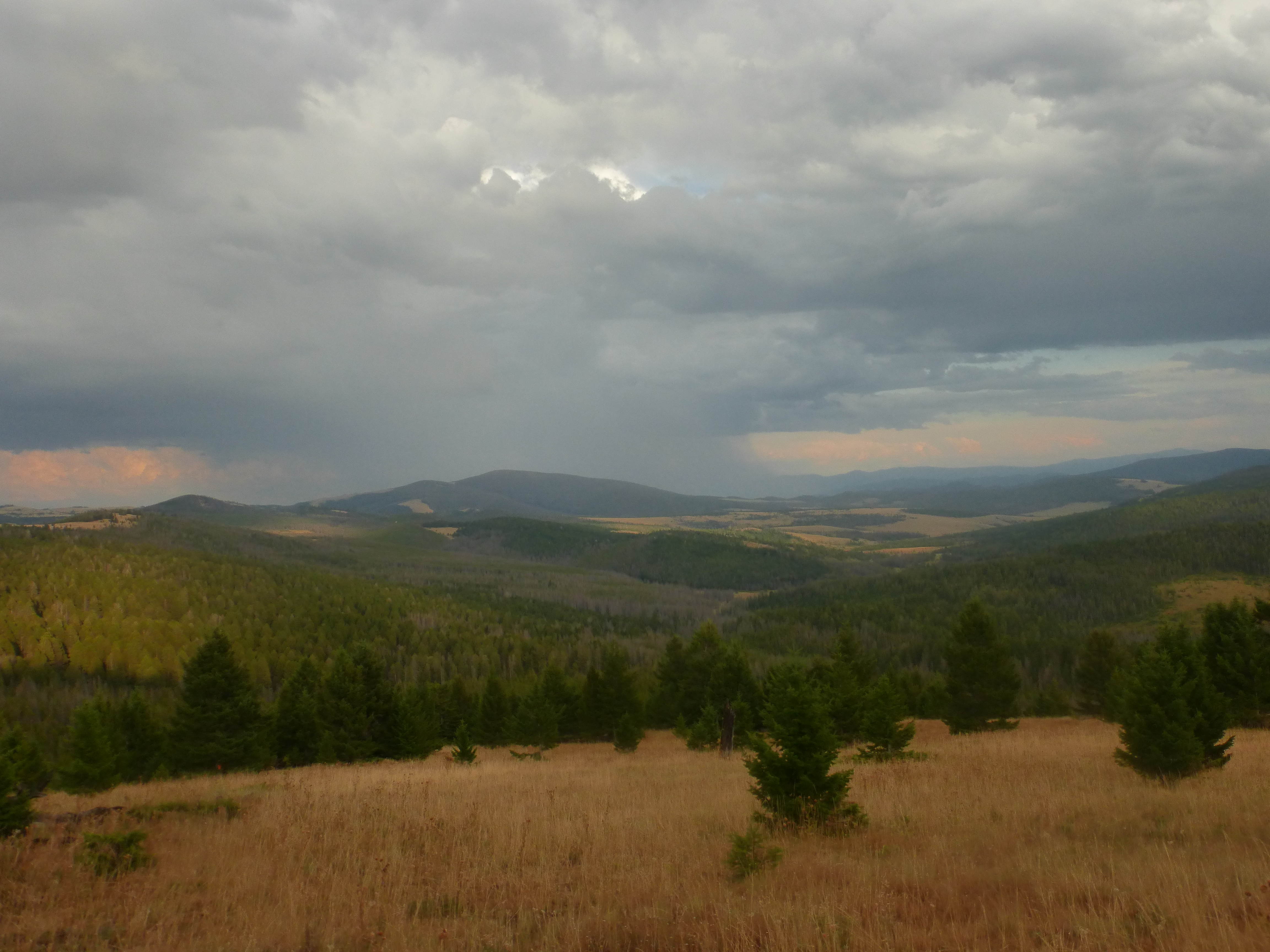
Taking a shower after 10 days is a great feeling.  The mud, dirt and grime of your body washes away, sloshing down the drain and quickly forgotten.  How much dirt and grime I put down the drain is a badge of honor and this time it didn’t disappoint. We were dropped off at the Lamplighter Motel, a collection of small individual ‘bunkhouses’ that accommodated various sized groups.  The owner was a kind man who offered us a little discount because we were hikers but crammed 5 of us into a 2-room bunkhouse.  It’s a crazy atmosphere with 5 people in one little room.  It’s a yard sale of clothes, groceries, beer cans, cell phones, drying sleeping bags and cameras being charged and prepared for the next section.  My first stop was the grocery store to pick up all the cravings I had during the last section including chicken, grape gatorade and popcorn.  With my food needs satisfied, the group settled in to watch the beginning of the NFL season with my beloved Broncos playing their season opener.  We slept that night two to a bed with the smell of nasty shoes and Taco Bell clinging in the air. The next morning came on like a tidal wave.  The guy who had dropped us off called and said he could take us back to the pass at 9 am.  It was 8:30 am.  I had hoped to hang out more in town and relax but a guaranteed ride is hard to pass up.  I couldn’t decide but soon opted for the guaranteed ride.  I now had 15 minutes to shop for the 64-mile section to Rogers Pass, which would get me to Lincoln for resupply.  You would have thought I was on the old 90’s  TV show Super Market sweep for how fast I got all my grocery shopping done. Before I knew it, I was riding in the back of the pickup, waving good-bye, ending my “lengthy” 12-hour stay in Helena. The trail snaked up and around the mountain.  I opted to take the Ley purple route, staying low in the valley versus going up high on the divide because of the thick clouds in the distant.  Walking the dirt roads for a few hours I found a nice patch of shade and had a quick lunch.  Surprisingly I got a call from my mom who lives in Europe and I Skyped with her awhile, sitting in the shade of the trees.  All was well until a large crack broke the conversation.  I quickly, and probably to my mothers horror, hung up while yelling something like ‘Here it comes!’.   I quickly threw on my rain gear and battened down my pack and walked right into the storm.  The marble sized hail came with a fury, slamming into my head and body from all angles.  Trickles of water quickly collaborated with the others to create large streams where there once was a dirt road.  I cowered under a tree that offered little protection and after a while I just said “to hell with it” and walked out into the bombing of hail.   The hail bombardment continued for a solid 30 minutes before letting up and the sun finally smiled on me again.

Hail bombardment

Hail bombardment

Twice this size before melting in my hand

Twice this size before melting in my hand

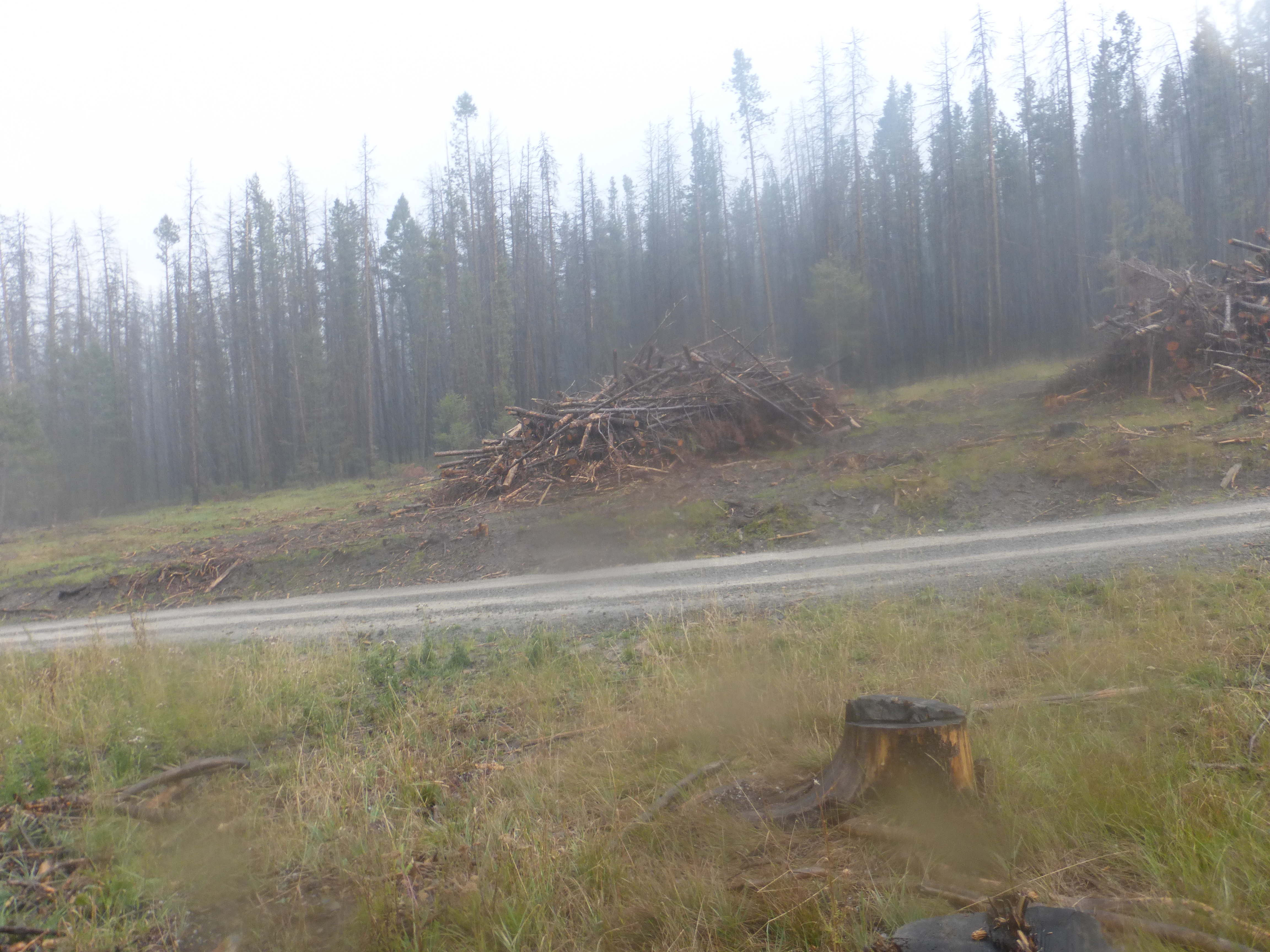
I was walking alone and climbed even higher into the Helena National Forest feeling great.  That day I learned that I actually enjoy being wet, cold and a little miserable while hiking.   Cresting a ridge I found my next water source, which I definitely felt in need of.  I opened up the lid of the spring and found it to be nearly empty.  I was able to get enough water out of it for that night and a little for the next day to make it.   I would later learn that the group behind me would find it in even worse condition, filled with dead squirrels that had fallen in. My nose awoke me the next morning.  It was a clean smell; a freshness that absorbed into my nostrils.  I rolled to my side, still in my sleeping bag and peeked out under my vestibule and saw that I was surrounded in mud thick fog.  I could barely see 15 feet from the tent.  It was a slow moving ghost of white that flowed over me like a stone in a creek. P1010842 I crawled out of my bag and stood outside my tent with my bare feet sending a cold mossy chill up my body as the fog engulfed me.  It was the freshest air I had ever smelled in my life.  I raised my arms out, puffed out my chest, tilted my head back, opened up my nose and took a long deep breath.  The air quickly ran down my throat, into my lungs and was absorbed throughout my entire body.  I was cleansed.  I was free and I knew it. The whole day was full of amazing hiking.  The fog rolled in and over me all day leaving the forest mysterious and medieval.  Pine trees with green moss hanging from its limbs and fog hiding everything else in the background.  The fog was my mistress, teasing me with quick flashes of distant peaks and trail.  I snaked up and down the crest of the mountain excited to feel its next move and tantalizing surprise. P1010845 This day had been an experience that I would soon not forget.  The day ended with a continued rain but I didn’t care.  I was happy and content.  I made it to Stemple Pass where a hunter invited me into his RV for hamburger steak and 2 tasty beers.  I slept that night with a smile stretched across my face. In the morning I woke to a revived spirit, one that was ready to tackle the trail with no worries, only focus on the end goal.  I hiked along the mix of trail and dusty dirt road having to choose between the confusing official CDT route and or the alternates.  Thinking I was on the alternate I headed around a mountain and came to a clearing.   An established trail was to my left; a more defined one was on the right.  I choose right.  Wrong choice.  I went for about 2 miles, always looking back, questioning my decision.  Finally I realized I had taken a wrong turn.  Instead of turning around and going back the way I came, I figured why not just go cross country and connect back up with the trail I should have gone with.  I was in the middle of the woods, following game trails that lead nowhere but somewhere.  I knew I was in the middle of nothing but kept going thinking that eventually I would hit a road I saw on my map but wasn’t particularly sure if I would.  The place was uninviting but not scary.  I decided to just keeping going, assuming it was the best course of action at this point.  Stop thinking and just go. P1010809 I hit a road about 2 hours later and followed it to what I figured was an intersection with the trail I should have been on from the get go.  I needed to clear my head so I sat there, drying out my gear from the night before, digging into my food bag finding whatever chocolate I had left.  I eventually went cross -country to meet up with the original trail and followed it until nightfall, giving up on the ridge walk that awaited me in the morning. P1010904 
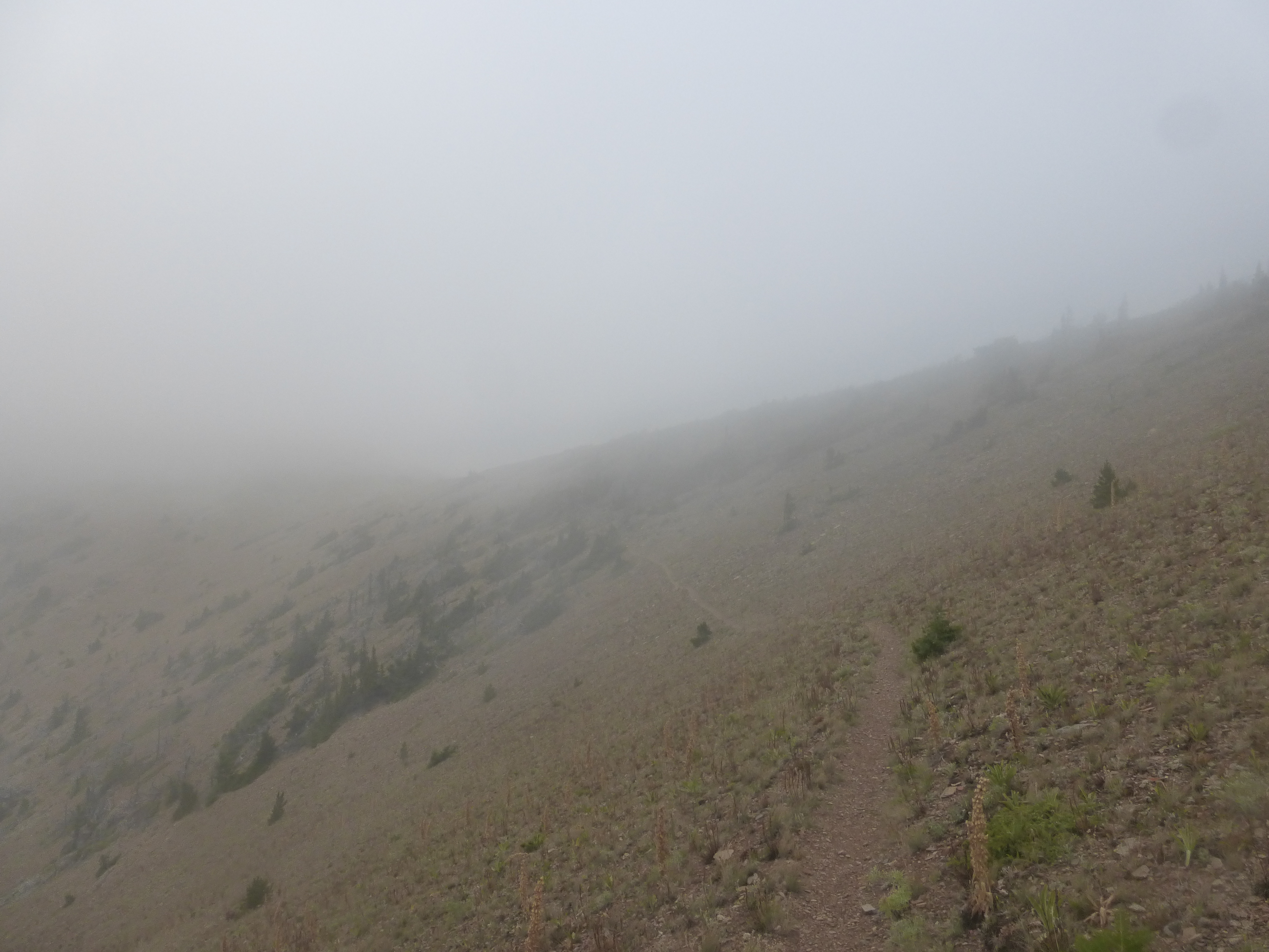
In the morning I woke up to beautiful conditions of more fog and clouds that covered my path.  It was glorious.  I was high up on a ridge that was obscured with clouds rolling through, up and over the ridge.  I felt like I was part of the clouds and not just passing through.  This lasted for about 15 miles before coming down the mountain to Rogers Pass and my highway to Lincoln.  I was semi-happy to have hit the road, not really needing to get to town other than to satisfy my stomach’s desire for the indulgences of town food.  I put out my thumb in the cold and waited for a ride.  No ride came.  I didn’t care deep down if someone stopped or not, I was in the zone, fully charged and ready to tackle the trail.  My trail friends popped out of trees and I noticed them out of the corner of my eye.  I felt happy to see them, and ready to abandon my hitchhiking quest. After standing by the side of the road for the better part of 2 hours I felt ready to hike, instead of hitchhiking. It was 53 miles to my next resupply in Benchmark.  My food bag was getting a little light but I had bought more food then I needed in Helena.  Maybe I would make it on what I had to eat or maybe I would go hungry for a day or so. What I lacked in food I made up in desire to keep going and not stop.  I was ready for the next section dubbed “The Roller Coaster”.


Leave a comment

Butte to Helena

P1010769

I arrived in Butte with a good spirit, having just joined my new group of hikers who allowed me to join them on the trail for however long I wanted to.  I was excited to be with a new group, to have some new experiences and learn from these 3 other hikers that were on their way to achieving their triple crown (Appalachian Trail, Pacific Crest Trail & Continental Divide Trail).

We spent a couple of days resting in the cramped confines of a two queen bed hotel room for the 5 of us, 1 of them being a old friend of my new group from Oregon who was in the neighborhood.  We ate Chinese food, enjoyed the local brewery and I saw my first and only movie on the trail on Labor Day.  I was grossly disappointed with the movie but at least the movie theatre experience made me feel a apart of society again, that I was once again capable of doing normal things.  We spotted a Labor Day picnic at a community park hosted by the local electrical and pipe fitters union where there was free hotdogs and soda to be had and being cheap hikers we were obligated to stop by and consume our 3 hotdogs and 4 bags of chips like any true American.

P1010711

After a couple of days of leisure we started back on the trail right where we had stopped.  I was only about a mile outside of Whitehall but my other companions were about 4 miles behind me.  A farmers market that offered up fresh local produce and cookies that I was happy to buy and enjoy immediately distracted me.  My companions passed me after finding a too comfortable tree to enjoy my new food.  Walking the roads several people stopped to ask what we were doing and I gave them my regular response.  Most said that’s great but a few said that’s crazy.

P1010764

That day was all about road walking, going under the bridge of highway 90 as the cars and trucks zipped by at high speeds and then entering the local forest area on the east side of Butte.  Walking the gravel roads of forest areas is a big part of a CDT hike and they can be methodical and boring.  I was lucky enough to be recommended a new podcast ‘Things you should know’ and was enjoying learning about how ejector seats work, universal health care and diving bells.  Podcasts are a great way to make the miles just slip away.  That night we slept in a typical car camping spot while our friend from Oregon met up with us and brought pizza and beer.  The next morning we rose with a purpose but not the usual one.  It was Sunday and that meant that the newest episode of Breaking Bad was on AMC and we did not want to miss it. It would be a 17-mile day and we had to be done by 5 to get back to a hotel room that had AMC and watch our show that night.  We all walked with a purpose that day even if it was for a T.V show.

You hike for different reasons every day

You hike for different reasons every day

After we all injected or should I say snorted our Breaking Bad fix we were off again, entering the Beaverhead-Deerlodge National forest.  We had 71 miles to go to get to Helena and we were back on the official CDT after taking the Big Sky Variant due to time restraints and fires.   We made it up Champions Pass and through some pretty normal hiking that had good water sources, easy to follow trail signs, big open views and old mining towns long ago abandoned.  Excitingly as we sat next to the trail one day for lunch 2 old friends happened to turn the corner and walk right into us.  We hadn’t seen them in several weeks and it was great to be back with them.  Immediately we started talking about which sections had sucked, what town was cool and what goodies we had decided to carry.  We had ourselves a little party at camp that night and it was great to be amongst friends.  I knew that night was one to be cherished and remembered as only a night like that can be.

P1010747

We all hiked at different speeds so it was a constant game of leapfrog as you went.  One person would stop for a break as the other person kept going until you started up again and caught back up to them.  Each person was in their own worlds, listening to their music, books, podcasts or the sound of their own feet.  The trail would take you up high to gorgeous views and then surround you in woods that looked like no one had hiked them in a long time.  You’re brought back to reality when you pass huge power lines as they buzz with electricity and make eerie sounds as the wind passes around them.

P1010743

P1010799

P1010752

After only 3 days we covered the 71 miles to McDonald Pass, which was our highway to hitch into Helena.  The view before you hit the highway was a vast expanse of forest and a large open valley to the east where Helena waited for us.  It was a gorgeous view and one that I will remember.  I arrived at the pass, second only to Bonelady, who was drying out her sleeping bag from last nights rain waiting for us to arrive.  I had chatted up some nice tourist at the ‘lookout’ but that did not lead to a ride into town.  It’s all about chatting up the people you can actually talk to to get a ride because that is much easier then putting out your thumb and hoping for the best.  Eventually 5 out of 6 of us were at the pass and a nice guy pulled over and immediately asked if we were CDT hikers.  We said yes and he mentioned how we were going to be the 15th hikers he was taking into town.  We had great trail magic with someone who knew what we were all about.   We piled into his truck leaving one person behind to catch his own ride.  Now this isn’t considered rude mind you.  We had waited for as long as we could and you can’t jeopardize a ride that can take 5 hikers to town.  If we had let this ride slip away we wouldn’t have been considered nice but idiots.  So we drove off heading into Helena for a day of rest and the fried chicken I had been dreaming about for the past several days.

HIKER TO TOWN

HIKER TO TOWN


2 Comments

Apps for Thru Hiking

apps

I brought a phone with me on my thru hike, yes a phone, and in the end I was very happy I did.  Some say that a phone takes away from your experience, which it can, but if used correctly as a tool, it can enhance your hiking experience, not hinder.  I used it to stay in touch with family and friends, check the weather ahead, listen to audio books, read books, get intel on the trail ahead, listen to music, take pictures and video, transfer photos, listen to podcasts and keep a audio journal.  Apps helped to enrich my experience on the trail.

OverDrive Media Consule:  Do you have a library card?  If yes, then you can use this great app to connect to your local libraries digital collection of ebooks & audio books.  After you’ve downloaded the app, you enter in your library card number and start searching your libraries collection.  You can scroll through hundreds if not thousands of titles to download to your phone in several formats that are available whenever you want. I listened to a total of 19 audio books on my thru hike.  It was a great way to use the time I had to learn about things I normally wouldn’t read about or catch up on all the things I wanted to learn about.  Starting and stopping your progress was easy and you can borrow the title for 14 days to listen/read your selection.   You can also put holds on titles that aren’t currently available and get an email notification when it’s ready for you to download.

Smart Voice Recorder:  After hiking 25 miles the last thing I wanted to do was type a diary entry on my phone.  I started out using a word program but after losing several entries due to crashes I gave up and downloaded this app.  Being able to simply push a button and record my thought and feelings without having to stumble through typing was great.  You have so much emotion on the trail that listening to your tone, mood and feelings afterwards brings you back.  I also recorded random thoughts and great reminders to do that day, next town stop or just stupid random thoughts.  The recordings are crisp, void of any dead noise and easy to transfer from my phone to computer.  No more worrying about spelling or my fat fingers messing something up.

Spotify:  Music, music, and music!!!  I listened to a ton of music on my hike.  Everything from Rage Against the Machine, Rolling Stones, Wutang Clan, B.B King, Elvis and everything in between.  For only $10 a month for the Premium subscription, you can download as many titles to your phone as it can handle.  I enjoyed listening to music before but wasn’t able to listen to a lot of it that was unknown to me.  I had the opportunity to listen to bands and artist I never heard of by following the ‘recommendations’ tab and other music by similar artists.  I’m now a fan of blue grass, classical and techno.  The sound of the birds and trees are great but when you need to get moving nothings better then putting on my headphones and listening to Gogol Bordello’s – Trans-Continental Hustle to get you moving!

iPP Podcast:  Podcasts are a great way to keep up with all the things that you love.  This app was easy to download and subscribing to podcasts was even easier.  All of your subscriptions are easy to track and new episodes are downloaded when you get back into cell reception.  You can store them for however long you like or can delete them once you’ve listened to it.  The podcasts I listened to most were:  Tara Brach (Dharma Talks & Guided Meditations) NPR Fresh Air, This American Life, The Truth, The Moth, TedTalks, Brewing TV and Stuff you should know.

Facebook:  I’m not a huge fan of Facebook but was an invaluable tool while on the trail.  The CDT thru hikers had a Facebook page, CDT 2013, that helped us keep everyone informed on trail conditions, best/cheap places to eat and sleep and to find out where your friends were.  Is the trail rerouted in the Winds?  Is the fire still raging out of control in southern Colorado?  What’s the best burger joint in Grants?  Facebook had it all.  Also, eventually you will get lonely on the trail so keeping up with friends and family back home and sharing your experience with them helps make your trip even more special.

P.S ( I had a Android phone but many of the above apps are available on the iPhone as well)

Do you bring electronic devices with you when you hike?  Which ones and why?


21 Comments

Finished!! Hello Canada!

P1020594

Oh man, I can’t believe I’m saying this but I REACHED THE CANADIAN BORDER!!!   I can’t believe that I made it and am thrilled that I’ve accomplished my goal.  Thanks Grannyhiker and OregonTrail for checking in on me, things have been crazy trying to get things in order.  I apologize for being behind on my blog posts but trying to find a computer in small Montana towns had been very difficult.  I’ll be doing some catch up work in the next week.  I’ve got some great stories of what happened in Montana including the hike through the Tobacco Range, sleeping in a public park in Bozeman, finding a wallet with $350 inside, avoiding fires & hunters in the Bob Marshall Wilderness and my cold and snowy finish in Glacier National Park!  Stay tuned.


2 Comments

Section 6: Grants to Cuba

Summit of Mt. Taylor

Summit of Mt. Taylor

I lay in bed with the TV flickering on a random daytime show that makes no sense nor do I care who the actual baby daddy is.  This is the zero day that I had in Grants, it didn’t involve moving because of my aching foot that was tender to each step that I had taken.  The rest of the group had left that morning but I knew that an extra day would give my foot the rest it needed to make it to Cuba, which was the next destination for my next segment.

Grants is small towns that once use to be a booming city for Uranium mining and use to have one of the biggest and most productive Uranium mines in the country.  As the local shuttle drive told me high school kids were dropping out of school to go work the mines for the average starting salary of $80,000 per year, creating a huge void in the school system.  Once the government stopped buying the Uranium, the mine laid off 4,000 people overnight, starting a mass exodus out of the town.  Grant has since recovered but you can still see the boarded up shops of the downtown but you can still feel the local pride by its banners and its people.

After resting in the hotel room, doing some shopping at Wal-Mart and getting a resupply box ready to be shipped to Ghost Ranch it was time to leave.  My foot was feeling a little better but I was ready to keep moving.  I’ve learned the longer I stay in town the more comfortable I get and the more my head starts spinning with ideas.  I called the local shuttle to give me a ride to the post office and then to the Mumm’s who are local trail angels and were holding a new bladder system I had ordered from REI.  I was tired of always taking my pack off to drink water so wanted to try this new hydration system.  The Mumm’s are great people who leave out water caches at the start of the Malapais, entering the final canyon towards grants and one final one on the last stretch up Mt. Taylor.  They are wonderful people with a big heart and I was happy to meet them and give them a much-needed donation.

Hugo & Carole Mumm

Hugo & Carole Mumm

I got to the trailhead for the next segment and began the long hike to the base of Mt. Taylor, hiking about 10 miles that day to the water cache left by the Mumm’s.  I like staying next to caches as you can drink all you want and then camel up in the morning for the next day.  This was my first section alone since the border and I was actually happy to be hiking alone for this part.  I was able to hike at my own pace, my own schedule and gave me some time to think about the journey so far.

P1010098

I hiked up the 11,301 ft summit of Mt. Taylor, a leftover ridge from a volcano that had exploded many millions of years ago, now making it the high point of the CDT in New Mexico.  I was so happy to be gaining some elevation and the straight up trail and eventual switchbacks brought me back to this realization.  I summited Mt. Taylor in the morning with the sun rising over the huge horizon that laid before me.   To the south were the mountains I had walked through to reach Grants and to the west were the open plains of the desert landscape that hid Arizona not far away.  To the east and north you could see the next ridges and plateaus that would be my home for the next couple of days as I hiked on top of expanding Mesa’s.  I spent a little bit of time on top before making the descent down the mountain, following forest roads to my next water source, American Spring.  This was one of the nicest springs I had seen so far and was happy to get the water out of the pipe that was surrounded by great meadow full of grass and glorious shade.  What a change from the low-lying desert areas that had been my home for so long.  I ate a nice leisurely lunch there before continuing my trip down the mountain.  That day I hiked 27 miles making camp in a patch of tree’s after getting a burst of energy from Skrillz on my newly downloaded Spotify app.  Yes, some say technology is wrong in the woods but music is a great companion after a long day, especially Bob Marley.

Collared Lizard

The next day brought a boring road walk that seemed to never end.  It finally did at my next water source, Los Indios Spring.  This is the point where I’ve made one of my most stupidest mistakes of the CDT so far and taught me to read and then reread my map notes 10 times before making my next move.  The sign read Los Indios spring .5 miles so I thought that it was that far past the gate I had to walk through and down the 200ft canyon as noted on the maps.  I walked the .5 miles past the gate but, still no turn off or canyon.  I still saw foot prints so I kept walking, thinking the makers of the signs had made a mistake and I decided to keep on going.  I ended up stupidly walking about 3 miles before deciding to reread my maps and take the point of view of the southbound hiker and reading that at the gate you would go .5 miles down the canyon to the spring.  So this meant I had to walk the 3 miles back, go the .5 miles down the 200 ft canyon to get the water.  I don’t think I’ve ever walked so pissed off before in my life.  I walked back, got to the spring and threw down my pack in anger.  I knew I had made a mistake and being out of water for the last hour made me even more mad.  Why did I make this mistake?  What was I thinking? All of these things ran through my head to learn from the mistake I had just made and to not do it again but I knew that I would.

P1010119

After coming down off the high plateau and the breath taking view it provided it was back down to the desert floor where the fear of rattle snakes, heat and water resurfaced.  It was miserable.  That section of trail was miserable for me.

Back in the Mars like landscape

Back in the Mars like landscape

It was hot, the landscape was Mars like and it had no appeal for me.  It was only about 20 miles worth but it put me in such a bad mood that I found myself walking faster and harder then ever before.  After finally being in the tree’s and seeing green beautiful grass it was hard to right away switch back to the desert style hiking I had been enduring for weeks.

Beautiful View from the top of the Mesa

Beautiful View from the top of the Mesa

The last 20 miles before Cuba was a gorgeous change from the previous miles in the ugly desert because you spent so much time high on the plateaus that surround the area with wonderful rock formations, wonderful expanding views and cairned trail that was easy to follow.  It reminded me of hiking Utah which is one of my most sacred places to hike in the world.  I happily followed the cairned route up and down the mesa skirting the edge and then back to the middle again with my shoes filled with sand.  My shoes were dying and I couldn’t wait to get my nice new pair once I got to Cuba, saying good bye to these after 530 miles of hard walking.

My New Balance Leadville 100's lasted a long time over tough terrain

My New Balance Leadville 100’s lasted a long time over tough terrain

I walked into Cuba at 9 pm that night on Memorial Day, road walking the last 4 miles in the dimming light of the day as people drove home from parties and celebrations.  I was happy to get to town and plop down on the bed knowing that another section was done and a good rest was coming my way.  I lay on the floor of the shower with the water hitting my tired and bruised body knowing that this section was now done and that I was eating away at my eventual end of New Mexico.


5 Comments

10 Things I learned in my first 600 miles of Thru Hiking

Mile 0


1.  Do your research:  Before you leave you should try to learn as much as you can about the trail you are going to do.  This means finding all the resources that are available to you either online or talking to other hikers.  The internet is full of forums, articles, websites dedicated to the long trails so do your research before you leave.  You don’t need to learn every bend in the trail but at least know what to expect.

2. Be ready for plans to change:  When your sitting in your warm house, on your comfy couch and planning your trip its easy to think what you write down will be your schedule.  But, when your on the ground hiking every thing can and will change no matter what you do.  Things like unexpected zero days happen because the post office was closed when you got there or your body was in worse shape then you thought it would be.  Weather is unpredictable so you might go slower or don’t get the hitch you wanted. Be flexible to change and be happy when things actually go right.

3.  Know your abilities:  When you get on the trail you’re full of ideas of what you want to do, how fast you want to go and accomplishments to achieve.  When I started on the trail I wanted to do 20-25 mile days but quickly learned I wasn’t ready for that.  On the trail you see what I call “Team Lightning” the group that’s doing 20-30 miles right out of the gate.  They’re fast, have their gear and food locked in and they haul butt.  Don’t try to keep up with them.  Go at your pace, do what you know and just be yourself.

4.  Learn to love pain:  No matter what you do you will get blisters, your legs will hurt, your back will spasm and you will be in pain.  Learn to love it.  Understand that even though you hurt you sometimes have to keep going.

5.  Listen to your body:  If you are in pain and it feels like you can’t keep going just stop, slow down or take a day off to recover.  When you push it toO hard and don’t listen to your body it will just compound and it could take you out for a couple of days or worse make you go home with a major injury.

6.  Take care of your feet:  Your feet are what propel you on your hike so if you don’t take care of your feet you aren’t going anywhere.  During breaks take your shoes and socks off and let them dry out.  When you feel a ‘hot spot’ developing stop and take care of it-IMMEDIATELY! Learn how to handle blisters and make sure you have the necessary supplies to treat them properly.

7.  Have a positive attitude:  The trail can be brutal so learning to be positive no matter what your facing can help keep you going.  Its easy to get down on yourself for not making the miles you wanted, getting lost/misplaced from the trail and forgetting something.  I’ve learned to find something to laugh about every day either about something on the trail or something you did, its always good to have a good laugh to raise your spirits.

8.  Believe in the kindness of strangers:  Its amazing the unsolicited help you can get from strangers.  People will offer you rides, food, water and so many other things that it will surprise you.  In many of the towns you pass through people know about hikers and because we have a good reputation they are happy to help.  Always be nice to everyone you meet and a please and thank you go a long way.

9.  Get use to smelling:  Yes, you will stink.  You will stink so bad that you won’t even be able to smell yourself anymore.  Your feet, shoes and body will always have a certain funk to it so just get use to it.  When you get to town, do laundry first and don’t forget to presoak all your stuff because washing machines were designed for regular humans, not thru hikers.

10.  The thru hiking community is awesome:  The people that you meet on the trail are all great people and are probably out on the trail for the same reasons as you.  They are easy to spot and are welcoming with advice, tips and stories you can relate to.  Nothing is better then talking about that last 10 miles of trail or that water source that was suppose to be there but wasn’t with someone who understands. Everyone is out to make sure you succeed with your hike so be nice to everyone you meet on the trail because we all talk to each other and if you’re a mooch or a jerk, word will get out.


8 Comments

Thru hiking with Crohn’s

crohn's

Living with Crohn’s disease isn’t easy but, trying to hike 3,000 miles from Mexico to Canada doesn’t make it any easier.  I’ve lived with stomach pain since a very young age and it stopped me from doing all the normal things that kids and young people do.  Now as an adult, it’s even more difficult with work, social life and private life that’s affected by this disease and really, there is nothing we can do about it.  Regardless, I have decided to live my dream and hike the Continental Divide Trail (CDT) and bring Crohn’s with me.   Right now I’m in Ghost Ranch, NM, 580 miles from the Mexican border I started at 40 days ago.  These 580 miles have been a challenge for me because there is no place to hide from the pains that have been affecting me everyday with cramping, diarrhea and constant nausea.  Its hard enough trying to walk 20-25 miles a day with a 20 lb pack on, following “trail” that isn’t really there makes it even harder to keep your cool and keep going.  Luckily, you can ‘go’ where every you want but stopping several times a day doesn’t help you keep your pace and get the miles you need to make it to the next town.

I can go where ever I want

I can go where ever I want

Hiking 20-25 miles a day and thru-hiking in general requires that you eat 3,000-5,000 calories a day which makes you eat a lot of processed, disgusting manufactured food that has these high calories per ounce which is very important.  At home I can control my pains with a strict diet but out here I’m happy to eat a banana or apple every 5 days. This has been the biggest problem for me; getting the calories I need without causing me so much pain that I can’t get out of my sleeping bag in the morning.  Food is always on your mind as you stare at the “trail” ahead but, you know the pain that comes with it.  I try to buy whole grains or gluten free foods when I can but, Walmart, which seems to be the only grocery store in New Mexico, has a section that is smaller then the respect Crohn’s & Colitis patients get.
The trail has been wonderful as well.  The beautiful orange, red, purple and pink sunsets have brought me to tears that I can even be out here to enjoy this gorgeous landscape.  The smell of the plants, the wind in my face and the ever changing landscapes have given me a reason for my pain.  As I hike I am always looking around at the views, the little lizards that run across the trail and the birds with their great calls.  I’m always worried about 6 types of rattle snakes
that live in these areas and can say that unfortunately I have seen two already.  I’m not against snakes, they have their purpose but, for a Chron’s sufferer its pretty easy to scare the crap out of me.  One was a long, scary looking black tipped rattle snake I almost stepped on in the Gila River valley and another young one on the way into Grants, that was sunning itself on the warm road.  Both got into their coiled positions with their rattles rattling loudly, heads poised to
strike and muscles tight ready to leap the 3/4 of their body length to inject me with their venom.  I stayed far away from them letting them know I had NO intentions of causing them harm and that I would wait all day for them to get off the trail.  Even then I wait and proceed with caution just in case this is some new technique to bite me just for fun.

snake
I can’t imagine not being out here and I know that making it this far is a privilege that many other suffers can’t do.  When I get down on myself and the pain is to much, I think of all the other people who couldn’t be out here, who can’t make this type of journey.  I walk for you.  I walk to help find a cure for this disease and think that this pilgrimage is a blessing that I hope will inspire and change peoples minds about the what is possible for us.

If you wish to make a donation to fund research and awareness for Crohn’s and Colitis you can donate on my page:  http://www.stayclassy.org/fundraise?fcid=241603


8 Comments

Section 4: Doc Campbells to Pie Town

About to Rock the Gila's

About to Rock the Gila’s

Being at Doc Campbell’s was a great milestone of my trip as I knew that if I made it there that I was making good progress to make it across New Mexico and my eventual goal of Canada.  At Docs I got my resupply box that my sister had prepared for me with little surprises of good chocolates and notes from home that were welcomed motivation to keep going.  Knowing that people back home are supportive of my hike really keeps me going and the positive encouragement helps you stay connected to home.  After staying the night in the campgrounds to soak in the local hot springs which loosened my aching muscles we did the road walk up to the Gila Cliff Dwellings Visitor center and took the time to check out the site.  You can’t walk this far and just pass up a piece of local history that is only an extra 2 mile road walk away.  The dwellings were amazing, snuggled up on the rock facing south with the light hitting the interior of the caves.  The Mogollon’s are ancestors of the ancient Puebloen people of the southwest were in this area over 700 years ago. The caves at Gila are considered to be everything from ceremonial sites, permanent dwellings to only seasonal residence.  The caves are amazing and you can feel the history when your inside with the petroglyphs, the dark ceiling from the fires and the intricate construction of the homes that once stood there.  This is our American heritage and being there and walking in the same area that they once considered sacred was an honor.  After visiting the dwellings I took a alternate route towards the Middle Fork of the Gila River, coming out of a slot canyon to its wonderful high walls and its beautiful flowing river.  The river is amazing and I couldn’t wait to start getting my feet wet with its endless river crossings.

Cliff dwelling

hand print

After repacking my backpack just in case I fell in while making a crossing I put my sleeping bag, clothes and electronics in protective cases and just a plain old garbage bag.  I started the winding trail through the Gila, crossing from dry trail to dry trail, crossing the river with different depths where only my feet got wet to water up to my waist.  Having your feet and legs constantly wet was a nice change from the hot and sandy desert.  Dealing with wet feet all day brought new challenges of loose skin on my feet, more rocks in my shoes and trying to dry my socks and feet at night to prevent even more blisters.  I only got 1 new blister because of the Gila which was good for me.
Gila pic 1
gila pic 2
I slowed down my pace through the Gila’s as it was one of the places I was really looking forward to during my CDT trip. During one of these day dreaming episodes I was abruptly stopped in my tracks by a loud rattling sound.  Oh crap, I had almost just stepped on a black tipped rattle snake!  As soon as I heard the rattle I stopped, looked down and ran back really quick.  I hate snakes.  I don’t like them and honestly would have been happy as hell if I didn’t see one the entire time I was in New Mexico.  After running away, I made my way back a little closer to see the coiled up body of a huge rattle snake with its head sprung back, tongue out tasting the air and ready to strike.  I moved in closer to get some pictures and every time I did it rattled louder and louder.  If you’ve never heard a rattle snake before, trust me, you will know one is around because it is loud.  Cowboys and others in the southwest call them the “gentleman of the desert’ because of these rattles.  After about 15 minutes of picture taking, me checking my shorts and stepping back the snake slithered into the rocks below but not before giving me one last rattle to let me know who was in charge out here.  I gave it another 10 minutes before I ran across the trail where it had been, hoping it wouldn’t jump out and bite me.  I was glad that experience happened without me being bit and me not needing to change my shorts.
Holy Sh*t!!

Holy Sh*t!!

The rest of the Gila went great with its high cliff walls, winding river and beautiful cool temperatures and all the water I could drink.  In all I did 147 river crossings before hitting the end of the trail and getting back into the open valley’s ahead.
After the Gila’s we entered into the open plains again and towards higher mountains that rises above the valley floor, following new CDT trail and forest roads towards the highway that takes you to Reserve.  The water situation was tougher in this section because we had to take water from springs that were surrounded with cow pies and other nasty stuff making me miss the Gila even more then I already was.  Passing through burn area that had used blazes like you see on the AT for trail markers made it very difficult to navigate through.  The blazes were chopped into the tree but, of course this was burned as well and blended with the rest of the tree.  Losing the trail here was easy to do and took me extra time to make it through the section down to the highway.  Once down at the highway I made a failed attempt to hitch to Reserve to surrender to my craving for town food.  After 3 hrs of attempting to get a ride, I gave up and slept in the tree’s eating my sad rice and tuna dinner versus the big steak I had been envisioning for days.
burned trees
The next morning I got up and headed into the Apache Forest on my way to Pie town and the famed Toaster house I had heard so much about.  I had been following the Ley route the entire way but, heard the official route was new and nice so I decided to go that way.  After about 3 hours of constant winding around the hills I got frustrated  and bushwacked back to Ley’s route and continued from there.  The official route is nice, don’t get me wrong but thru hikers don’t want to take the scenic route, we just want to get there already.  So after summiting Mangas Mountain and coming back down the other side I made a push to make it into Pie town before the Cafe would close.  That morning I decided to hike the 30.5 miles to the Toaster House, which would be my longest day of hiking ever.  The trail was good and the roads were easy to follow but the road just kept going on and on and on with no end in site.  After making my last left turn and knowing I only 5 more miles to go I made the final push in the dark to make it to the Toaster house at 9:30 pm.  I was greeted by 2 CDT bikers and a fridge full of Tostinos pizzas which I ate 2 of, drank about a gallon of water and crashed in one of the beds.  The Toaster house is an amazing place and Nita is a wonderful women who leaves it open for all weary travelers to enjoy.  The pie is amazing, the people are colorful and welcoming.  The Toaster house is truly like a CDT hall of fame and I only wished the walls could talk….
toaster house


17 Comments

Section 3: Emory Pass to Doc Campbells

P1000485

After 2 days of rest in Silver City, it was time to leave and get back on the trail.  I was happy to get out because I was starting to feel a little too comfortable with my soft bed, unlimited TV and showers whenever I wanted.  I wasn’t on vacation. I was thru hiking, damn it, and it was time to go. During my shopping at Walmart, which is the only place to shop in the last couple of cities, I bought a large piece of cardboard to help us with our hitchhiking. I used the term Sunday had used before but with a twist:  “Hikers to Emory Pass.”  This way people would know that I’m a hiker and not homeless. Also, stating specifically where I’m going might let people know that they won’t have to take me to Florida or something.  A smiley face wouldn’t hurt either…

After deciding to just go right outside of our hotel, we took our spot on the road and started the hitching process.  I took off my hat, cleaned up my shirt, put on a big (but not cheesy) smile on and held the sign. Two and a half hours later, we got a ride by a lady who was only going to the intersection of the road that would take us to Emory Pass.  She wasn’t from New Mexico so she didn’t know if riding in the back of a truck was legal or not, and at that point I didn’t care either, so I hopped in.  I kept a low profile just in case the cops drove by and just laid back and watched the clouds go by as the wind whipped passed me and gripped my hat so it didn’t fly away.  After about 10 minutes, we were at the intersecton saying good bye when another person that had seen us earlier asked us hop into her van.  It was only 10 seconds between hitches, which was fantastic, and gave us hope we might get to the pass soon.  We rode in the van with a woman and her son to the last intersection where any car passing us would be going to Emory Pass.  Surprisingly, it took another two and a half hours to get a ride up to the pass.  During that time, the sun beat down on us with no break.

Hitchin'

Hitchin’

Another hiker came out from the corner of the road toward us and told us he was a CDT hiker who was headed back to Gypsum, CO. Apparently he had no maps and was hiking the CDT with only a road atlas which I thought was crazy!  He got a ride with us and ended up going all the way to Santa Fe with the lady and her kids, who gave us a ride. Once on Emory Pass we hit the trail and hiked the 5 miles to the top of Hillsboro Peak lookout in about 3 hours, due to of the long switchback trail that kept going on forever to the 10,009 ft summit.  At the top was an unmanned fire lookout tower, a cabin for the lookout person and a cabin that was free for all people to enjoy.  We settled into the cabin for a great night of playing cards. It had a small room with bunkbeds, wood stove and a great porch that looked east.  I sat on the porch for a long time, gazing over the open basin below and the distant views that it provided.  That night we had the most amazing time eating and playing poker using rocks as poker chips, by the light of my headlamp.  It was truly a great moment of the trip so far and will not be soon forgotten.  That night the wind howled non-stop, as I lay snug inside the creaking cabin safe from the elements.

P1000419

P1000418

The next morning we headed out, winding around the mountain, up and down several of the saddles that the route traversed.  You could tell that the area was not well maintained, as trails fading into nothing and junctions pointing us in directions we didn’t think a trail could exist.  After a long lunch, we made our way down a newer looking trail, looking for the road we hoped to join up with.  The trail was faint, but was covered with cairns, as if a drunk person had placed them as a joke to the unknowing hiker.  After several hours, we finally reached the road and began our 15 mile hike down into Mimbres.  With no real camping available in Mimbres, we stayed that night 5 miles outside of town, happy to have gotten a signal on my phone where we watched Gilbert Godfried standup comedy, which was a great change of pace.

The following morning we awoke to a gorgeous sunrise of orange, pink and yellow that lit up the mountain and everything around us.  We made the 5 mile walk to town, ready to hit our next trailhead. It was next to the Forest Service building that also held our desperately needed water supply. Half way to the building a truck stopped next to us and asked if we were hikers.  We were easy to spot I guess, looking smelly, beaten and wearing packs… no real place to hide. Steve was a Mimbres local with a seasoned face and a hand-rolled smoke hanging out of his mouth.  We told him we were CDT hikers and started chatting.  He asked if we wanted to go to his house and take a shower and use the internet.  Under normal circumstances I would think twice about this type of situation, but being stinky and thirsty we agreed and made our way to his house, which was only a mile back the way we came.  We showered and chatted with Steve, who had actually built most of the trail in the area.  In his 30 years in the valley he had been everywhere, he said, working with scientist and the forest service.  He was a great guy and I was happy to have met him.  After that, we hit the trail, but not before stopping at the Elk X-ing Cafe to destroy a quick burger.

P1000456

Heading up the Allie Canyon trail we saw our first CDT marker at the top. It only took 200 miles to see our first marker!  That same day we met up with the offical route that the Crazy Cook hikers take and were happy to finally had made it to the lower Gila River.  It was like entering an oasis with all the water that we could drink.  Beautiful flowing water that wasn’t a nasty stagnant cow tank. A paradise you just wanted to jump into and never leave.  We stared down into the canyon and were excited to finally make it to the Gila River.

P1000502

We walked the next one and a half days on the lower Gila keeping a look out for petroglyphs, dwellings and mountain lions from all the prints that we had seen on the river banks.  This also started the river crossings, which for me was welcomed because of the cool and crisp feeling of cold water on your feet and thighs, at times.  We wound back and forth across the river to banks of drier ground, only to cross again.  Any time our feet started drying it was time to get them wet again.  This is where lots of mesh comes in to play and can make or break your feet.  Why you would wear water proof shoes or anything like that I don’t know. We made a nice camp in the canyon and listened to the first rain that night from 3 am until 7 am, when we crawled out of our tents.  We reached Doc Campbells after just over a day in the canyon and were happy to be there.  It was time for our resupply boxes and hot springs to warm our cold feet and aching bodies.  Next was the Middle fork of the Gila and a whole other story….

P1000558


19 Comments

Section 2: Deming to Emory Pass

P1000354

A bum knee isn’t something to stop you from hiking, so I took off from the American Inn hotel after taking a day off to rest the knee.  I started out with a new knee brace from Walmart and enough food to make it through the next section.  The first 6 miles was a road walk through town towards an old non-working windmill outside of town, following the highway that had brought me into town.  I was still in high spirits, despite my aching knee, which I figure is just part of the experience.

Windmillin'

Windmillin’

The weather was hot walking out of Deming. I’ve learned that road-walking on the highway is not only fun from the steaming heat rising from the asphalt as it hits you in the face, but that most people don’t drive, they stare at their phones as they text, which is scary.  I was happy to leave the highway and start weaving through the residential streets north of Deming.  After about 7 miles I was outside of town and heading toward the broken windmill that was my first landmark on the map.  Once I found that, I was on my way to Spider Windmill. It had good water, but was also surrounded by the typical mounds of horse manure and whatnot.  The water was greenish with floaties, which I’ve become used to.  Its amazing how quickly you become used to something that normally you would look at and say, “I would never touch that.”

Leaving Spider Windmill I headed northwest to a non-functioning windmill and gate.  The map did not have rose on it so it was difficult to orienteer, but I took my best guess and started walking.  I thought it was odd to be going cross-country when the maps said there was a road, but I’m learning that in New Mexico, a “road” often isn’t really anything more than an obscure line in the dirt.  Admittedly, I got completely misplaced after about 2 miles, seeing no tracks or foot prints from the group of hikers who had left 2 days before me.  I was being hard on myself because at home I’d stare and stare at the maps. I thought I’d have a better idea of what to expect, but staring at them in the comfort of my home is completely different than actually being here.  I decided to sit down, drink some water, calm myself down and figure out where I was and where I needed to be going.  After about 15 minutes, I stood up high on a fence and spotted a shiny object about 3 miles to the west of me. I was convinced it had to be the non-functioning windmill and decided to go for it.  After an hour I reached it and the “heavy gate” that was supposed to be there.  Although I was relieved, I can say it was the lowest point of the trip so far.  I consider myself a good navigator, so getting lost 10 miles outside of town was disheartening.  It’s a real blow to your ego to get lost in a place you thought you had researched thoroughly.  I started feeling as though, if I had gotten lost here, how am I going to handle being in the middle of nowhere?  During my little pity party I saw 3 people walking toward the tank and figured they were other CDT hikers.  Immediately my mood changed and I was relieved when they finally got to the tank and I met Alarick, Abbey and Daniel, who were CDT hikers as well.  They sat down with me in the shade behind the tank and we started sharing stories of the trail. They were needing new shoes already and they shared some of their high and low points.  I have to admit it was great to be around other hikers and to hear they had been having trouble as well.  Swallowing my pride, I asked if I could hike with them and I was grateful when they said yes.  So now I was part of pack of CDT hikers and was very happy about it. We hiked together for a few more hours to the nicest windmill so far. There was good water and actual shade from a real tree, not just a big bush.

P1000360

Over the next couple of days we hiked together, leaning on each other for navigation, sharing food and having good laughs. We got misplaced the next morning, requiring us to go cross-country to get back on the actual trail.  Alarick and Abby had been suffering from severe blisters that looked horribly painful to walk on.  They were determined to keep going, though. They’re both strong hikers who definitely have a no-quit attitude.  Being from Seattle, they had done plenty of hiking and had decided to do the trail as a challenge, just as I had.  Daniel was from Austria and was on the CDT because he was debating between this trail and the Pacific Crest Trail (PCT) and flipped a coin, which landed him here with me.  I was grateful to have the company.

Over the next couple of days we hiked from windmill to windmill, fighting the brutal New Mexico wind, full of sand that whips you in the face each and every moment of the day.  There is no escaping this wind… It is relentless. I don’t know how the people or the cows who live here handle it.  We met a local rancher with a weathered face. He was nice enough to inform (and scare the crap out of ) me by saying this area is home to 6 different types of rattlesnakes, of which the rancher explained, “If you get bit by one of thems Mojave rattlesnakes you might as well bend over and kiss your ass good bye, because there ain’ts no anti-venom for them.” Having already been hyper-aware of rattlesnakes, I was now even more worried about them.  According to the rancher, during this time of year they hang out in the afternoon, hiding behind rocks and biting people as they walk by.  Great.

P1000366

Hulk Hogan the Messiah?

Hulk Hogan the Messiah?

Over the next couple of days we traveled from the desert to the hills which had trees and shade for us to hide under.  We passed an abandoned house that looked like one day the owners just picked up and left. There were shoes, clothes, dishes and piles of National Enquirers laying around.  Its was a creepy place for us to take our afternoon siesta, but it was shaded and provided us with some good laughs thanks to the tabloids, which told of aliens, bat boy and how JFK is still alive.  The next day we got deeper into the hills and met with another hiker named Sunday who joined our group, as well.  It was fun hiking in a pack and hearing his stories from the thru hike of the PCT he completed last year.  We got misplaced again, which left us with a fun bushwack over two mountains and down several sketchy sections to get back to the trail.  Once back on the trail we headed toward our last water source, which was a spring that was 200 meters from a trail junction.  Well, that water was barely there, leaving the 5 of us only 1 liter of water each to make it the 7 miles to Emory Pass.  That night, tired and dehydrated, I dreamt of showers, pools and ice cold classes of water.  I’ve never dreamt of water before and got a taste of what it feels like to be severely dehydrated, wanting nothing more then to chug a bottle of water.

Emory Pass!

Emory Pass!

The next morning we reached Emory pass at 10 am. We held a sign reading NEED WATER, which fortunately worked because a kind person gave us half a gallon, which we split between the 5 of us.  Now it was time to get a hitch.  Alarick, Abby & Daniel held a sign that read HIKER TO TOWN, which got them a ride after about an hour of trying, leaving me and Sunday to get the next one.  We got a ride an hour later with a nice couple on their way back to Arizona.  They were a wonderful couple who drove us all the way to the Motel 6 where I stayed for the next two days resting my swollen right ankle.  I’ll be going back to Emory Pass tomorrow to start the next leg of this journey though Mimbres and on to Doc Campbell’s at the foot of the Gila River, which I’m very excited for.  So far I have been humbled by this experience and can’t wait to keep going because I’m loving the experience and want more!

HIKER TO TOWN

HIKER TO TOWN