
After being in the ultra-tourist town of Grand Lake, I was ready to get back on the trail. Steamboat was 73 miles away and the hike would include plenty of high ridges. I headed out of town following the highway, officially entering Rocky Mountain National Park. Soon I would start winding up the never-ending connections of ATV roads that lead to the ridge of Cascade Mountain. After a couple of hours I reached the ridge that would take me to the top of Rudy Mountain. However, after spying some thick, dark clouds to the west, I decided to get my tent set up and hunker down for the inevitable storm that was going to pass over me soon. I was correct in my prediction as heavy rain, hail and lighting rushed over my tent. The gale-force winds and rain were so strong I could feel myself almost being lifted off of the ground. I laid there knowing I had no control over what was happening, and that was amplified when lighting struck not 50 yards from my tent. It was an immediate BOOM-CRACK followed by a sensation of electricity flowing right through my body. My hair stood up like Mr. T and I could feel a complete sensation fill my body. I had just been a medium for the current to flow through me. This was the scariest weather-related incident on the trail, for me, so far and I hope it doesn’t happen again.
The next day, I packed up and made my way around Cascade Mountain and down the dirt bike track, leading to connecting trails to Willow Creek Pass. The trail was good but the constant up and down was draining my energy. I only made it a couple of miles past the pass and made camp in a car camping spot that provided some protection from the rain. In the morning I climbed up Parkview Mountain, which has an old weather cabin at the top that is now littered with mice and spiders. The cabin was also full of tags from CDT hikers that came before me and other hikers I’d have heard of like D-Low, Andrew Skurka, Lint and the ghosts of many other hikers that came before me. It was like the CDT wall of fame and I was proud to leave my mark behind for all others to look at, in the future. Leaving the cabin lead up the ridge at 11,200’ until dropping down and around Haystack Mountain.

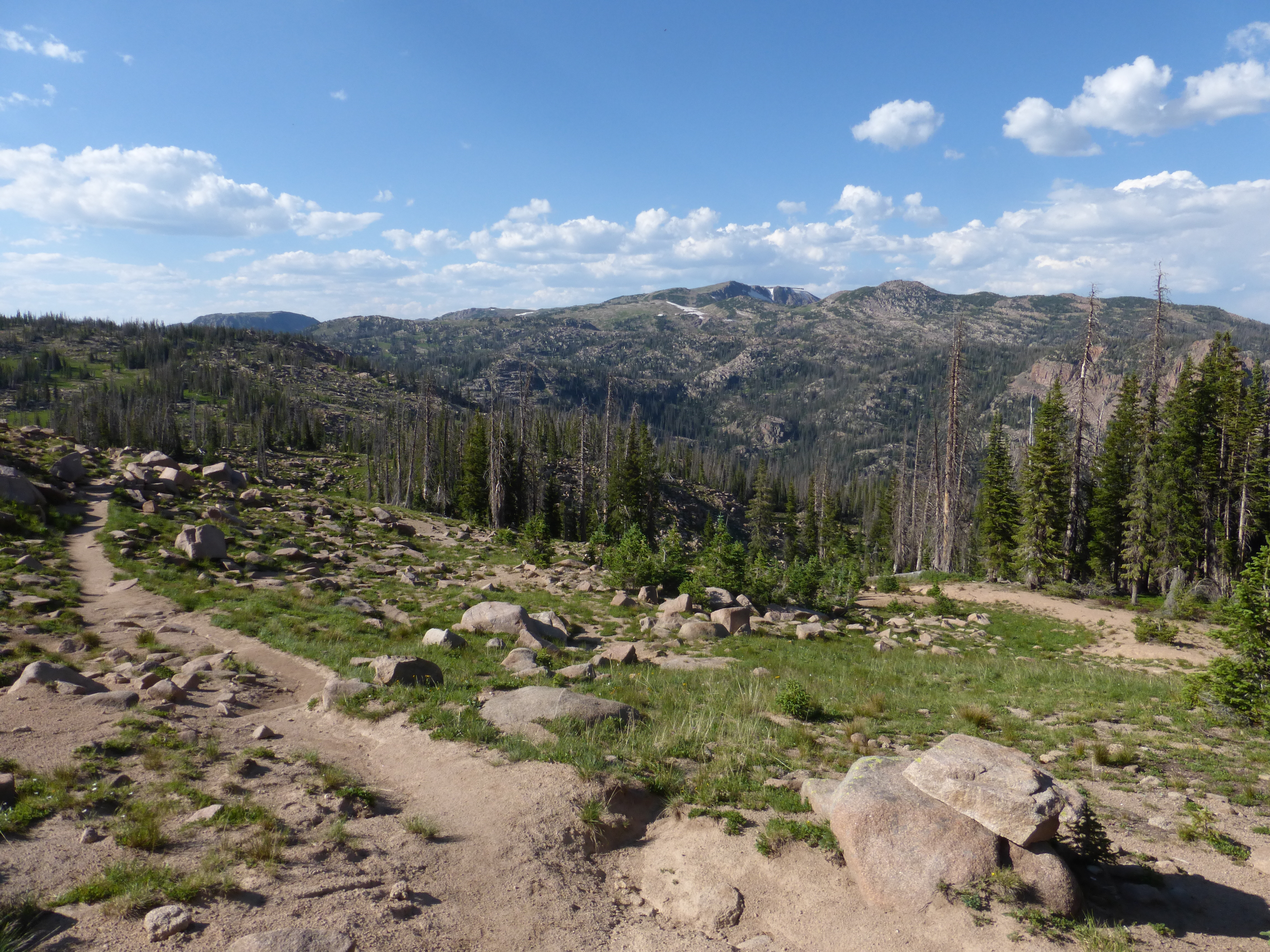
Being up high was great for the views but it makes water sources scarce, so its important to camel up or take enough with you. The trail remained high on the ridge for most of this section, which I really enjoyed, but made timing really important. You have to get up early enough to avoid the afternoon thunderstorms because you don’t want to get caught up high when the clouds come bearing down on you. I also didn’t want to do too many “bonus” miles escaping the ridges. Luckily this didn’t happen to me, but I got close a couple of times.
I started my descent from the mountains on Indian Creek Road, which leads to Highway 14 and eventually, Muddy Pass. It was a dirt road that went on for a long time. My sunglasses fell victim to my brain dead walk. I left them at the last decent water spot I could find before a herd of cows fouled the water. I like to think there’s a cow out there wearing my shades right now. After spending the night in a camping spot off the road, surrounded by cow pies, I started my walk down highway 14, which connects to highway 40 at Muddy Pass and the end of the section at Rabbit Ears Pass. Walking a total of 15 miles on the highway is hell. Not only are cars passing only 2 feet from you as you’re walking the barely-there shoulder, but it turns your feet into ground beef. It was a miserably hot day.
After making it to Rabbit Ears Pass and hitching into town with another hiker named Pacer, I was happy to have the comfort of a hotel and a hot shower.

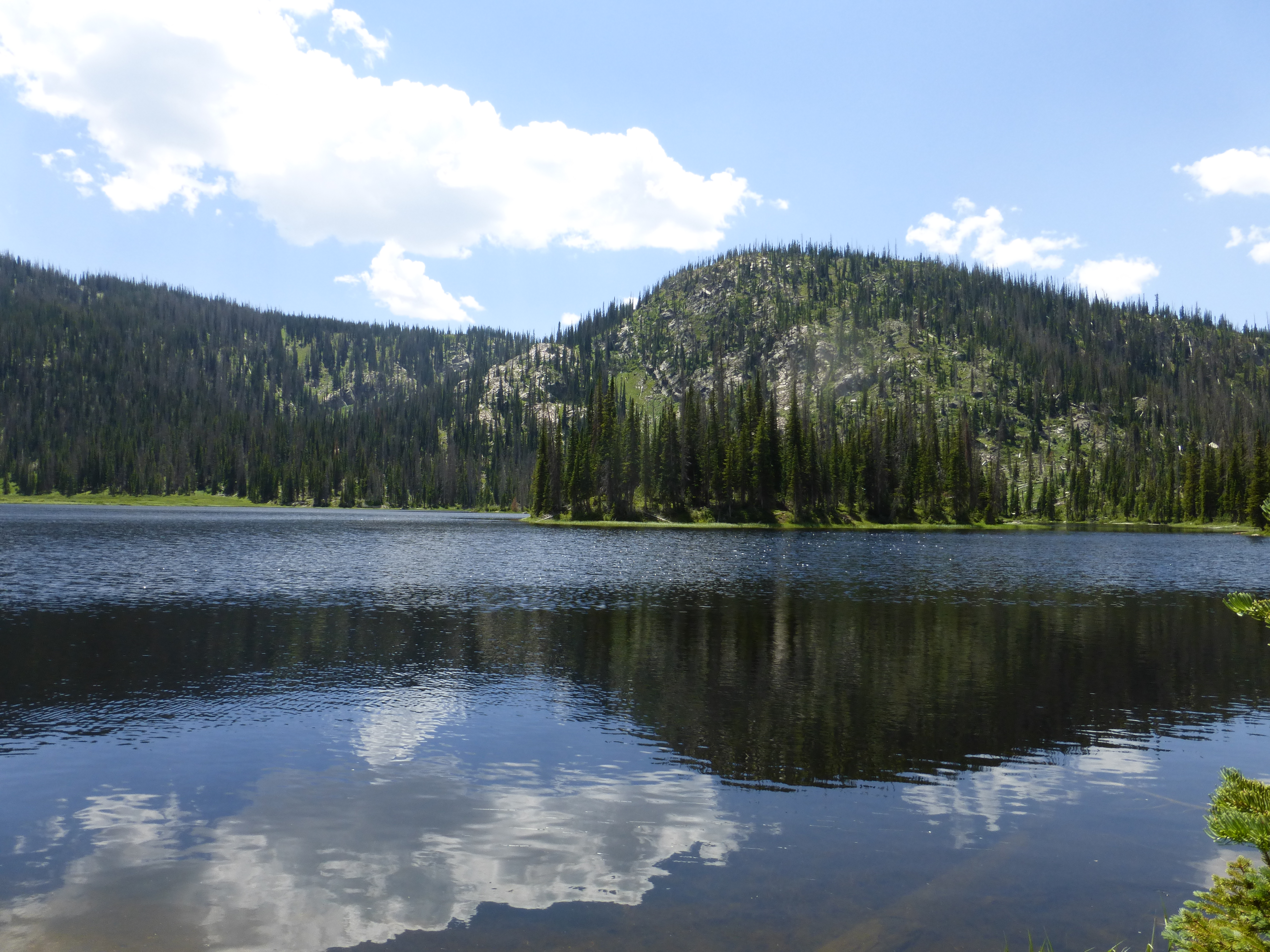
Leaving Steamboat and rejoining the trail at the pass, I was excited to be entering the Mt. Zirkel Wilderness Area. This area is famous for its high passes, alpine lakes and gorgeous scenery. It had been a place I’d wanted to visit for some time and I was happy it was on my route. It was also the first place I had seen the name ‘Wyoming’ so far, following the Wyoming trail 1101 until I hit the border. The Zirkel did not disappointment, with its many lakes such as Round Lake, Luna Lake and dozens of others. Going over or near Mt. Ethel, Lost Ranger Peak and The Dome which was spectacular. I took an alternate path down the Three Island Lakes trail as it was a little shorter and described as scenic on the Ley maps. I was not disappointed with a great lake to dip my feet into after some rough down hill and hot weather.
Dropping down to the forest road and following it on my way to Diamond Park I was flagged down my some campers next to the road. They asked me what I was doing and I gave them the now-scripted story of hiking to Canada on the CDT. One of the guys in the group quickly advised me that “well hell, you must need a beer!” Yes, yes I did need a beer! I quickly became friends with this group of campers that consisted of two families and their kids, out car camping. They were great people; feeding me a burger, potato salad, beans and BBQ chips. Before dinner it was customary to drink a couple of beers and then shoot off some guns, which I was happy to do, since I don’t own guns nor shoot them off very often. Turns out I’m a pretty good shot!

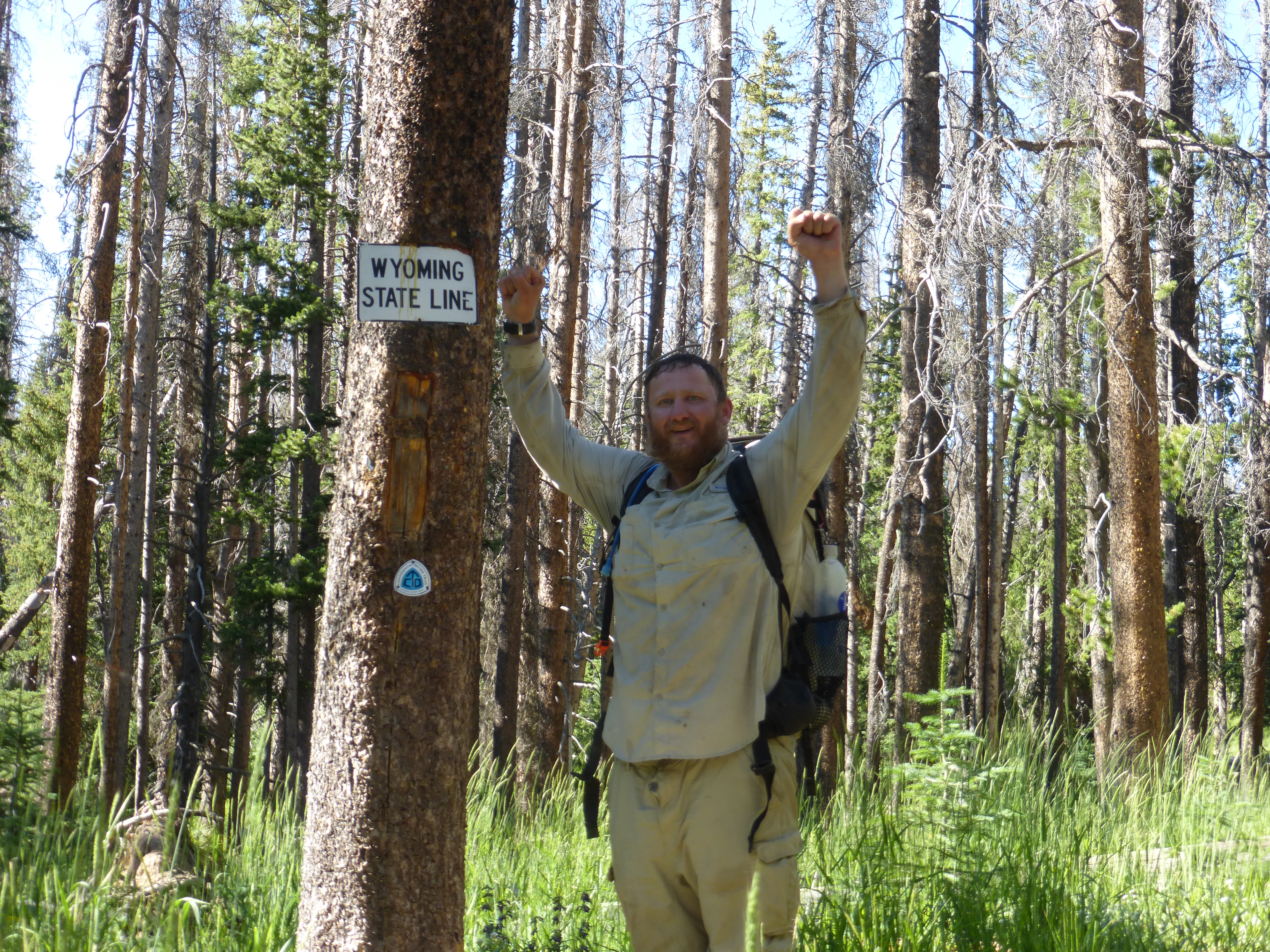
In the morning I said my goodbyes and headed up trail knowing I was getting close to the Wyoming border. I hurriedly made my way on forest roads and deadfall trail. I tried to make it to the border that day, but fell short by only 7 miles. In the morning I got up early and bolted up the trail knowing Wyoming was close. Finally around noon I saw a sign nailed to a tree saying ‘Wyoming State Line’. I was elated! I was so happy to had known I walked into Wyoming. I took about 40 pictures of myself with the sign, near the sign, funny face, serious face, thumbs up and the victorious arms raised pose. There’s a white line of rocks that marks the borderline of the two states and I couldn’t help jumping back and forth between the two and lay there so that my upper body was in my Wyoming while my lower body was in Colorado. I’m a dork but it was fun to play around.
Not long after that I was at Battle Pass hitching my way down to Encampment where my resupply was hopefully sitting at the post office. I was excited be in Wyoming and knew that I now only had one more state to go!
